NM21-773-45
| NASA Photo ID | NM21-773-45 |
| Focal Length | 250mm |
| Date taken | 1996.07.__ |
| Time taken | GMT |
Cloud masks available for this image:
Spacecraft nadir point:
Photo center point: 51.5° N, 55.0° E
Photo center point by machine learning:
Photo center point: 51.5° N, 55.0° E
Photo center point by machine learning:
Nadir to Photo Center: Northwest
Spacecraft Altitude: nautical miles (0km)
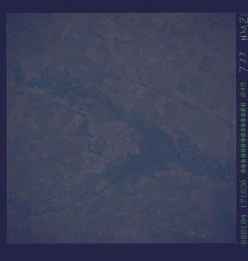
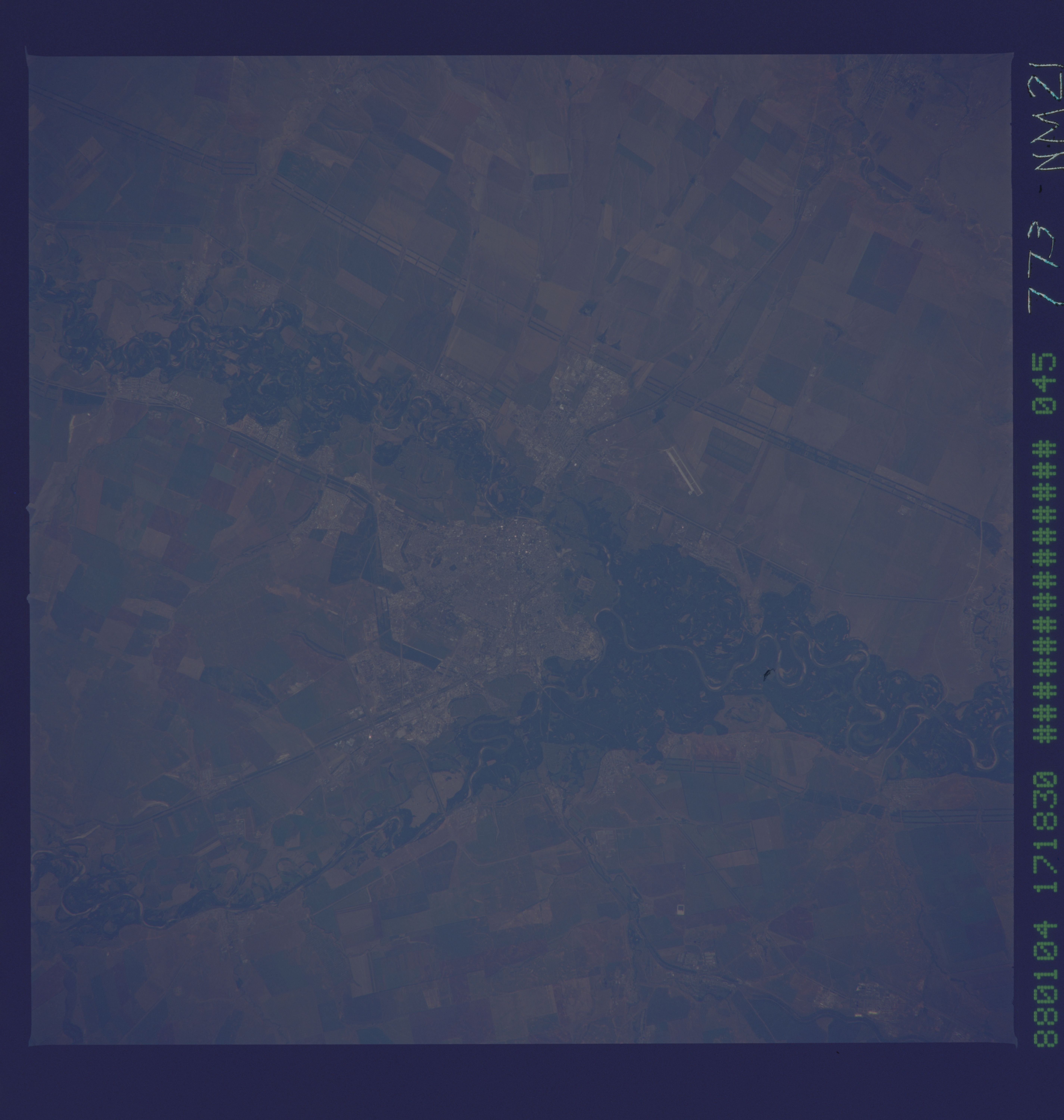
Country or Geographic Name: | RUSSIAN FEDERATION |
Features: | ORENBURG, URAL RIVER, AGR. |
| Features Found Using Machine Learning: | |
Cloud Cover Percentage: | 0 (no clouds present) |
Sun Elevation Angle: | ° |
Sun Azimuth: | ° |
Camera: | Hasselblad |
Focal Length: | 250mm |
Camera Tilt: | Low Oblique |
Format: | 5046: Kodak, natural color positive, Lumiere 100/5046, ASA 100, standard base |
Film Exposure: | Normal |
| Additional Information | |
| Width | Height | Annotated | Cropped | Purpose | Links |
|---|---|---|---|---|---|
| 5700 pixels | 6000 pixels | No | No | Download Image | |
| 500 pixels | 526 pixels | No | No | Download Image |
Download Packaged File
Download a Google Earth KML for this Image
View photo footprint information
Download a GeoTIFF for this photo
Image Caption: The city of Orenburg lies on the Ural River south of Russia's Ural Mountains. The city is surrounded by the river floodplains, rich agricultural land , and long lines of trees (shelter belts) which were planted to break the wind. As the Russian economy changes, the large Soviet farming collectives are becoming privatized. Photography from Mir can help document the changes in land management.
