NM21-770-7
| NASA Photo ID | NM21-770-7 |
| Focal Length | 100mm |
| Date taken | 1996.07.06 |
| Time taken | GMT |
Resolutions offered for this image:
3904 x 3850 pixels 639 x 631 pixels 5700 x 6000 pixels 500 x 526 pixels
3904 x 3850 pixels 639 x 631 pixels 5700 x 6000 pixels 500 x 526 pixels
Cloud masks available for this image:
Spacecraft nadir point:
Photo center point: 46.5° N, 122.0° W
Photo center point by machine learning:
Photo center point: 46.5° N, 122.0° W
Photo center point by machine learning:
Nadir to Photo Center: North
Spacecraft Altitude: nautical miles (0km)
Country or Geographic Name: | USA-WASHINGTON |
Features: | MT. RAINIER, CASCADE MTS. |
| Features Found Using Machine Learning: | |
Cloud Cover Percentage: | 0 (no clouds present) |
Sun Elevation Angle: | ° |
Sun Azimuth: | ° |
Camera: | Hasselblad |
Focal Length: | 100mm |
Camera Tilt: | Low Oblique |
Format: | 5046: Kodak, natural color positive, Lumiere 100/5046, ASA 100, standard base |
Film Exposure: | Normal |
| Additional Information | |
| Width | Height | Annotated | Cropped | Purpose | Links |
|---|---|---|---|---|---|
| 3904 pixels | 3850 pixels | No | No | Earth From Space collection | Download Image |
| 639 pixels | 631 pixels | No | No | Earth From Space collection | Download Image |
| 5700 pixels | 6000 pixels | No | No | Download Image | |
| 500 pixels | 526 pixels | No | No | Download Image |
Download Packaged File
Download a Google Earth KML for this Image
View photo footprint information
Download a GeoTIFF for this photo
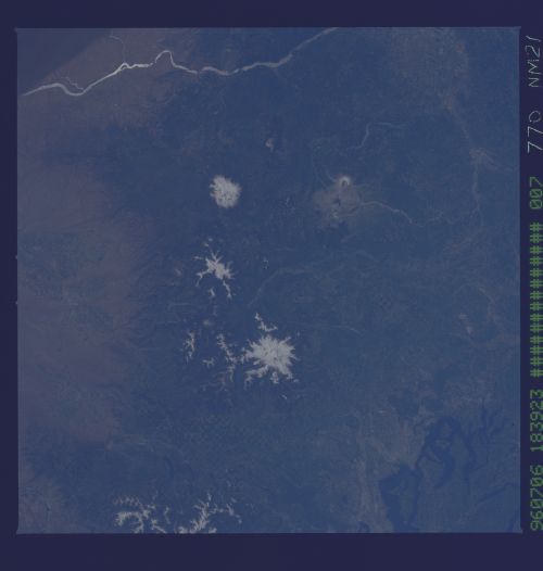
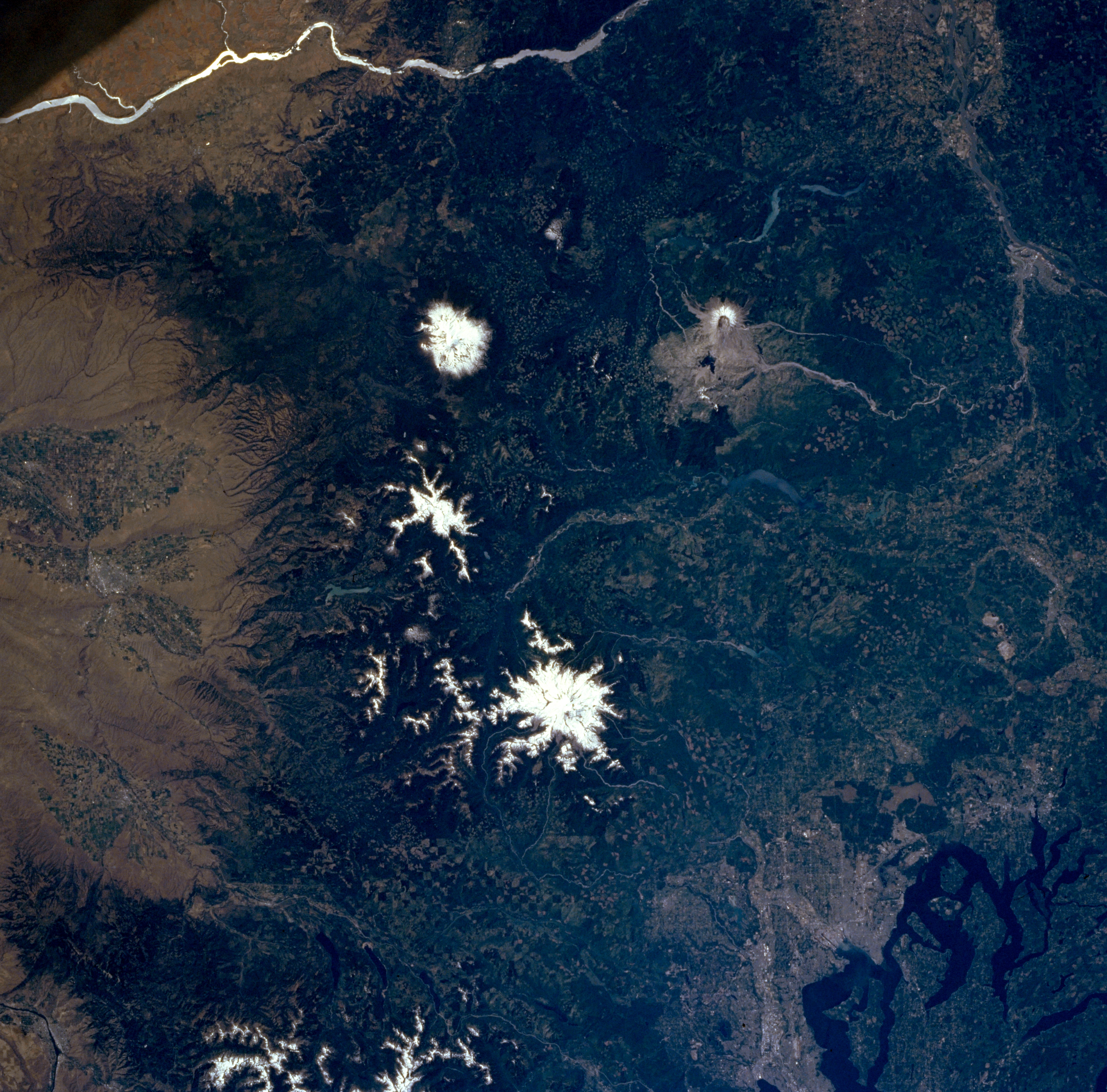
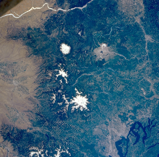
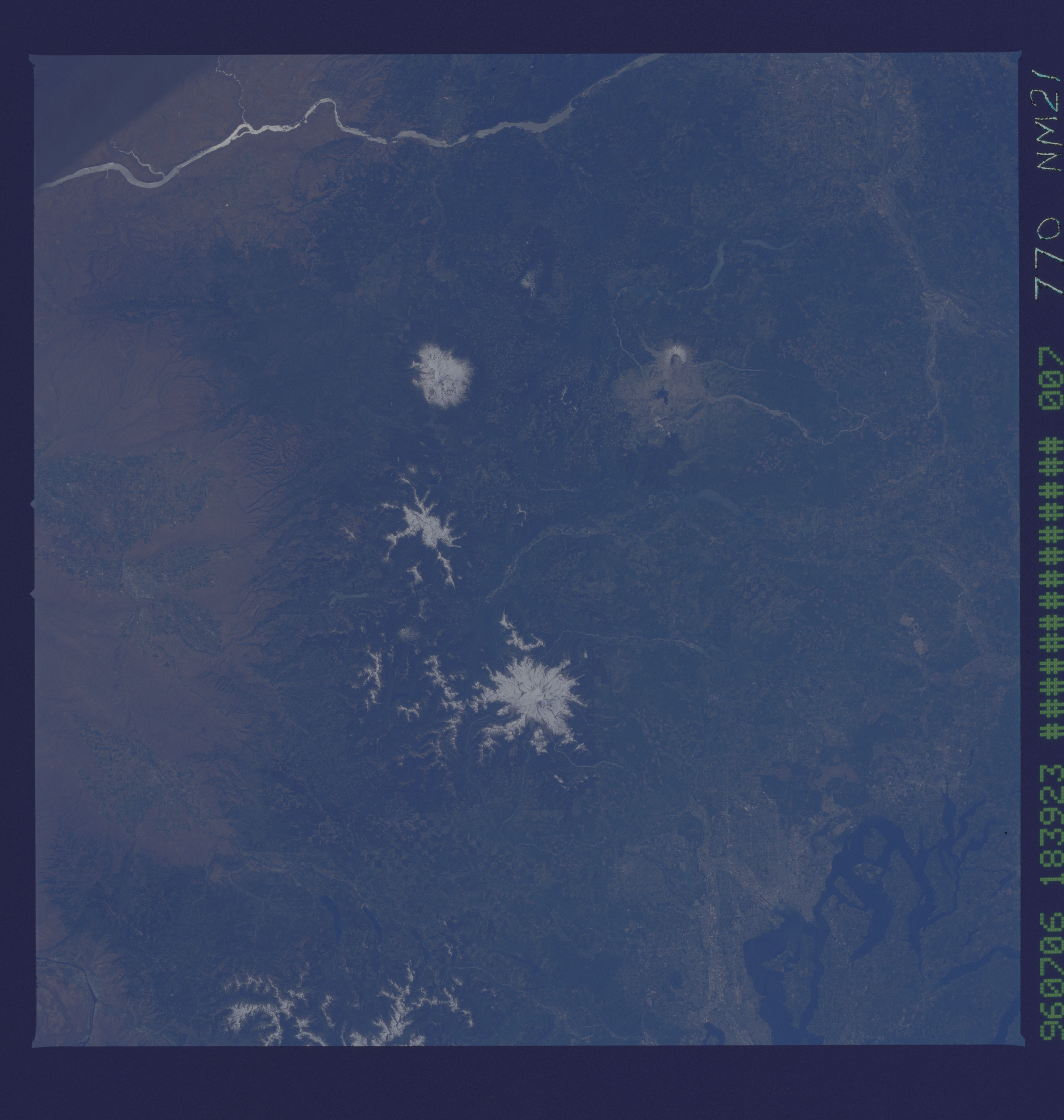
Image Caption: NM21-770-007 Mount Saint Helens, Mount Adams, and Mount Rainier; Washington; U.S.A. Winter 1996
The southern Washington Cascade Range is visible in this near-vertical photograph. The Columbia River, separating the states of Oregon and Washington, can be seen at the top of the photograph. The second-highest peak in the Cascade Range, Mount Adams, is visible north of the river. The horseshoe-shaped summit and caldera of Mount Saint Helens and the gray blast zone from its eruption of May 18, 1980, can be seen west of Mount Adams. North of Mount Adams and Mount Saint Helens is Mount Rainier, the highest peak in the Cascade Range and the second highest peak in the contiguous United States. The streams draining Mount Saint Helens remain choked with ash from the eruption. Mount Rainier is also considered to be one of the prime volcanic hazards in the United States because of its proximity to the Tacoma-Seattle region (upper left corner). Puget Sound and the cities of Olympia, Tacoma, and Seattle are visible near the bottom right, and the city of Yakima is barely discernible near the center left. The checkerboard pattern in the forests of the Cascades is from logging clear cuts.
The southern Washington Cascade Range is visible in this near-vertical photograph. The Columbia River, separating the states of Oregon and Washington, can be seen at the top of the photograph. The second-highest peak in the Cascade Range, Mount Adams, is visible north of the river. The horseshoe-shaped summit and caldera of Mount Saint Helens and the gray blast zone from its eruption of May 18, 1980, can be seen west of Mount Adams. North of Mount Adams and Mount Saint Helens is Mount Rainier, the highest peak in the Cascade Range and the second highest peak in the contiguous United States. The streams draining Mount Saint Helens remain choked with ash from the eruption. Mount Rainier is also considered to be one of the prime volcanic hazards in the United States because of its proximity to the Tacoma-Seattle region (upper left corner). Puget Sound and the cities of Olympia, Tacoma, and Seattle are visible near the bottom right, and the city of Yakima is barely discernible near the center left. The checkerboard pattern in the forests of the Cascades is from logging clear cuts.
