NM21-767-94
| NASA Photo ID | NM21-767-94 |
| Focal Length | 250mm |
| Date taken | 1996.07.__ |
| Time taken | GMT |
Resolutions offered for this image:
3904 x 3904 pixels 639 x 639 pixels 5700 x 6000 pixels 500 x 526 pixels
3904 x 3904 pixels 639 x 639 pixels 5700 x 6000 pixels 500 x 526 pixels

Cloud masks available for this image:
Spacecraft nadir point:
Photo center point: 41.5° N, 87.5° W
Photo center point by machine learning:
Photo center point: 41.5° N, 87.5° W
Photo center point by machine learning:
Nadir to Photo Center: East
Spacecraft Altitude: nautical miles (0km)
Country or Geographic Name: | USA-INDIANA |
Features: | GARY, L. MICHIGAN, AGR. |
| Features Found Using Machine Learning: | |
Cloud Cover Percentage: | 0 (no clouds present) |
Sun Elevation Angle: | ° |
Sun Azimuth: | ° |
Camera: | Hasselblad |
Focal Length: | 250mm |
Camera Tilt: | Low Oblique |
Format: | 5046: Kodak, natural color positive, Lumiere 100/5046, ASA 100, standard base |
Film Exposure: | Normal |
| Additional Information | |
| Width | Height | Annotated | Cropped | Purpose | Links |
|---|---|---|---|---|---|
| 3904 pixels | 3904 pixels | No | No | Earth From Space collection | Download Image |
| 639 pixels | 639 pixels | No | No | Earth From Space collection | Download Image |
| 5700 pixels | 6000 pixels | No | No | Download Image | |
| 500 pixels | 526 pixels | No | No | Download Image |
Download Packaged File
Download a Google Earth KML for this Image
View photo footprint information
Download a GeoTIFF for this photo
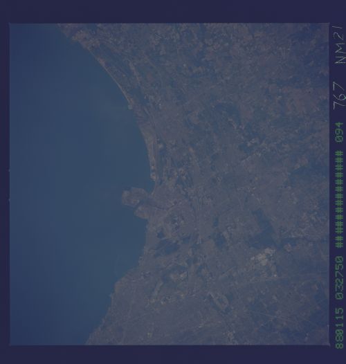
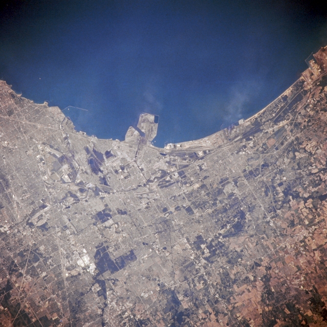
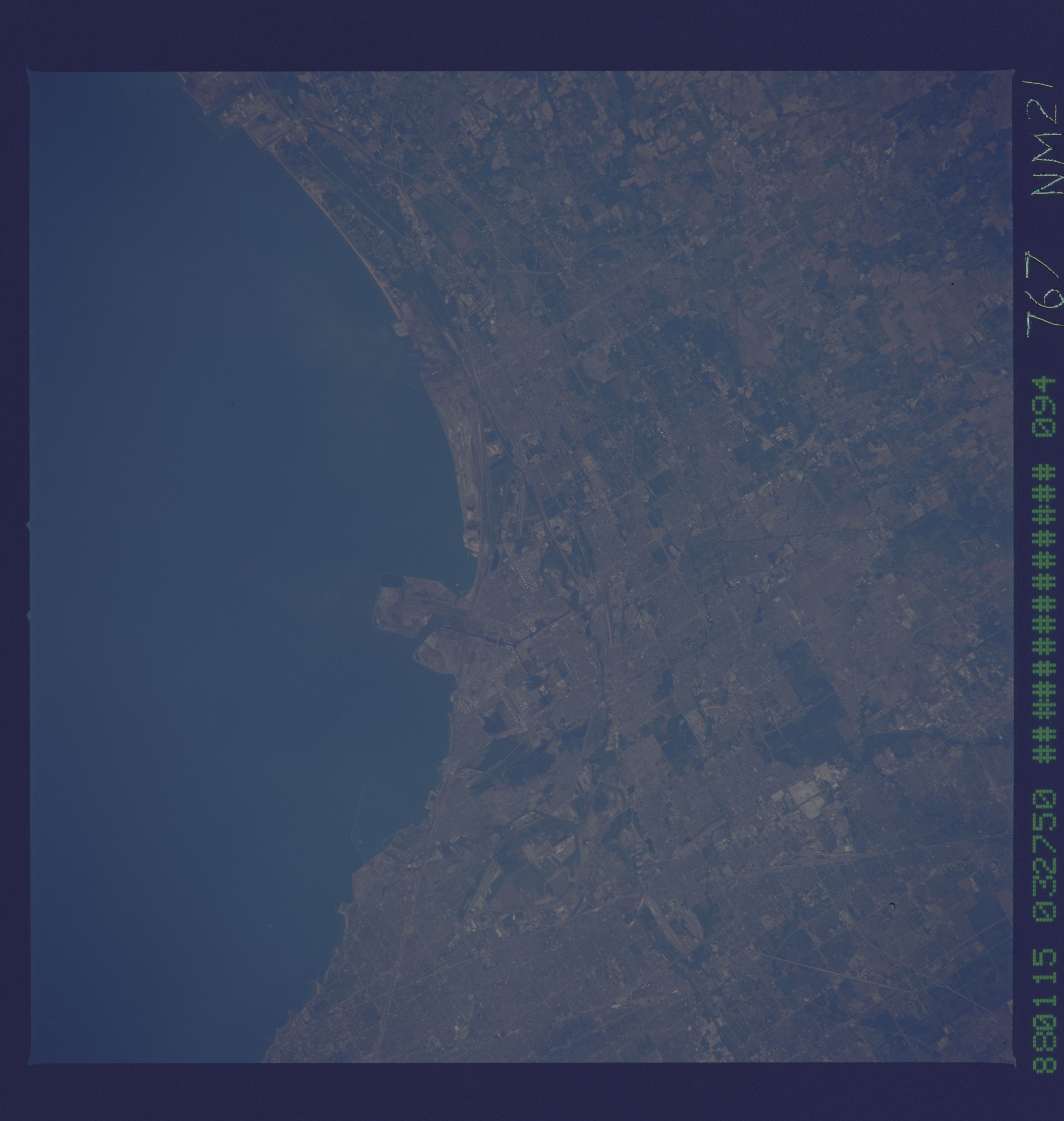
Image Caption: NM21-767-094 Gary and Hammond, Indiana, U.S.A. Winter 1995 - 1996
The heavy industrial area of northwestern Indiana and the southern end of Lake Michigan are featured in this north-northeast-looking, low-oblique photograph. Following the outline of Lake Michigan west to east are the industrial cities of Whiting, Hammond, Gary, Portage, and Michigan City. Gary (near center), one of the world's greatest steel centers, is strategically located midway between the iron ore beds of Minnesota and the coal areas of the eastern and southeastern United States. South of the cities and the industrial complex are the rich agricultural lands that produce corn and soybeans. The white shorelines east of Gary are part of the Indiana Dunes National Lakeshore, an area with sand dunes 200 feet (60 meters) high, beaches, and marshes abutting the south shore of Lake Michigan.
The heavy industrial area of northwestern Indiana and the southern end of Lake Michigan are featured in this north-northeast-looking, low-oblique photograph. Following the outline of Lake Michigan west to east are the industrial cities of Whiting, Hammond, Gary, Portage, and Michigan City. Gary (near center), one of the world's greatest steel centers, is strategically located midway between the iron ore beds of Minnesota and the coal areas of the eastern and southeastern United States. South of the cities and the industrial complex are the rich agricultural lands that produce corn and soybeans. The white shorelines east of Gary are part of the Indiana Dunes National Lakeshore, an area with sand dunes 200 feet (60 meters) high, beaches, and marshes abutting the south shore of Lake Michigan.
