NM21-766-79
| NASA Photo ID | NM21-766-79 |
| Focal Length | 250mm |
| Date taken | 1996.07.05 |
| Time taken | GMT |
Resolutions offered for this image:
3898 x 3880 pixels 639 x 637 pixels 5700 x 6000 pixels 500 x 526 pixels
3898 x 3880 pixels 639 x 637 pixels 5700 x 6000 pixels 500 x 526 pixels

Cloud masks available for this image:
Spacecraft nadir point:
Photo center point: 42.5° N, 71.0° W
Photo center point by machine learning:
Photo center point: 42.5° N, 71.0° W
Photo center point by machine learning:
Nadir to Photo Center: North
Spacecraft Altitude: nautical miles (0km)
Country or Geographic Name: | USA-MASSACHUSETTS |
Features: | BOSTON, MASSACHUSETTS B. |
| Features Found Using Machine Learning: | |
Cloud Cover Percentage: | 5 (1-10)% |
Sun Elevation Angle: | ° |
Sun Azimuth: | ° |
Camera: | Hasselblad |
Focal Length: | 250mm |
Camera Tilt: | Low Oblique |
Format: | 5046: Kodak, natural color positive, Lumiere 100/5046, ASA 100, standard base |
Film Exposure: | Normal |
| Additional Information | |
| Width | Height | Annotated | Cropped | Purpose | Links |
|---|---|---|---|---|---|
| 3898 pixels | 3880 pixels | No | No | Earth From Space collection | Download Image |
| 639 pixels | 637 pixels | No | No | Earth From Space collection | Download Image |
| 5700 pixels | 6000 pixels | No | No | Download Image | |
| 500 pixels | 526 pixels | No | No | Download Image |
Download Packaged File
Download a Google Earth KML for this Image
View photo footprint information
Download a GeoTIFF for this photo
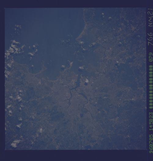
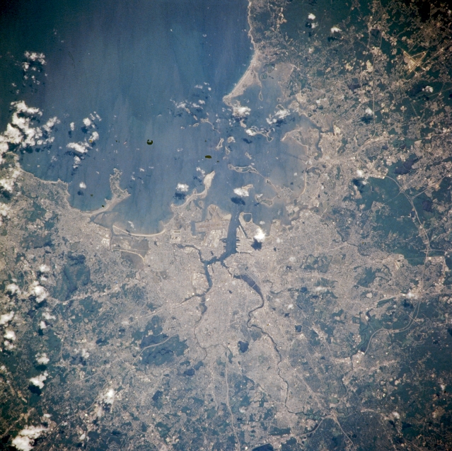
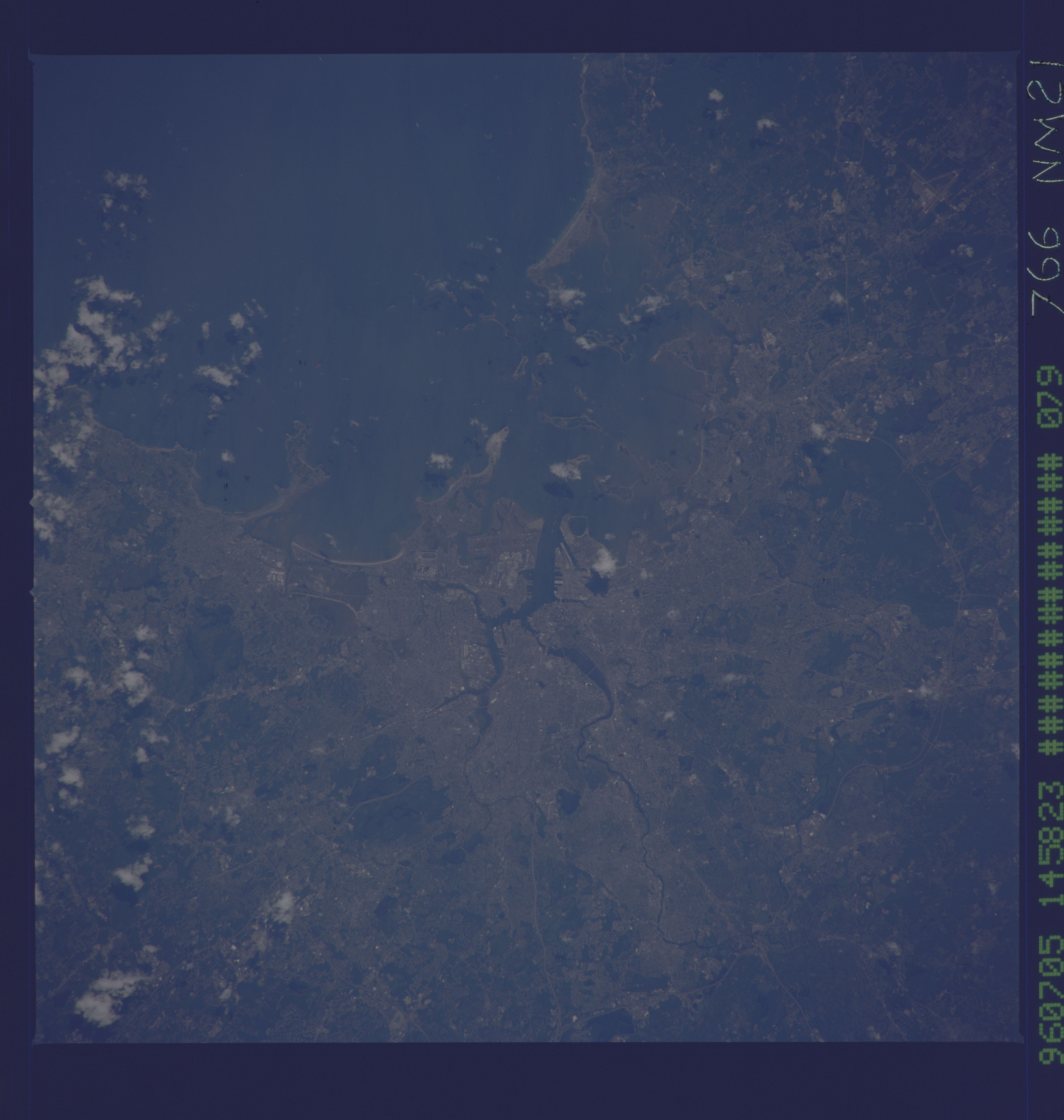
Image Caption: NM21-766-079 Boston, Massachusetts, U.S.A. Winter 1995-1996
Apparent in this near-vertical photograph are Boston and surrounding communities. Situated at the head of Boston Bay at the mouths of the Mystic and Charles Rivers, Boston is the largest city in New England. A major financial and cultural center, Boston is also a leading port, an important fishing center, and the greatest wool market in the United States. The city and surrounding area are rich in history, especially the American Revolutionary War period. Visible are the runways of Logan International Airport (center), major transportation arteries radiating outward from the central city, and Massachusetts Bay.
Apparent in this near-vertical photograph are Boston and surrounding communities. Situated at the head of Boston Bay at the mouths of the Mystic and Charles Rivers, Boston is the largest city in New England. A major financial and cultural center, Boston is also a leading port, an important fishing center, and the greatest wool market in the United States. The city and surrounding area are rich in history, especially the American Revolutionary War period. Visible are the runways of Logan International Airport (center), major transportation arteries radiating outward from the central city, and Massachusetts Bay.
