NM21-753-23

| NASA Photo ID | NM21-753-23 |
| Focal Length | 250mm |
| Date taken | 1996.06.22 |
| Time taken | 14:36:09 GMT |
Resolutions offered for this image:
791 x 804 pixels 5700 x 6000 pixels 500 x 526 pixels 437 x 426 pixels 437 x 426 pixels
791 x 804 pixels 5700 x 6000 pixels 500 x 526 pixels 437 x 426 pixels 437 x 426 pixels

Cloud masks available for this image:
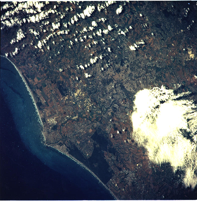
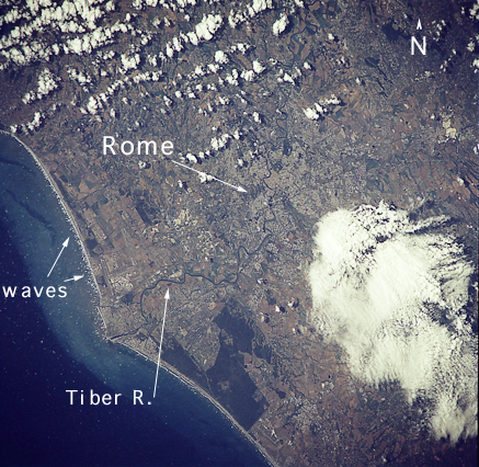
Spacecraft nadir point: 41.5° N, 11.8° E
Photo center point: 42.0° N, 12.5° E
Photo center point by machine learning:
Photo center point: 42.0° N, 12.5° E
Photo center point by machine learning:
Nadir to Photo Center: Northeast
Spacecraft Altitude: 208 nautical miles (385km)
Camera: | Hasselblad |
Focal Length: | 250mm |
Camera Tilt: | 14 degrees |
Format: | 5046: Kodak, natural color positive, Lumiere 100/5046, ASA 100, standard base |
Film Exposure: | Normal |
| Additional Information | |
| Width | Height | Annotated | Cropped | Purpose | Links |
|---|---|---|---|---|---|
| 791 pixels | 804 pixels | No | No | Cities collection | Download Image |
| 5700 pixels | 6000 pixels | No | No | Download Image | |
| 500 pixels | 526 pixels | No | No | Download Image | |
| 437 pixels | 426 pixels | Yes | No | Download Image | |
| 437 pixels | 426 pixels | Download Image |
Download Packaged File
Download a Google Earth KML for this Image
View photo footprint information
Download a GeoTIFF for this photo
Image Caption: none
