NM21-746-24
| NASA Photo ID | NM21-746-24 |
| Focal Length | 100mm |
| Date taken | 1996.05.14 |
| Time taken | 08:48:01 GMT |
Resolutions offered for this image:
4072 x 4090 pixels 637 x 640 pixels 5700 x 6000 pixels 500 x 526 pixels
4072 x 4090 pixels 637 x 640 pixels 5700 x 6000 pixels 500 x 526 pixels

Cloud masks available for this image:
Spacecraft nadir point: 46.2° N, 55.1° E
Photo center point: 44.5° N, 59.5° E
Photo center point by machine learning:
Photo center point: 44.5° N, 59.5° E
Photo center point by machine learning:
Nadir to Photo Center: East
Spacecraft Altitude: 210 nautical miles (389km)
Camera: | Hasselblad |
Focal Length: | 100mm |
Camera Tilt: | 53 degrees |
Format: | 5046: Kodak, natural color positive, Lumiere 100/5046, ASA 100, standard base |
Film Exposure: | Normal |
| Additional Information | |
| Width | Height | Annotated | Cropped | Purpose | Links |
|---|---|---|---|---|---|
| 4072 pixels | 4090 pixels | No | No | Earth From Space collection | Download Image |
| 637 pixels | 640 pixels | No | No | Earth From Space collection | Download Image |
| 5700 pixels | 6000 pixels | No | No | Download Image | |
| 500 pixels | 526 pixels | No | No | Download Image |
Download Packaged File
Download a Google Earth KML for this Image
View photo footprint information
Download a GeoTIFF for this photo
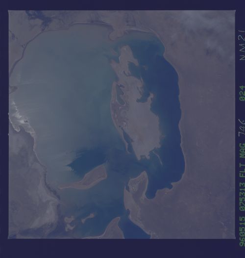
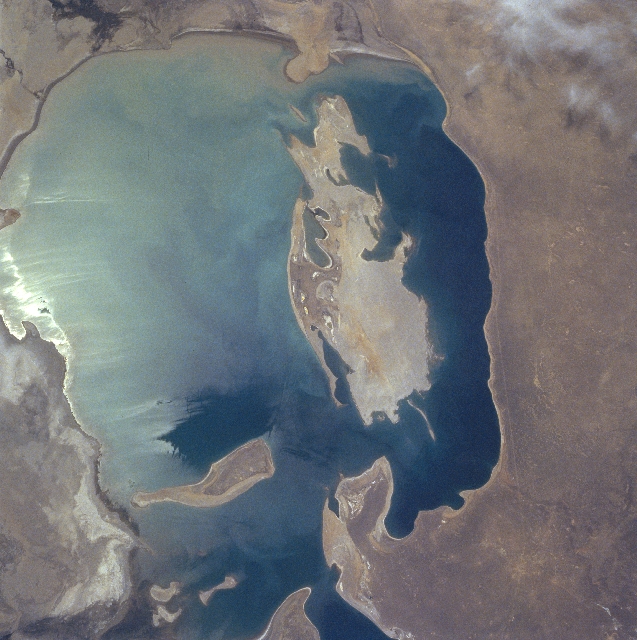
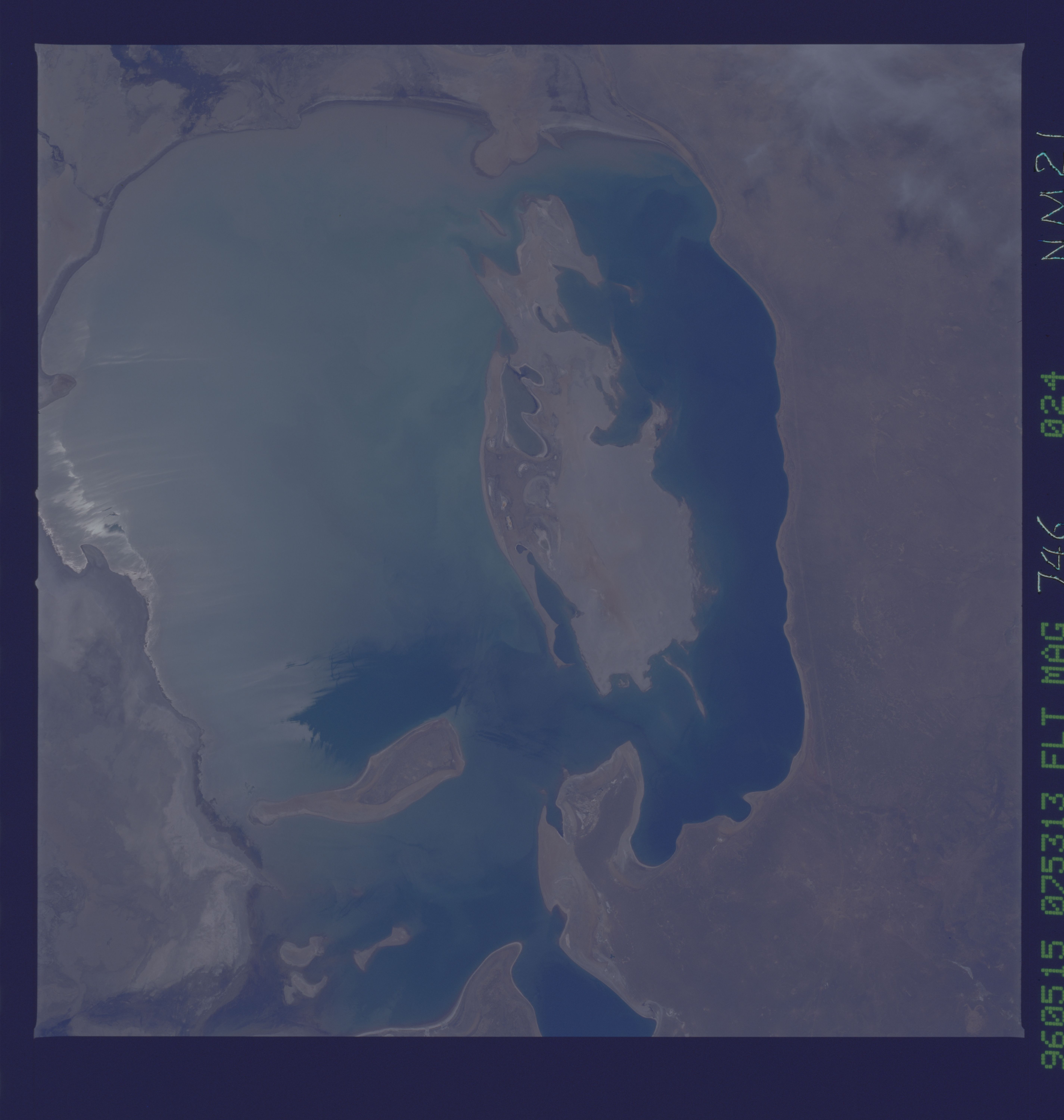
Image Caption: NM21-746-024 Aral Sea, Kazakhstan and Uzbekistan Spring-Summer 1996
As a result of the shrinking size (due to the loss of recharge water and a high rate of evaporation) of the Aral Sea, both Vozrozhdeniya Island (irregular-shaped, large) and Barsakel'mes Island (elongated, smaller) are gaining more surface area, which was formerly the sea floor. If sea level continues to drop the Aral Sea could continue to become more compartmentalized (the Little Aral Sea - not in this image - has already been created north of the Aral Sea). As more of the sea bottom is exposed and the islands and peninsulas become connected land, the existing Aral Sea could become several separate bodies of water - forming new lakes. Since much less fresh water now enters the sea (most water diverted for agriculture), salinity levels have steadily increased since 1960. The bright area in the eastern (left) half of the sea is caused by the sun's reflection off of the water's surface, a phenomenon known as sunglint or sun glitter. A pipeline right of way and a road (thin, light-colored, lined feature) parallel the west side of the sea.
As a result of the shrinking size (due to the loss of recharge water and a high rate of evaporation) of the Aral Sea, both Vozrozhdeniya Island (irregular-shaped, large) and Barsakel'mes Island (elongated, smaller) are gaining more surface area, which was formerly the sea floor. If sea level continues to drop the Aral Sea could continue to become more compartmentalized (the Little Aral Sea - not in this image - has already been created north of the Aral Sea). As more of the sea bottom is exposed and the islands and peninsulas become connected land, the existing Aral Sea could become several separate bodies of water - forming new lakes. Since much less fresh water now enters the sea (most water diverted for agriculture), salinity levels have steadily increased since 1960. The bright area in the eastern (left) half of the sea is caused by the sun's reflection off of the water's surface, a phenomenon known as sunglint or sun glitter. A pipeline right of way and a road (thin, light-colored, lined feature) parallel the west side of the sea.
