NM21-740-24
| NASA Photo ID | NM21-740-24 |
| Focal Length | 250mm |
| Date taken | 1996.05.02 |
| Time taken | GMT |
Resolutions offered for this image:
788 x 788 pixels 4096 x 4096 pixels 640 x 640 pixels 5700 x 6000 pixels 5625 x 5698 pixels 500 x 526 pixels 960 x 936 pixels
788 x 788 pixels 4096 x 4096 pixels 640 x 640 pixels 5700 x 6000 pixels 5625 x 5698 pixels 500 x 526 pixels 960 x 936 pixels


Cloud masks available for this image:
Spacecraft nadir point:
Photo center point: 41.0° N, 29.0° E
Photo center point by machine learning:
Photo center point: 41.0° N, 29.0° E
Photo center point by machine learning:
Nadir to Photo Center:
Spacecraft Altitude: nautical miles (0km)
Country or Geographic Name: | TURKEY |
Features: | ISTANBUL, THE GOLDEN HORN |
| Features Found Using Machine Learning: | |
Cloud Cover Percentage: | 0 (no clouds present) |
Sun Elevation Angle: | ° |
Sun Azimuth: | ° |
Camera: | Hasselblad |
Focal Length: | 250mm |
Camera Tilt: | Near Vertical |
Format: | 5046: Kodak, natural color positive, Lumiere 100/5046, ASA 100, standard base |
Film Exposure: | Normal |
| Additional Information | |
| Width | Height | Annotated | Cropped | Purpose | Links |
|---|---|---|---|---|---|
| 788 pixels | 788 pixels | No | No | Cities collection | Download Image |
| 4096 pixels | 4096 pixels | No | No | Earth From Space collection | Download Image |
| 640 pixels | 640 pixels | No | No | Earth From Space collection | Download Image |
| 5700 pixels | 6000 pixels | No | No | Download Image | |
| 5625 pixels | 5698 pixels | No | No | Publisher Request | Download Image |
| 500 pixels | 526 pixels | No | No | Download Image | |
| 960 pixels | 936 pixels | Yes | No | Download Image |
Download Packaged File
Download a Google Earth KML for this Image
View photo footprint information
Download a GeoTIFF for this photo
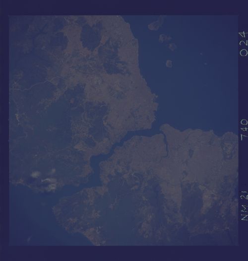
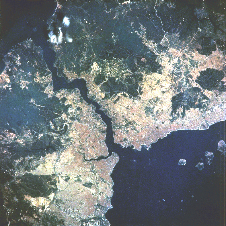
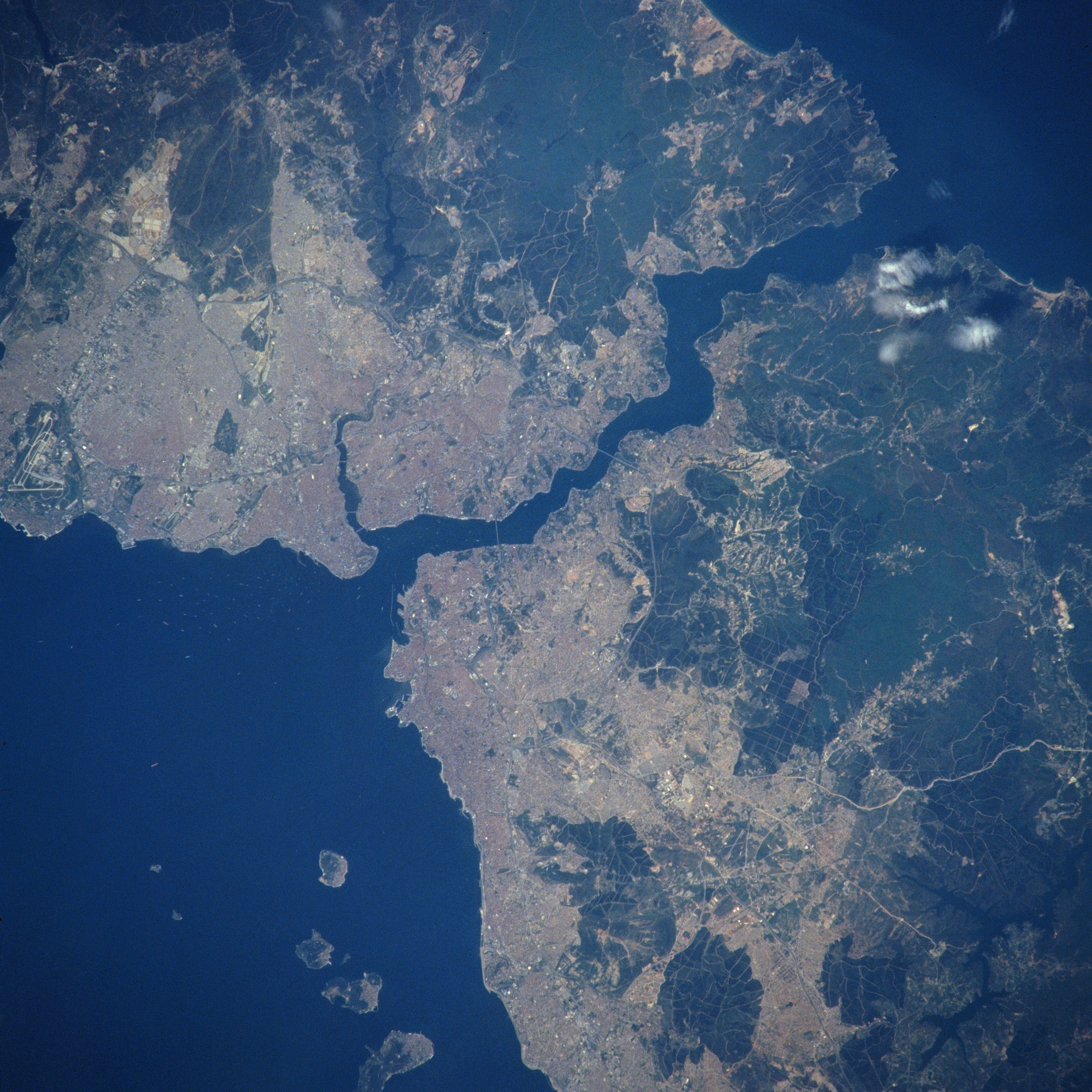
Image Caption: NM21-740-024 Bosporus, Istanbul, Turkey Spring/Summer 1996
One of the world's strategic waterways, the Bosporus can be seen in this west-looking view. The Bosporus, which means "ox-ford", connects the Black Sea (top right) with the Sea of Marmara (Marble Sea) (bottom left). It also separates European Turkey (upper left) from Asiatic Turkey (bottom right). Structurally, the Bosporus is an inundated valley following an irregular northeast-southwest course, 18 miles (29 km) long, widths varying from a little over 2 miles (4 km) at its northern mouth to 800 yards (730 meters) at Rumeli Hisari, midway along the strait. Although the current flows from north to south, there is a strong subsurface counter current, and numerous points and coves that set up whirls and eddies that make navigation of the strait dangerous to the inexperienced. At the Bosporus' southern end is located one of the great historic cities in the world, Istanbul, formerly known as the city of Constantinople. Istanbul is the chief city, seaport, and tourist resort of Turkey as well a commercial and financial center. The European part of Istanbul is the terminus of an international rail service formerly called the Orient Express. In 1973, the European and Asian sections of Istanbul were linked by the opening of the Bosporus Suspension Bridge, (3524 feet/1074 meters long), which is discernible near the center of the image. Also discernible on the image just to the south of Istanbul anchored in the Sea of Marmara are large merchant ships (white-looking dots). In August 1999, a severe earthquake occurred just east of the Istanbul region on the Asian side killing thousands and destroying numerous buildings and other structures.
One of the world's strategic waterways, the Bosporus can be seen in this west-looking view. The Bosporus, which means "ox-ford", connects the Black Sea (top right) with the Sea of Marmara (Marble Sea) (bottom left). It also separates European Turkey (upper left) from Asiatic Turkey (bottom right). Structurally, the Bosporus is an inundated valley following an irregular northeast-southwest course, 18 miles (29 km) long, widths varying from a little over 2 miles (4 km) at its northern mouth to 800 yards (730 meters) at Rumeli Hisari, midway along the strait. Although the current flows from north to south, there is a strong subsurface counter current, and numerous points and coves that set up whirls and eddies that make navigation of the strait dangerous to the inexperienced. At the Bosporus' southern end is located one of the great historic cities in the world, Istanbul, formerly known as the city of Constantinople. Istanbul is the chief city, seaport, and tourist resort of Turkey as well a commercial and financial center. The European part of Istanbul is the terminus of an international rail service formerly called the Orient Express. In 1973, the European and Asian sections of Istanbul were linked by the opening of the Bosporus Suspension Bridge, (3524 feet/1074 meters long), which is discernible near the center of the image. Also discernible on the image just to the south of Istanbul anchored in the Sea of Marmara are large merchant ships (white-looking dots). In August 1999, a severe earthquake occurred just east of the Istanbul region on the Asian side killing thousands and destroying numerous buildings and other structures.
