NM21-735-62
| NASA Photo ID | NM21-735-62 |
| Focal Length | 250mm |
| Date taken | 1996.05.02 |
| Time taken | 08:51:20 GMT |
Resolutions offered for this image:
5700 x 6000 pixels 500 x 526 pixels 3184 x 3158 pixels 640 x 646 pixels 600 x 590 pixels
5700 x 6000 pixels 500 x 526 pixels 3184 x 3158 pixels 640 x 646 pixels 600 x 590 pixels


Cloud masks available for this image:
Spacecraft nadir point: 51.4° N, 100.9° E
Photo center point:
Photo center point by machine learning:
Photo center point:
Photo center point by machine learning:
Nadir to Photo Center: Southwest
Spacecraft Altitude: 210 nautical miles (389km)
Camera: | Hasselblad |
Focal Length: | 250mm |
Camera Tilt: | High Oblique |
Format: | 5046: Kodak, natural color positive, Lumiere 100/5046, ASA 100, standard base |
Film Exposure: | Normal |
| Additional Information | |
| Width | Height | Annotated | Cropped | Purpose | Links |
|---|---|---|---|---|---|
| 5700 pixels | 6000 pixels | No | No | Download Image | |
| 500 pixels | 526 pixels | No | No | Download Image | |
| 3184 pixels | 3158 pixels | Download Image | |||
| 640 pixels | 646 pixels | Yes | No | Download Image | |
| 600 pixels | 590 pixels | Download Image |
Download Packaged File
Download a Google Earth KML for this Image
View photo footprint information
Download a GeoTIFF for this photo
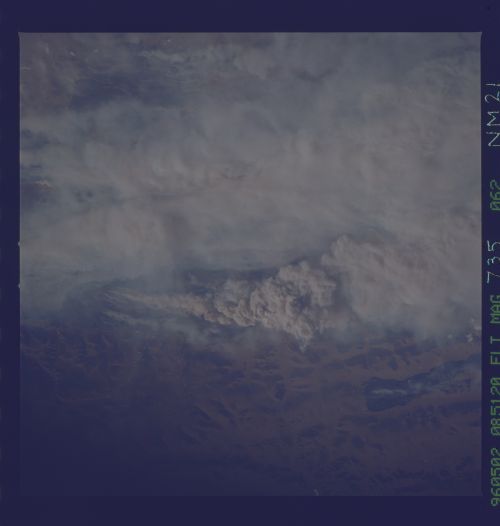
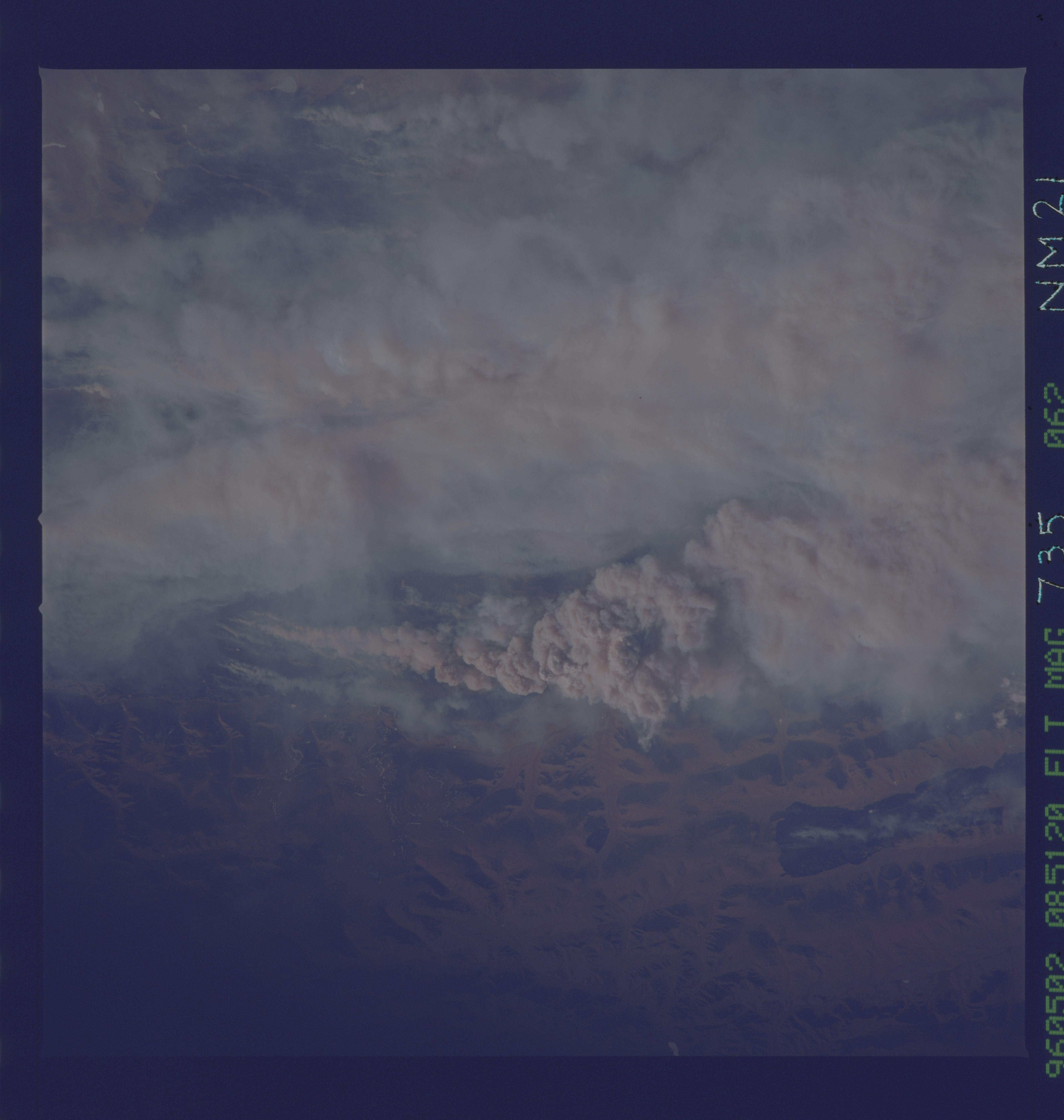
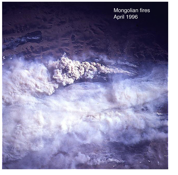
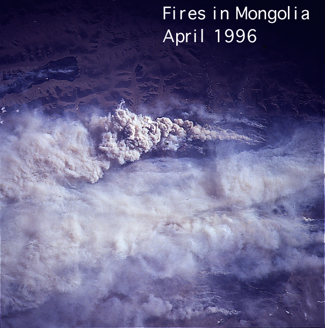
Image Caption: In April, 1996, Mongolian forest fires raged out of control for more than three weeks. More than 80 fires consumed the land, and the smoke pall from the fires was described by the Mir 21 crew members as the worst smoke they had ever seen from orbit. This view captures part of the thick smoke palls from the burning forests on the Mongolian Steppe.
