NASA7-723-69
| NASA Photo ID | NASA7-723-69 |
| Focal Length | 250mm |
| Date taken | 1998.05.12 |
| Time taken | GMT |
Resolutions offered for this image:
4048 x 4048 pixels 639 x 639 pixels 4400 x 4600 pixels 492 x 515 pixels 493 x 506 pixels 479 x 480 pixels
4048 x 4048 pixels 639 x 639 pixels 4400 x 4600 pixels 492 x 515 pixels 493 x 506 pixels 479 x 480 pixels


Cloud masks available for this image:
Spacecraft nadir point:
Photo center point: 36.0° N, 96.0° W
Photo center point by machine learning:
Photo center point: 36.0° N, 96.0° W
Photo center point by machine learning:
Nadir to Photo Center:
Spacecraft Altitude: nautical miles (0km)
Country or Geographic Name: | USA-OKLAHOMA |
Features: | TULSA, ARKANSAS RIVER |
| Features Found Using Machine Learning: | |
Cloud Cover Percentage: | 0 (no clouds present) |
Sun Elevation Angle: | ° |
Sun Azimuth: | ° |
Camera: | Hasselblad |
Focal Length: | 250mm |
Camera Tilt: | Low Oblique |
Format: | 5069: Kodak Elite 100S, E6 Reversal, Replaces Lumiere, Warmer in tone vs. Lumiere |
Film Exposure: | Normal |
| Additional Information | |
| Width | Height | Annotated | Cropped | Purpose | Links |
|---|---|---|---|---|---|
| 4048 pixels | 4048 pixels | No | No | Earth From Space collection | Download Image |
| 639 pixels | 639 pixels | No | No | Earth From Space collection | Download Image |
| 4400 pixels | 4600 pixels | No | No | Download Image | |
| 492 pixels | 515 pixels | No | No | Download Image | |
| 493 pixels | 506 pixels | No | No | Download Image | |
| 479 pixels | 480 pixels | Download Image |
Download Packaged File
Download a Google Earth KML for this Image
View photo footprint information
Download a GeoTIFF for this photo
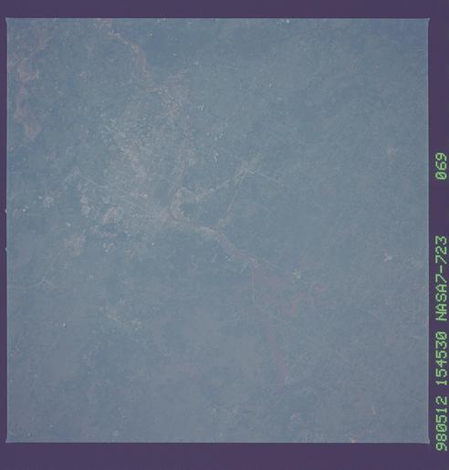
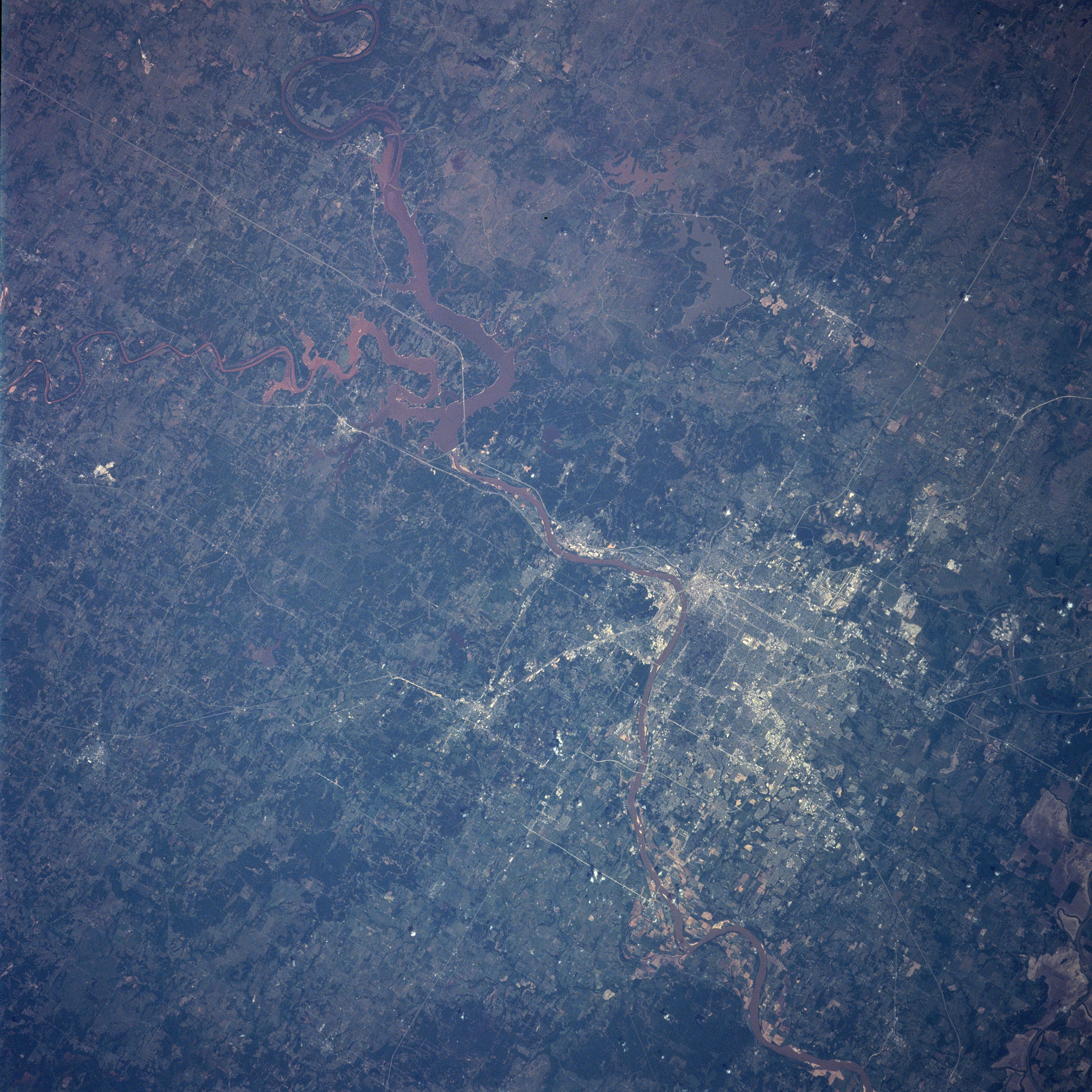
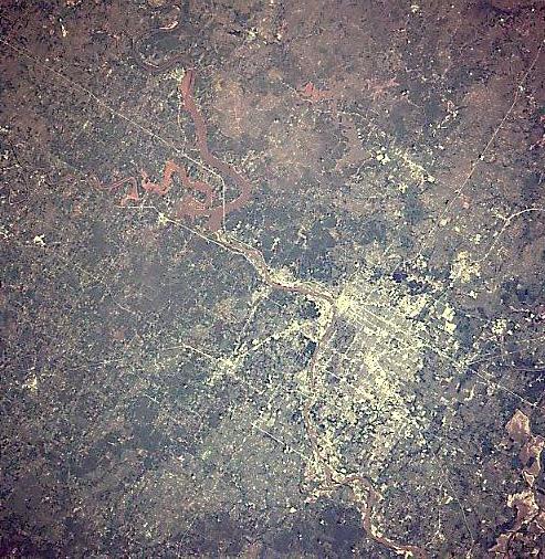
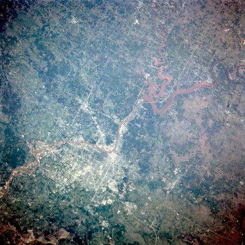
Image Caption: NASA7-723-069 Keystone Reservoir, Tulsa, Oklahoma Spring, 1998
Sediment-laden Keystone Lake and the city of Tulsa (white and gray) can be seen in this west-northwest-looking view. Keystone Reservoir, covering an area of 263000 acres (105200 hectares), is fed by the Cimmaron and the Arkansas Rivers. The reservoir provides hydroelectric power to the region and is a major resort and recreational area. In addition to its oil resources, Tulsa is a major manufacturing, financial, cultural, medical, and educational center. With the opening of the Arkansas-Verdigris Waterway in 1971 at Catoosa, a small suburban town just east of Tulsa, the city gained navigation to the Mississippi River, and became a major inland port. The Osage Indian Reservation sits to the northwest of the city. Sediment-laden Skiatook Lake is discernible just to the north of Keystone Lake and is within the boundaries of the reservation. Near the bottom right of the image, Fort Gibson Lake is visible. The reddish-color of the water features in the photograph are due to the heavy sediment loads. Much of the sediments are deposited in the various lakes (which are actually reservoirs) when the water slows down as it enters the reservoirs.
Sediment-laden Keystone Lake and the city of Tulsa (white and gray) can be seen in this west-northwest-looking view. Keystone Reservoir, covering an area of 263000 acres (105200 hectares), is fed by the Cimmaron and the Arkansas Rivers. The reservoir provides hydroelectric power to the region and is a major resort and recreational area. In addition to its oil resources, Tulsa is a major manufacturing, financial, cultural, medical, and educational center. With the opening of the Arkansas-Verdigris Waterway in 1971 at Catoosa, a small suburban town just east of Tulsa, the city gained navigation to the Mississippi River, and became a major inland port. The Osage Indian Reservation sits to the northwest of the city. Sediment-laden Skiatook Lake is discernible just to the north of Keystone Lake and is within the boundaries of the reservation. Near the bottom right of the image, Fort Gibson Lake is visible. The reddish-color of the water features in the photograph are due to the heavy sediment loads. Much of the sediments are deposited in the various lakes (which are actually reservoirs) when the water slows down as it enters the reservoirs.
