NASA7-723-36
| NASA Photo ID | NASA7-723-36 |
| Focal Length | 100mm |
| Date taken | 1998.05.10 |
| Time taken | GMT |
Resolutions offered for this image:
4096 x 4096 pixels 640 x 640 pixels 4400 x 4600 pixels 492 x 515 pixels 505 x 495 pixels 479 x 479 pixels
4096 x 4096 pixels 640 x 640 pixels 4400 x 4600 pixels 492 x 515 pixels 505 x 495 pixels 479 x 479 pixels


Cloud masks available for this image:
Spacecraft nadir point:
Photo center point: 49.0° N, 94.5° W
Photo center point by machine learning:
Photo center point: 49.0° N, 94.5° W
Photo center point by machine learning:
Nadir to Photo Center:
Spacecraft Altitude: nautical miles (0km)
Country or Geographic Name: | CANADA-O |
Features: | LAKE OF THE WOODS, AGR. |
| Features Found Using Machine Learning: | |
Cloud Cover Percentage: | 5 (1-10)% |
Sun Elevation Angle: | ° |
Sun Azimuth: | ° |
Camera: | Hasselblad |
Focal Length: | 100mm |
Camera Tilt: | Low Oblique |
Format: | 5069: Kodak Elite 100S, E6 Reversal, Replaces Lumiere, Warmer in tone vs. Lumiere |
Film Exposure: | Normal |
| Additional Information | |
| Width | Height | Annotated | Cropped | Purpose | Links |
|---|---|---|---|---|---|
| 4096 pixels | 4096 pixels | No | No | Earth From Space collection | Download Image |
| 640 pixels | 640 pixels | No | No | Earth From Space collection | Download Image |
| 4400 pixels | 4600 pixels | No | No | Download Image | |
| 492 pixels | 515 pixels | No | No | Download Image | |
| 505 pixels | 495 pixels | No | No | Download Image | |
| 479 pixels | 479 pixels | Download Image |
Download Packaged File
Download a Google Earth KML for this Image
View photo footprint information
Download a GeoTIFF for this photo
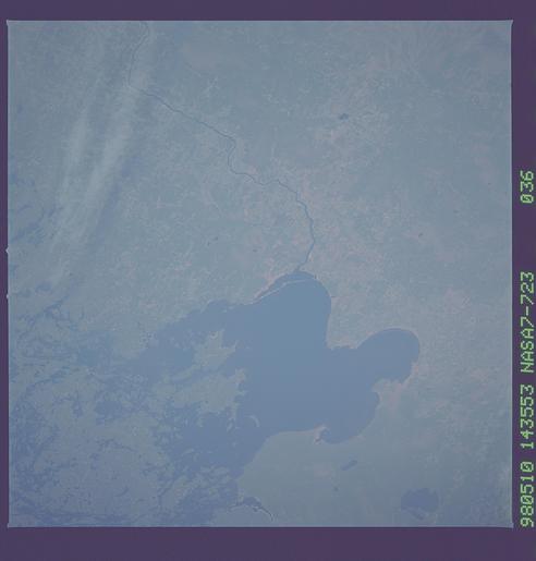
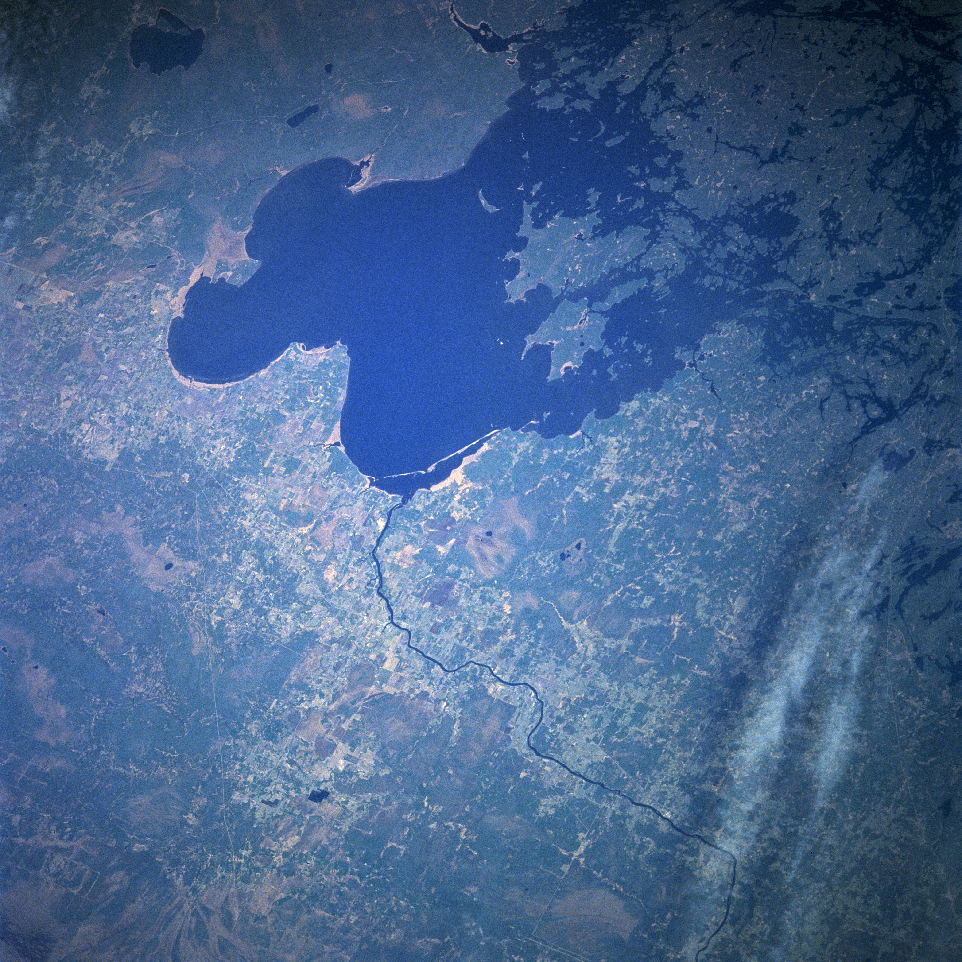
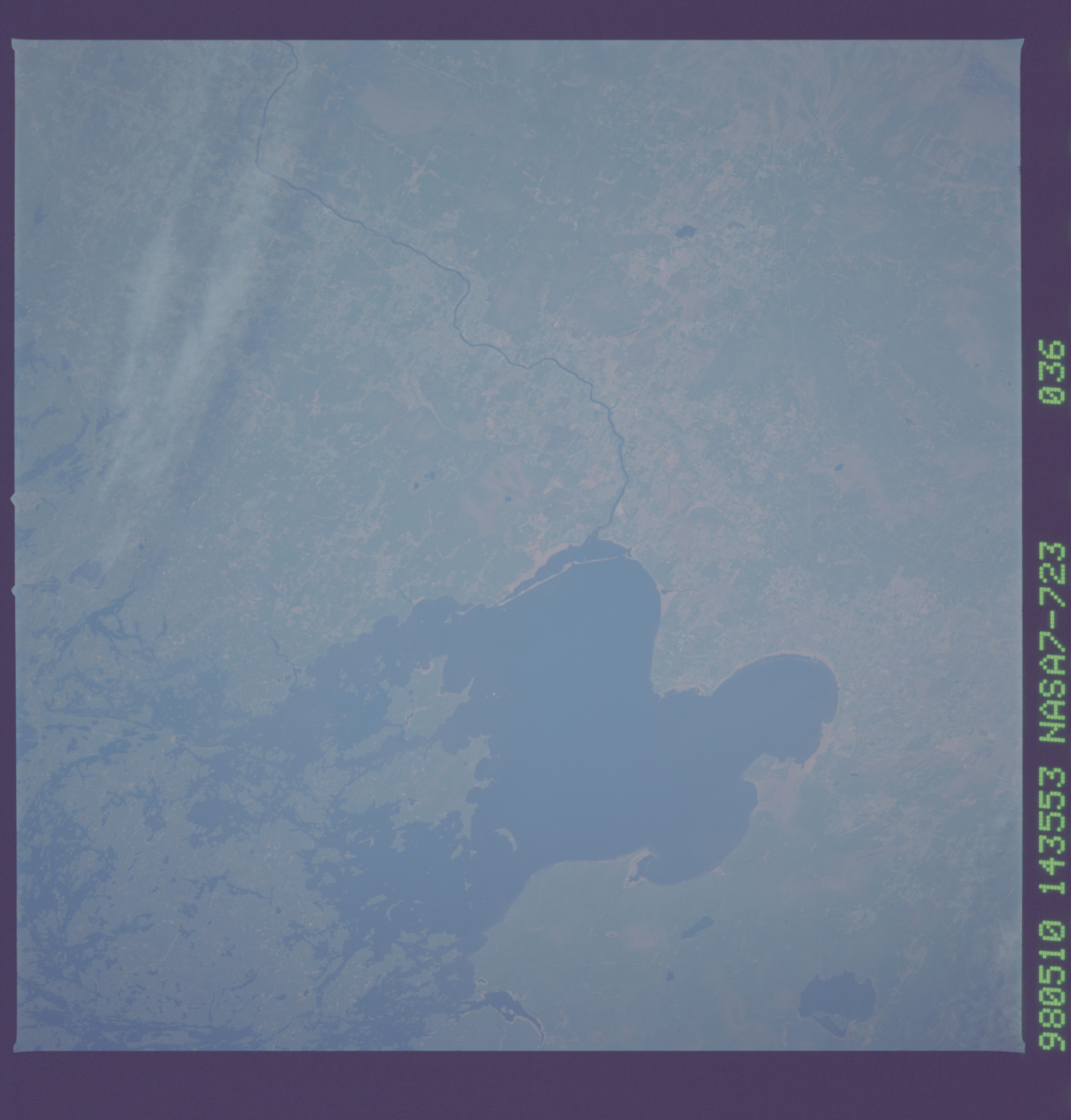
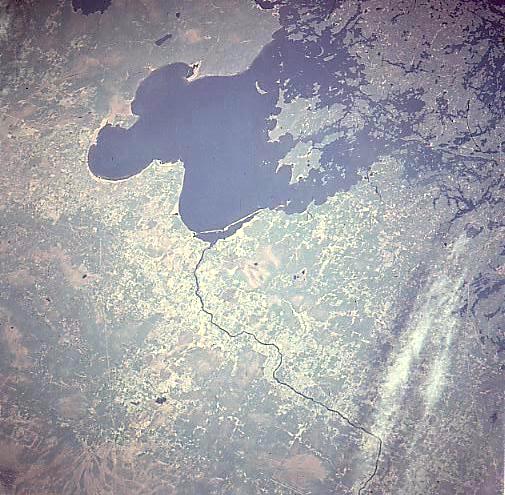
Image Caption: NASA7-723-036 Lake of the Woods, Ontario, Canada May, 1998
The second largest inland lake in Ontario, Lake of the Woods can be seen in this west-northwest looking low-oblique view. Lake of the Woods is nearly 100 miles (161 km) long, 70 miles (115 km) wide, and covers an area of 1485 square miles (3846 sq km). Located in the southern Canadian Shield, Lake of the Woods was once part of the ancient glacial Lake Agassiz. The lake, with more than 14000 islands and almost 65000 miles (104650 km) of shoreline, is a resort area renowned for excellent fishing and other recreational activities. Headwaters of the Rainy River (right of center) are around Rainy Lake near International Falls, Minnesota (not visible on the image). The Rainy River flows 85 miles (135 km) westward along the Canadian and United States border before entering the Lake of the Woods.
The second largest inland lake in Ontario, Lake of the Woods can be seen in this west-northwest looking low-oblique view. Lake of the Woods is nearly 100 miles (161 km) long, 70 miles (115 km) wide, and covers an area of 1485 square miles (3846 sq km). Located in the southern Canadian Shield, Lake of the Woods was once part of the ancient glacial Lake Agassiz. The lake, with more than 14000 islands and almost 65000 miles (104650 km) of shoreline, is a resort area renowned for excellent fishing and other recreational activities. Headwaters of the Rainy River (right of center) are around Rainy Lake near International Falls, Minnesota (not visible on the image). The Rainy River flows 85 miles (135 km) westward along the Canadian and United States border before entering the Lake of the Woods.
