NASA7-722-46B
| NASA Photo ID | NASA7-722-46B |
| Focal Length | 250mm |
| Date taken | 1998.05.08 |
| Time taken | GMT |
Resolutions offered for this image:
4096 x 4040 pixels 640 x 631 pixels 4400 x 4600 pixels 492 x 515 pixels
4096 x 4040 pixels 640 x 631 pixels 4400 x 4600 pixels 492 x 515 pixels


Cloud masks available for this image:
Spacecraft nadir point:
Photo center point: 47.5° N, 9.5° E
Photo center point by machine learning:
Photo center point: 47.5° N, 9.5° E
Photo center point by machine learning:
Nadir to Photo Center:
Spacecraft Altitude: nautical miles (0km)
Country or Geographic Name: | GERMANY |
Features: | BODENSEE, RHINE RIVER |
| Features Found Using Machine Learning: | |
Cloud Cover Percentage: | 0 (no clouds present) |
Sun Elevation Angle: | ° |
Sun Azimuth: | ° |
Camera: | Hasselblad |
Focal Length: | 250mm |
Camera Tilt: | Low Oblique |
Format: | 5069: Kodak Elite 100S, E6 Reversal, Replaces Lumiere, Warmer in tone vs. Lumiere |
Film Exposure: | Normal |
| Additional Information | |
| Width | Height | Annotated | Cropped | Purpose | Links |
|---|---|---|---|---|---|
| 4096 pixels | 4040 pixels | No | No | Earth From Space collection | Download Image |
| 640 pixels | 631 pixels | No | No | Earth From Space collection | Download Image |
| 4400 pixels | 4600 pixels | No | No | Download Image | |
| 492 pixels | 515 pixels | No | No | Download Image |
Download Packaged File
Download a Google Earth KML for this Image
View photo footprint information
Download a GeoTIFF for this photo
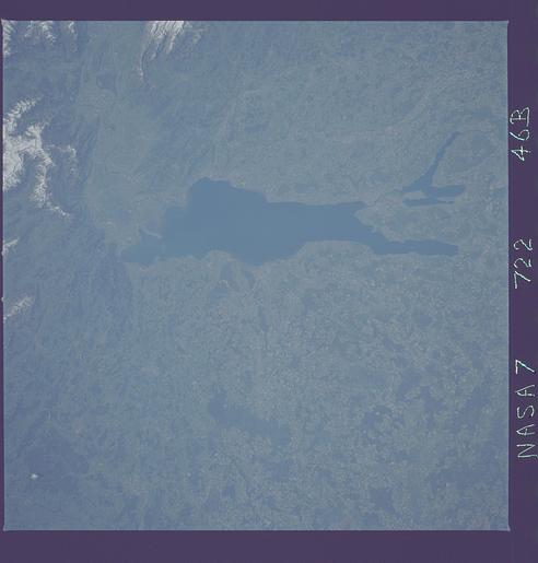
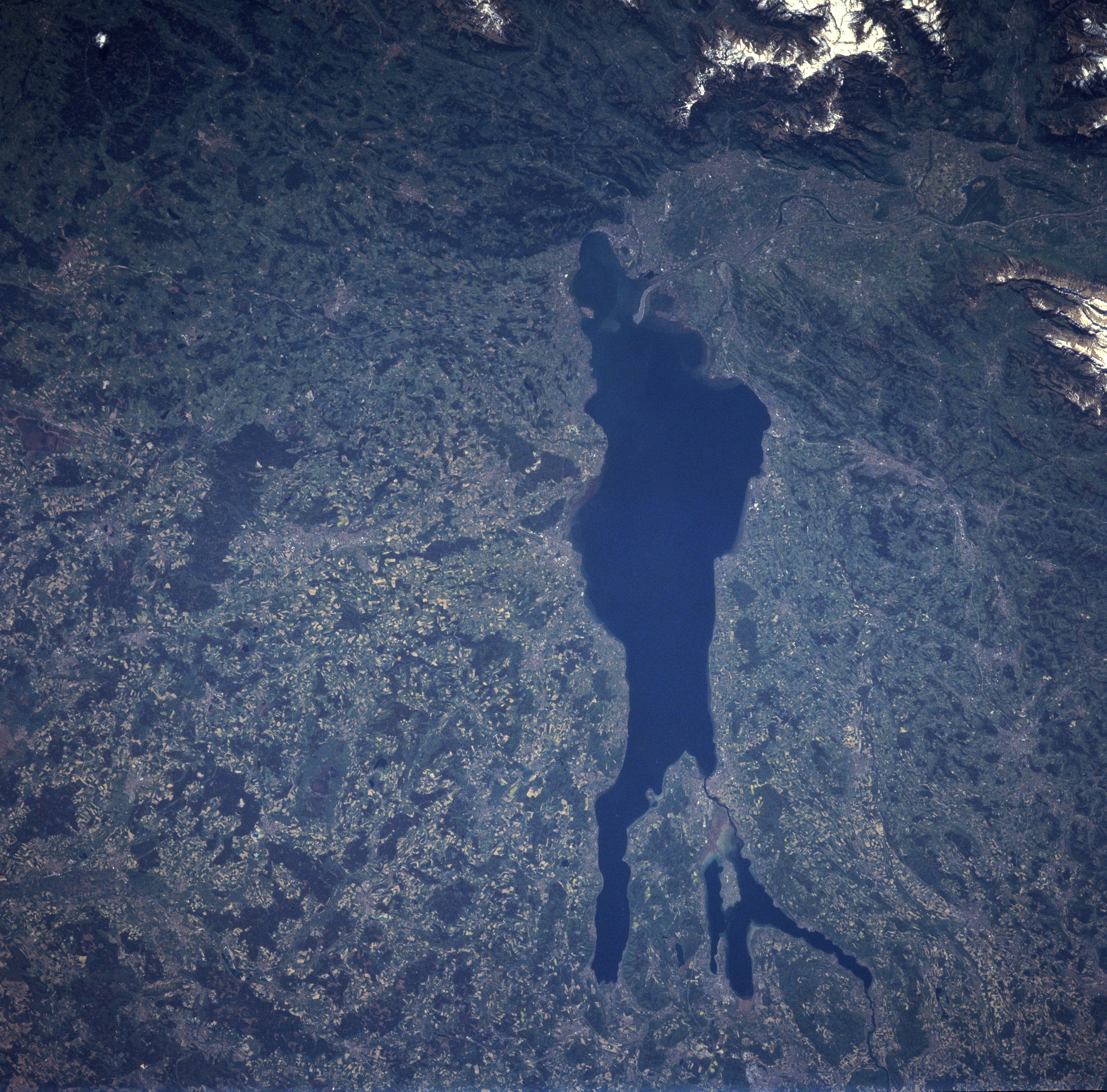
Image Caption: NASA7-722-46B Lake Constance, Germany Winter/Spring 1998
Lake Constance, sometimes referred to as the Bodensee, can be seen in this southwest-looking view. Lake Constance is 42 miles (68 Km) long and covers an area of 208 square miles (539 square Km). The lake's maximum depth is 827 feet (252 meters). The borders of three European countries run through Lake Constance. At the southeastern end of the lake (near the upper center) is the country of Austria. The Foothills of the Alps in the country of Austria are also visible in the upper left and upper center of the image. To the northeast or left of the lake is the country of Germany. To the southwest or right of the lake is the country of Switzerland. Fruit is grown on Lake Constance's fertile shores, and wine making, fishing, and tourism are major industries.
Lake Constance, sometimes referred to as the Bodensee, can be seen in this southwest-looking view. Lake Constance is 42 miles (68 Km) long and covers an area of 208 square miles (539 square Km). The lake's maximum depth is 827 feet (252 meters). The borders of three European countries run through Lake Constance. At the southeastern end of the lake (near the upper center) is the country of Austria. The Foothills of the Alps in the country of Austria are also visible in the upper left and upper center of the image. To the northeast or left of the lake is the country of Germany. To the southwest or right of the lake is the country of Switzerland. Fruit is grown on Lake Constance's fertile shores, and wine making, fishing, and tourism are major industries.
