NASA7-717-59
| NASA Photo ID | NASA7-717-59 |
| Focal Length | 250mm |
| Date taken | 1998.04.11 |
| Time taken | GMT |
Resolutions offered for this image:
4096 x 4096 pixels 640 x 640 pixels 4400 x 4600 pixels 492 x 515 pixels
4096 x 4096 pixels 640 x 640 pixels 4400 x 4600 pixels 492 x 515 pixels
Cloud masks available for this image:
Spacecraft nadir point:
Photo center point: 10.5° N, 64.0° W
Photo center point by machine learning:
Photo center point: 10.5° N, 64.0° W
Photo center point by machine learning:
Nadir to Photo Center:
Spacecraft Altitude: nautical miles (0km)
Camera: | Hasselblad |
Focal Length: | 250mm |
Camera Tilt: | Low Oblique |
Format: | 5069: Kodak Elite 100S, E6 Reversal, Replaces Lumiere, Warmer in tone vs. Lumiere |
Film Exposure: | Normal |
| Additional Information | |
| Width | Height | Annotated | Cropped | Purpose | Links |
|---|---|---|---|---|---|
| 4096 pixels | 4096 pixels | No | No | Earth From Space collection | Download Image |
| 640 pixels | 640 pixels | No | No | Earth From Space collection | Download Image |
| 4400 pixels | 4600 pixels | No | No | Download Image | |
| 492 pixels | 515 pixels | No | No | Download Image |
Download Packaged File
Download a Google Earth KML for this Image
View photo footprint information
Download a GeoTIFF for this photo
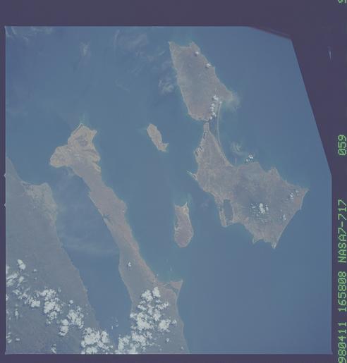
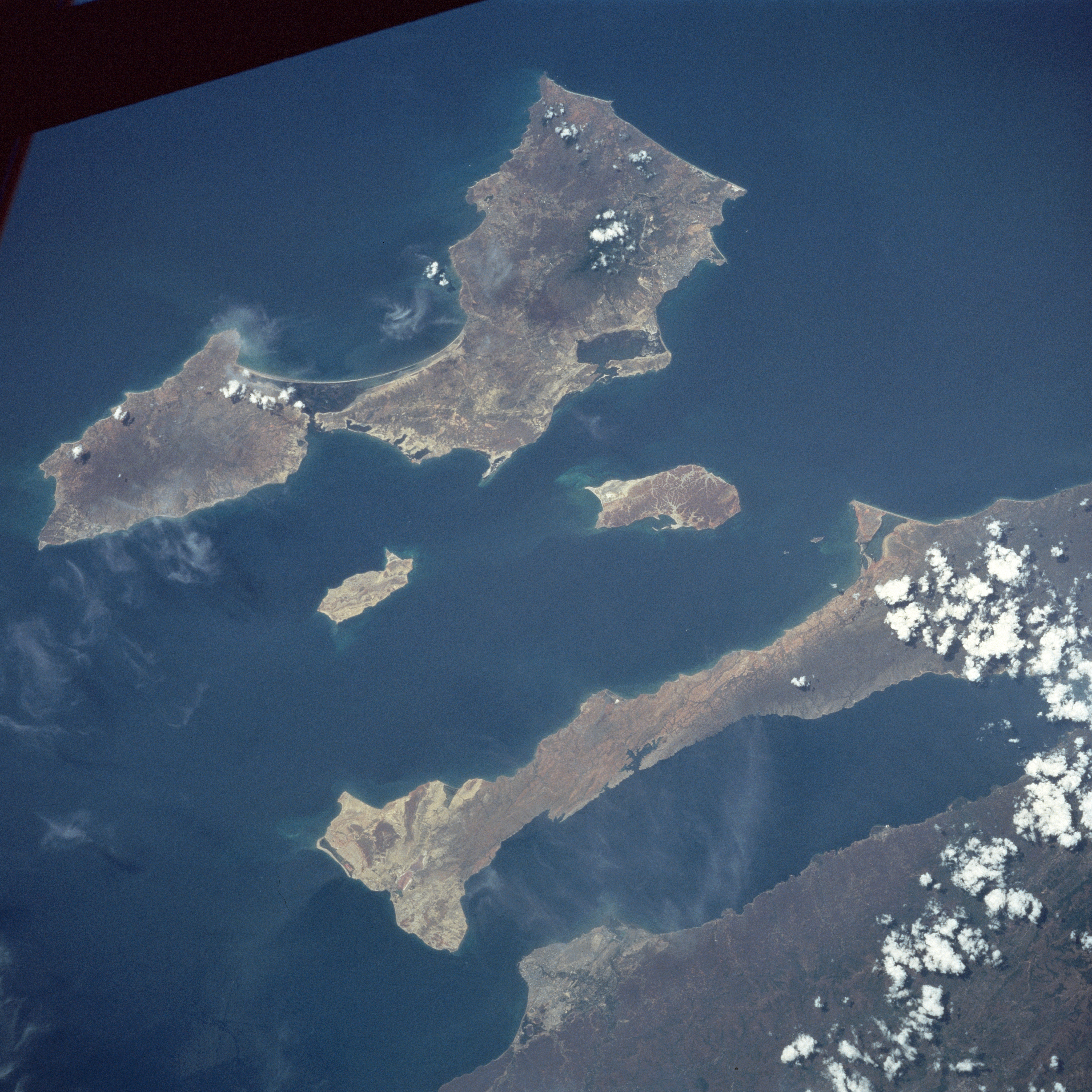
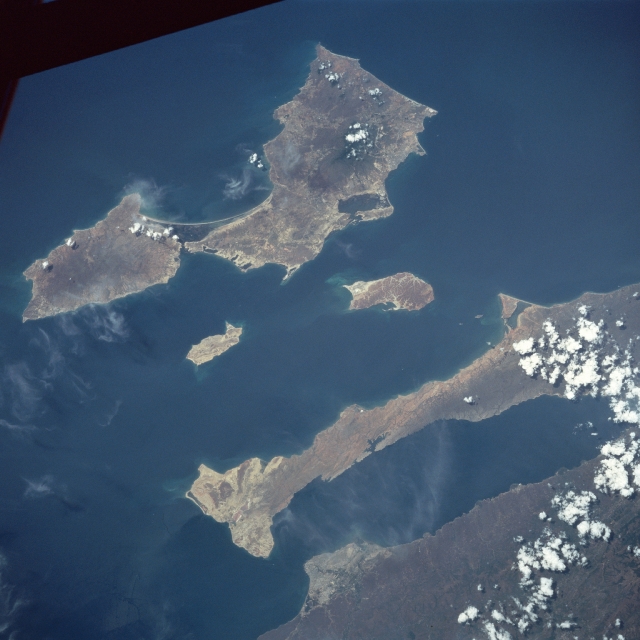
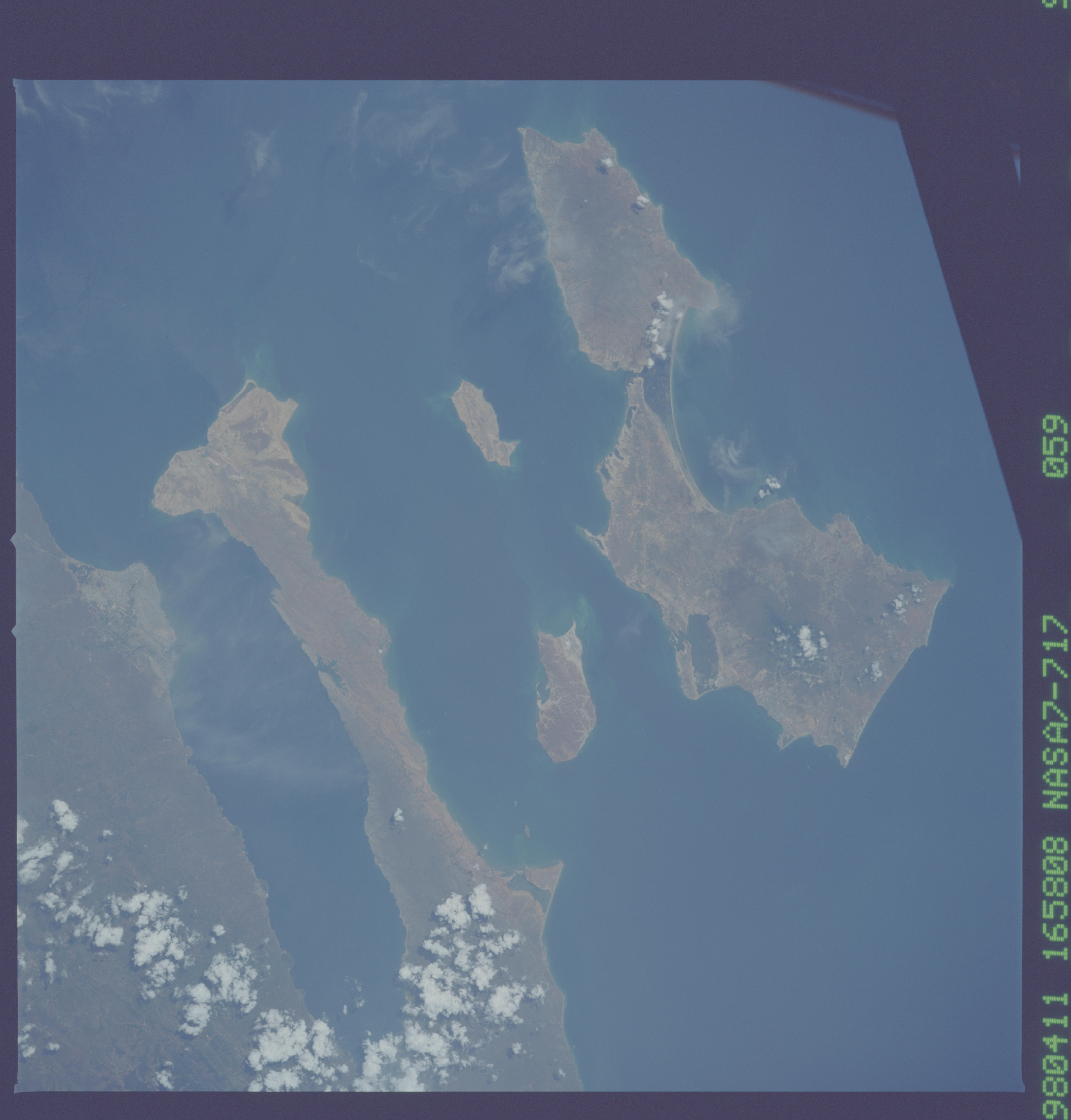
Image Caption: NASA7-717-059 Araya Peninsula, Margarita Island, Venezuela Winter/Spring 1998
This northeast-looking view shows the large island of Margarita, the Araya Peninsula, and the Gulf of Cariaco. Margarita Island has an area of 444 sq. miles (1150 sq. km) and is the top of a submerged mountain range that parallels the Venezuelan coast. Its chief city is Porlamar (barely discernible), located on the southeast side of the island. In 1969, the island was developed as a free port offering extensive tourist facilities. Tourism is now one of the leading industries of the island. The two islands to the south of Margarita Island are Cubagua (smaller) and Coche. The Araya Peninsula is actually an extension of the Paria Peninsula, further east, comprising the Northern Mountain Range. The Gulf of Cariaco to the south of the Araya Peninsula is an arm of the Caribbean Sea. The city of Cumana (bottom center) is the oldest existing European settlement in South America. Cumana has often suffered from earthquakes.
This northeast-looking view shows the large island of Margarita, the Araya Peninsula, and the Gulf of Cariaco. Margarita Island has an area of 444 sq. miles (1150 sq. km) and is the top of a submerged mountain range that parallels the Venezuelan coast. Its chief city is Porlamar (barely discernible), located on the southeast side of the island. In 1969, the island was developed as a free port offering extensive tourist facilities. Tourism is now one of the leading industries of the island. The two islands to the south of Margarita Island are Cubagua (smaller) and Coche. The Araya Peninsula is actually an extension of the Paria Peninsula, further east, comprising the Northern Mountain Range. The Gulf of Cariaco to the south of the Araya Peninsula is an arm of the Caribbean Sea. The city of Cumana (bottom center) is the oldest existing European settlement in South America. Cumana has often suffered from earthquakes.
