NASA7-711-51
| NASA Photo ID | NASA7-711-51 |
| Focal Length | 100mm |
| Date taken | 1998.03.13 |
| Time taken | GMT |
Resolutions offered for this image:
3905 x 4015 pixels 622 x 639 pixels 4400 x 4600 pixels 492 x 515 pixels 518 x 508 pixels
3905 x 4015 pixels 622 x 639 pixels 4400 x 4600 pixels 492 x 515 pixels 518 x 508 pixels

Cloud masks available for this image:
Spacecraft nadir point:
Photo center point: 16.5° N, 74.0° E
Photo center point by machine learning:
Photo center point: 16.5° N, 74.0° E
Photo center point by machine learning:
Nadir to Photo Center:
Spacecraft Altitude: nautical miles (0km)
Country or Geographic Name: | INDIA |
Features: | WESTERN GHATS, RESERVOIRS |
| Features Found Using Machine Learning: | |
Cloud Cover Percentage: | 5 (1-10)% |
Sun Elevation Angle: | ° |
Sun Azimuth: | ° |
Camera: | Hasselblad |
Focal Length: | 100mm |
Camera Tilt: | Low Oblique |
Format: | 5069: Kodak Elite 100S, E6 Reversal, Replaces Lumiere, Warmer in tone vs. Lumiere |
Film Exposure: | Normal |
| Additional Information | |
| Width | Height | Annotated | Cropped | Purpose | Links |
|---|---|---|---|---|---|
| 3905 pixels | 4015 pixels | No | No | Earth From Space collection | Download Image |
| 622 pixels | 639 pixels | No | No | Earth From Space collection | Download Image |
| 4400 pixels | 4600 pixels | No | No | Download Image | |
| 492 pixels | 515 pixels | No | No | Download Image | |
| 518 pixels | 508 pixels | Download Image |
Download Packaged File
Download a Google Earth KML for this Image
View photo footprint information
Download a GeoTIFF for this photo
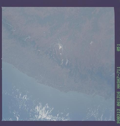
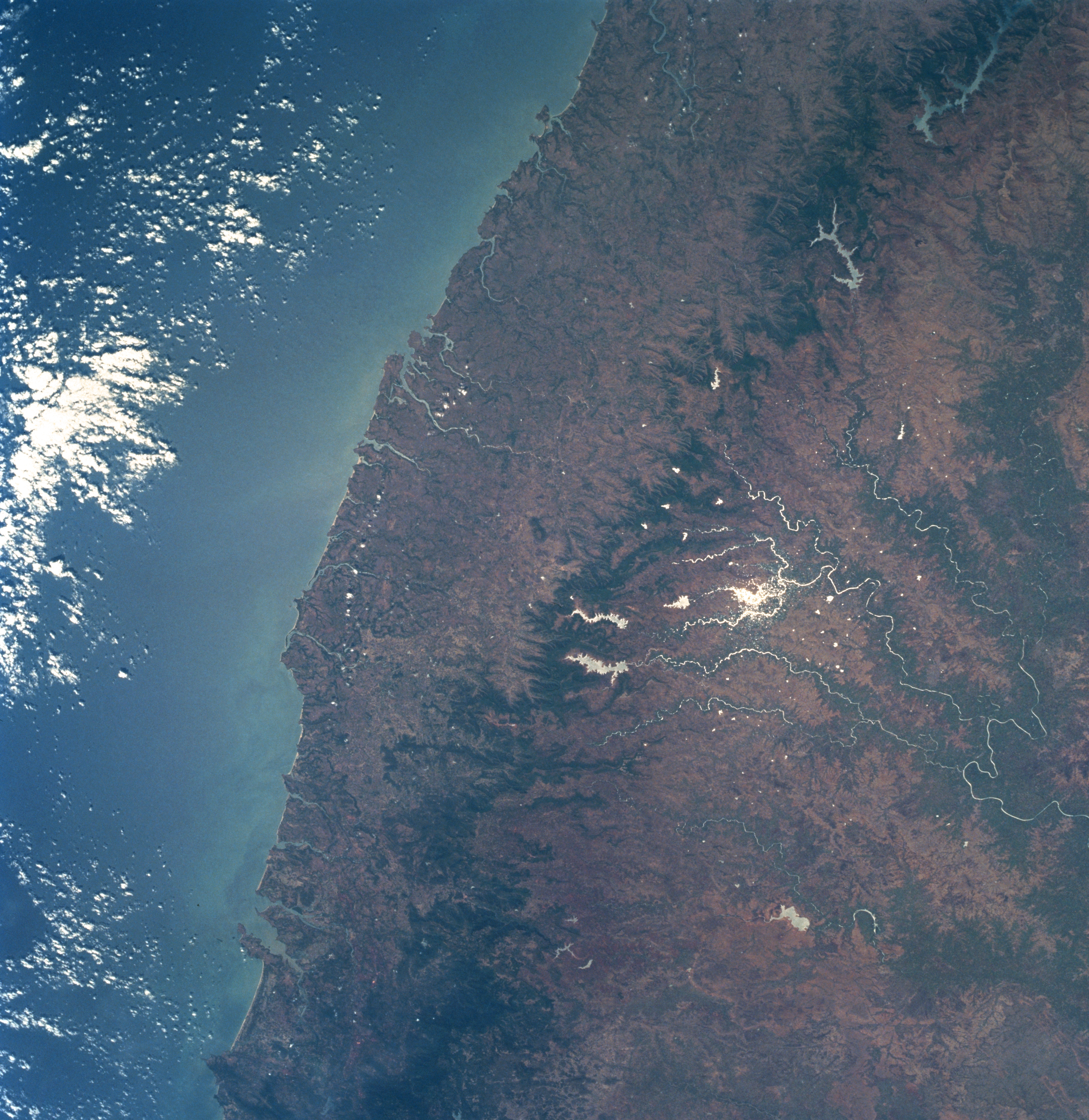
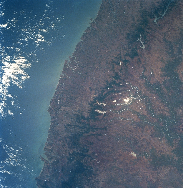
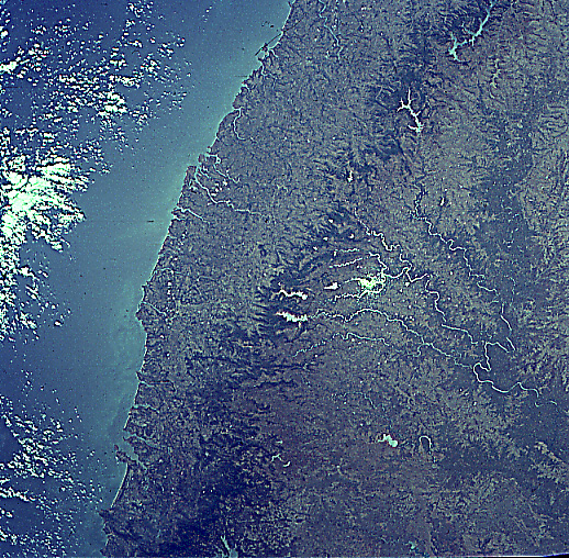
Image Caption: NASA7-711-051 Western Ghats, India Winter-Spring 1998
The irregular, dark-looking area that runs diagonally from the bottom left to the top right part of the image shows a section of the Western Ghats, a relatively low range of forested mountains that stretch along the southwest coast of India. Most of the elevations of the ridgelines and peaks in this section of the mountain range vary from 3000 feet to 4000 feet (915 meters to 1220 meters) above sea level with occasional elevations exceeding 4500 feet (1370 meters). The coastal plain in this area south of Bombay is narrow to almost nonexistent. The elevated landform east of the Western Ghats is the Deccan Plateau. The summer monsoon (rainy season) that brings in excess of 150 inches (4000 millimeters) of precipitation a year to this coastal region of southwest India has produced erosional canyons along the western facing slopes of the Western Ghats. Several eastward draining rivers (thin, white-looking lines), some with reservoirs (larger, white-looking features), are visible on the Deccan Plateau. The white-looking water is caused by the sun's reflection off of the surface of the water. The darker terrain along the eastern margin (left side) of the image is forested.
The irregular, dark-looking area that runs diagonally from the bottom left to the top right part of the image shows a section of the Western Ghats, a relatively low range of forested mountains that stretch along the southwest coast of India. Most of the elevations of the ridgelines and peaks in this section of the mountain range vary from 3000 feet to 4000 feet (915 meters to 1220 meters) above sea level with occasional elevations exceeding 4500 feet (1370 meters). The coastal plain in this area south of Bombay is narrow to almost nonexistent. The elevated landform east of the Western Ghats is the Deccan Plateau. The summer monsoon (rainy season) that brings in excess of 150 inches (4000 millimeters) of precipitation a year to this coastal region of southwest India has produced erosional canyons along the western facing slopes of the Western Ghats. Several eastward draining rivers (thin, white-looking lines), some with reservoirs (larger, white-looking features), are visible on the Deccan Plateau. The white-looking water is caused by the sun's reflection off of the surface of the water. The darker terrain along the eastern margin (left side) of the image is forested.
