ISS069-E-1403
| NASA Photo ID | ISS069-E-1403 |
| Focal Length | 1150mm |
| Date taken | 2023.04.09 |
| Time taken | 20:53:33 GMT |
4450 x 3708 pixels 720 x 600 pixels 5568 x 3712 pixels 640 x 427 pixels
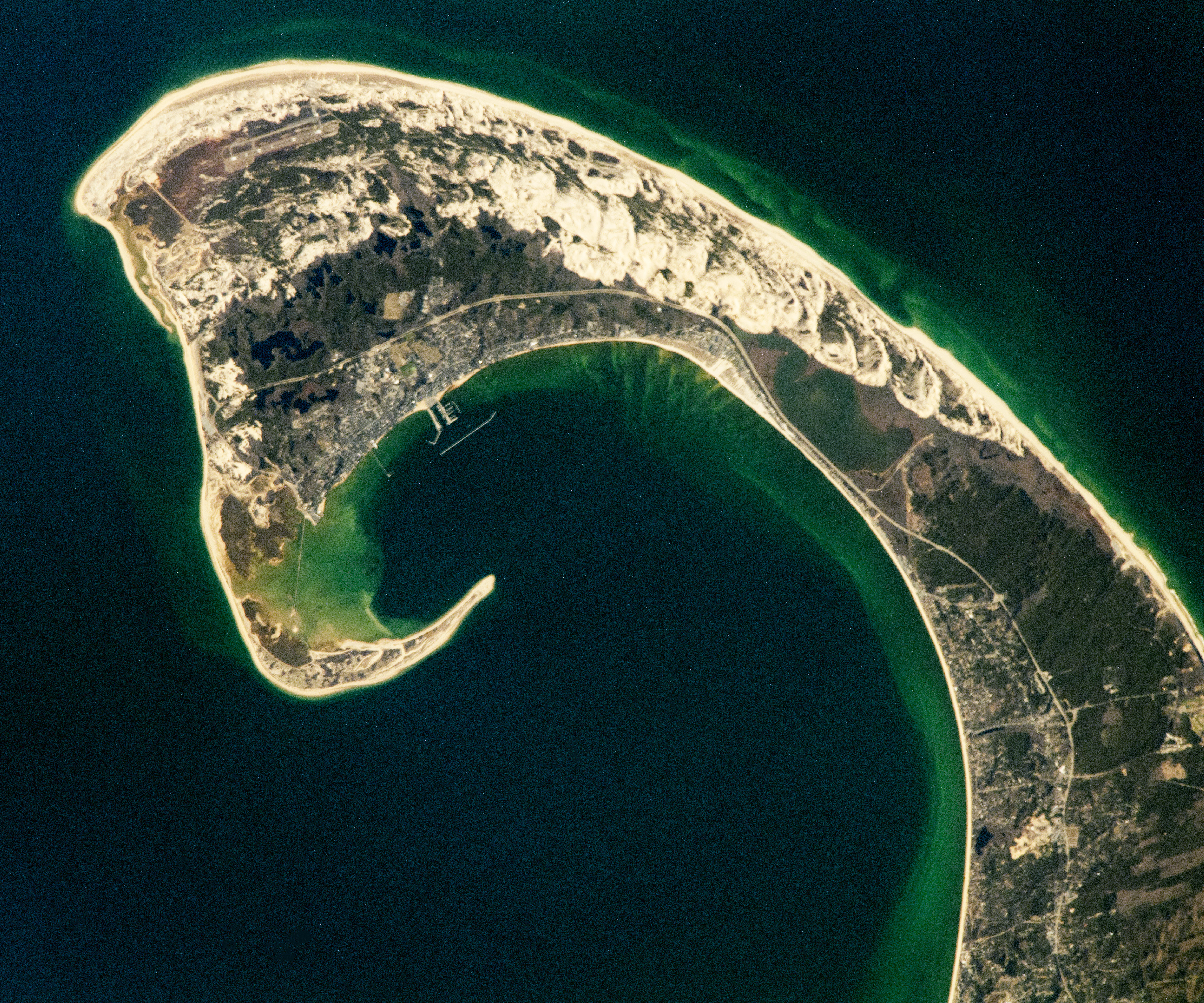
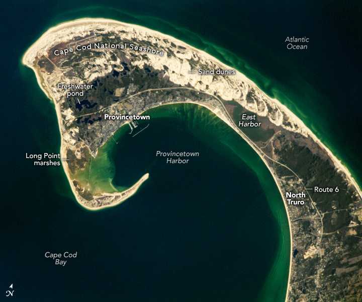
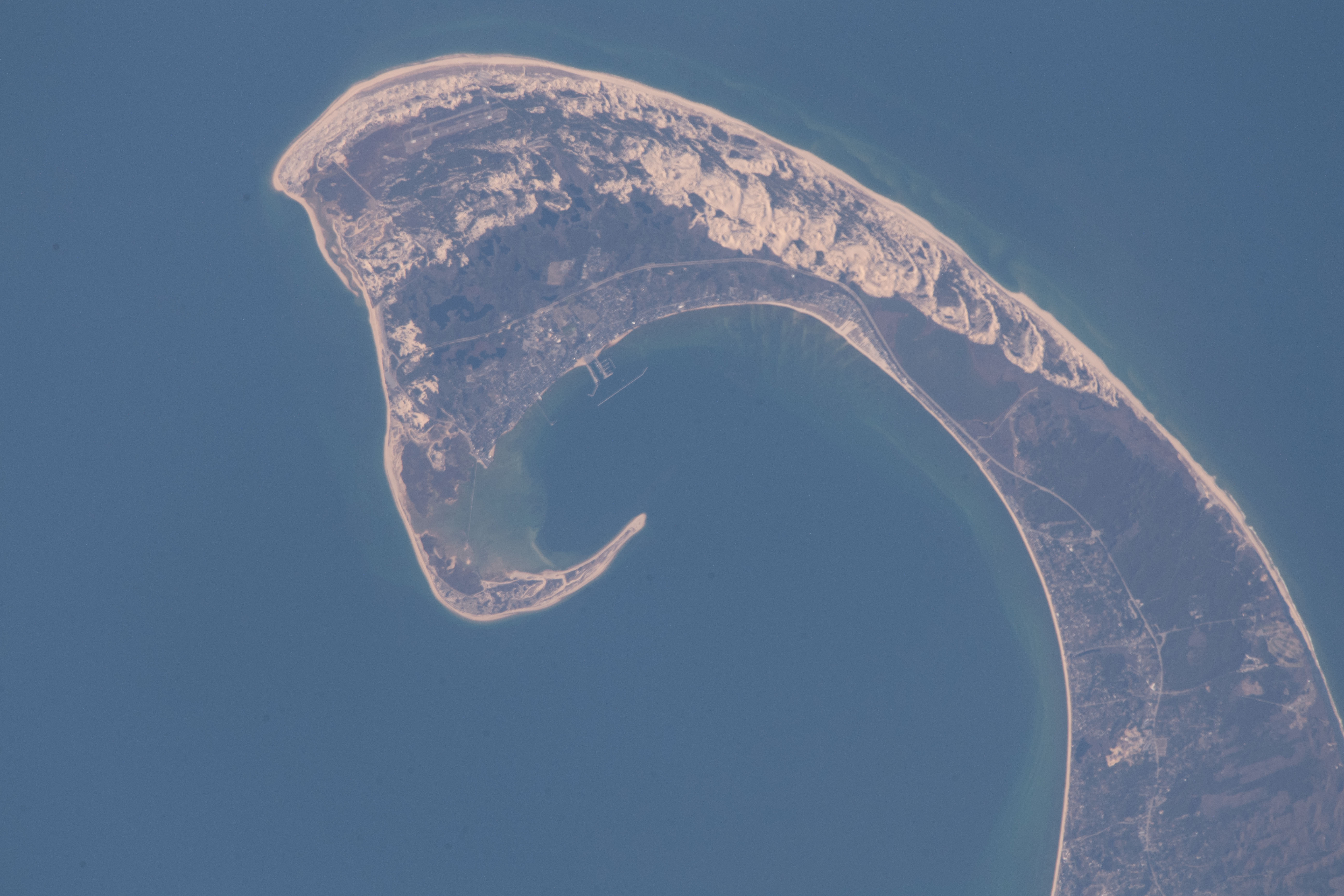


Photo center point:
Photo center point by machine learning: 42.04° N, 70.17° W

Country or Geographic Name: | |
Features: | |
| Features Found Using Machine Learning: | |
Cloud Cover Percentage: | |
Sun Elevation Angle: | 24° |
Sun Azimuth: | 258° |
Camera: | NIKON D5 S/N: 3503270 |
Focal Length: | 1150mm |
Camera Tilt: | |
Format: | |
Film Exposure: | |
| Additional Information | |
| Width | Height | Annotated | Cropped | Purpose | Links |
|---|---|---|---|---|---|
| 4450 pixels | 3708 pixels | No | Yes | NASA's Earth Observatory web site | Download Image |
| 720 pixels | 600 pixels | Yes | Yes | NASA's Earth Observatory web site | Download Image |
| 5568 pixels | 3712 pixels | No | No | Download Image | |
| 640 pixels | 427 pixels | No | No | Download Image |
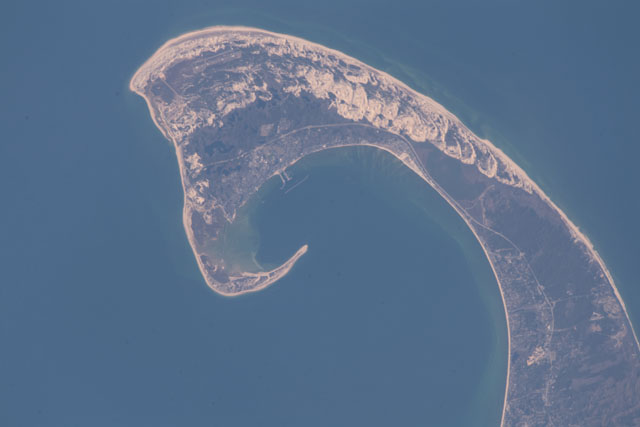
An astronaut aboard the International Space Station took this photograph of the Cape Cod peninsula while orbiting over the northeastern United States. The peninsula extends about 60 miles (100 kilometers) from the mainland of southern Massachusetts where it serves as a natural land barrier between Cape Cod Bay and the Atlantic Ocean.
Since 1842, ferries in Cape Cod Bay have connected Boston (west of this image) to Provincetown. Ferries and other ships sailing through Provincetown Harbor and around the peninsula’s elongated sandbar used the guidance of Long Point Lighthouse, first lit in 1827. The formation of the sandbar and shaping of the peninsula began many thousands of years before those ships set sail.
The Cape Cod peninsula’s distinct hook shape started forming 10,000 years ago by glacial erosion and movement of the Laurentide Ice Sheet. Subsequent natural processes, such as severe storms, waves, wind, and sea level rise have contributed to the shape of the peninsula.
The sand dunes visible in this image started forming after glacial retreat when sediment left by the glaciers was further modified and redeposited by coastal ocean currents. As glacial retreat continued, depressions left in the land surface were filled by groundwater—creating freshwater ponds.
The sand dunes, freshwater ponds, and other land features on the Atlantic-facing side of Route 6 reside in the northern portion of the Cape Cod National Seashore. The 70 square miles (180 square kilometers) of Cape Cod National Seashore support a variety of ecosystems, such as the salt marshes at Long Point near Provincetown and the human-made freshwater lake of East Harbor near North Truro.
The variety of ecosystems within Cape Cod National Seashore sustain over 450 species of amphibians, reptiles, fish, birds, and mammals, including 32 species that are rare or endangered. One of those species is the American oystercatcher, a large shorebird that uses a knife-like bill to eat shellfish.
