ISS067-E-315691
| NASA Photo ID | ISS067-E-315691 |
| Focal Length | 1150mm |
| Date taken | 2022.08.27 |
| Time taken | 21:42:24 GMT |
Resolutions offered for this image:
4176 x 2784 pixels 720 x 650 pixels 4176 x 2784 pixels 640 x 427 pixels
4176 x 2784 pixels 720 x 650 pixels 4176 x 2784 pixels 640 x 427 pixels
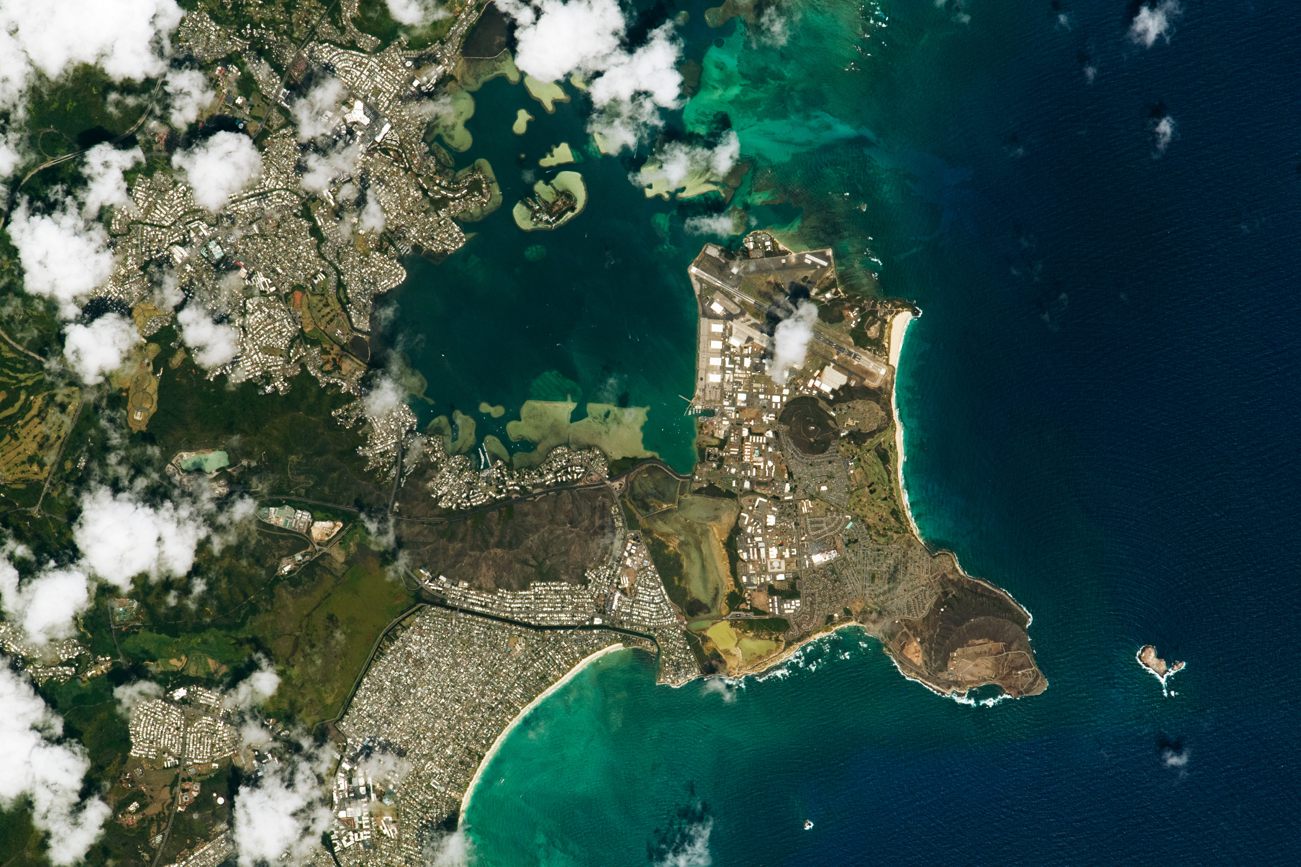


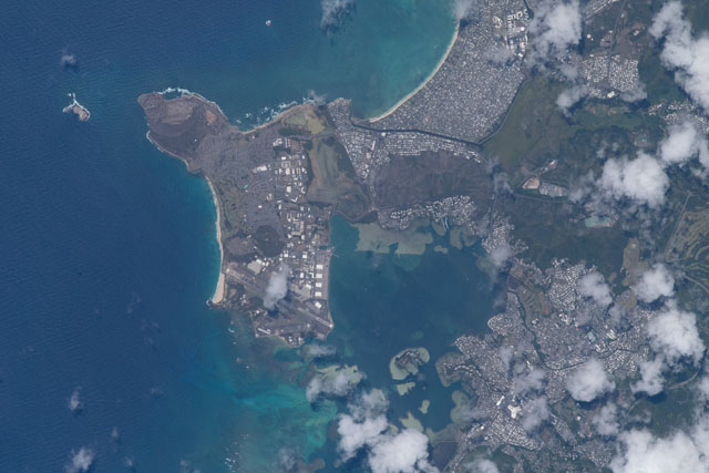
Spacecraft nadir point: 19.6° N, 156.6° W
Photo center point: 21.4° N, 157.8° W
Photo center point by machine learning: 21.43° N, 157.76° W
Photo center point: 21.4° N, 157.8° W
Photo center point by machine learning: 21.43° N, 157.76° W
Nadir to Photo Center: Northwest
Spacecraft Altitude: 223 nautical miles (413km)

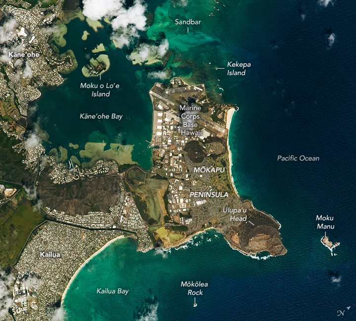
Country or Geographic Name: | USA-HAWAII |
Features: | KAILUA BAY, REEF, MCAS KANEOHE BAY |
| Features Found Using Machine Learning: | |
Cloud Cover Percentage: | 50 (26-50)% |
Sun Elevation Angle: | 75° |
Sun Azimuth: | 130° |
Camera: | Nikon D5 Electronic Still Camera |
Focal Length: | 1150mm |
Camera Tilt: | 30 degrees |
Format: | 5568E: 5568 x 3712 pixel CMOS sensor, 35.9 x 23.9 mm, total pixels: 21.33 million, Nikon FX format |
Film Exposure: | |
| Additional Information | |
| Width | Height | Annotated | Cropped | Purpose | Links |
|---|---|---|---|---|---|
| 4176 pixels | 2784 pixels | No | Yes | NASA's Earth Observatory web site | Download Image |
| 720 pixels | 650 pixels | Yes | Yes | NASA's Earth Observatory web site | Download Image |
| 4176 pixels | 2784 pixels | No | No | Download Image | |
| 640 pixels | 427 pixels | No | No | Download Image |
Download Packaged File
Download a Google Earth KML for this Image
View photo footprint information
Download a GeoTIFF for this photo
Image Caption: none
