ISS065-E-165726
| NASA Photo ID | ISS065-E-165726 |
| Focal Length | 1150mm |
| Date taken | 2021.07.04 |
| Time taken | 15:48:05 GMT |
4454 x 2970 pixels 720 x 480 pixels 5568 x 3712 pixels 640 x 427 pixels
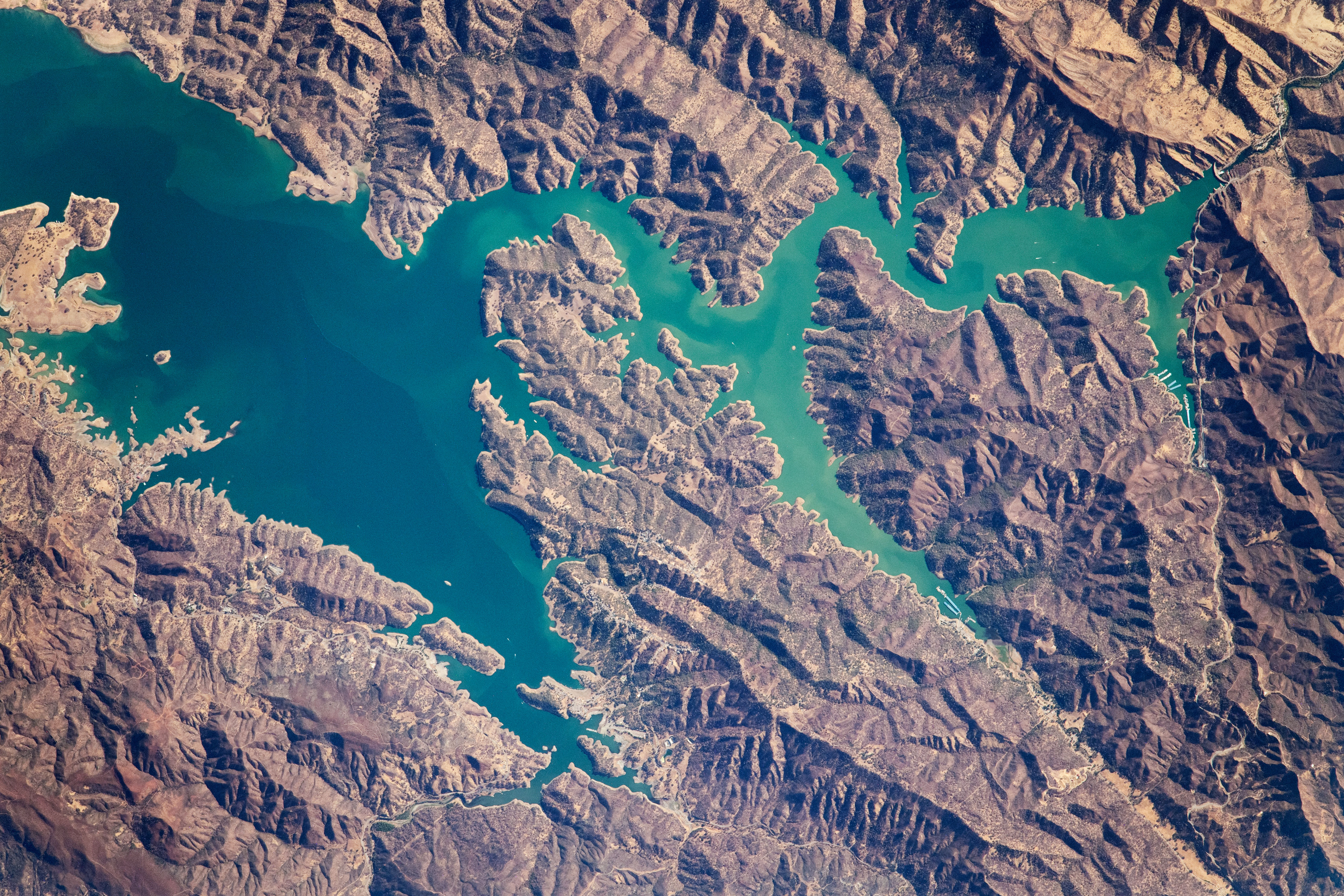
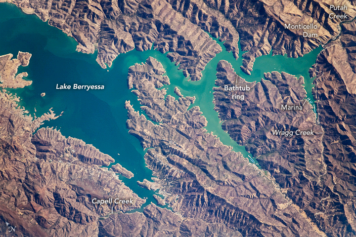


Photo center point: 38.5° N, 122.2° W
Photo center point by machine learning:
Country or Geographic Name: | USA-CALIFORNIA |
Features: | LAKE BERRYESSA, MONTICELLO DAM |
| Features Found Using Machine Learning: | |
Cloud Cover Percentage: | 10 (1-10)% |
Sun Elevation Angle: | 32° |
Sun Azimuth: | 85° |
Camera: | Nikon D5 Electronic Still Camera |
Focal Length: | 1150mm |
Camera Tilt: | 10 degrees |
Format: | 5568E: 5568 x 3712 pixel CMOS sensor, 35.9 x 23.9 mm, total pixels: 21.33 million, Nikon FX format |
Film Exposure: | |
| Additional Information | |
| Width | Height | Annotated | Cropped | Purpose | Links |
|---|---|---|---|---|---|
| 4454 pixels | 2970 pixels | Yes | No | Download Image | |
| 720 pixels | 480 pixels | Yes | No | Download Image | |
| 5568 pixels | 3712 pixels | No | No | Download Image | |
| 640 pixels | 427 pixels | No | No | Download Image |
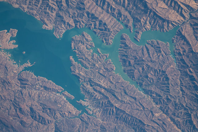
While in orbit over the San Francisco Bay Area, an astronaut onboard the International Space Station (ISS) took this photograph of the south end of Lake Berryessa, a large freshwater reservoir in nearby Napa County, California. The canyons surrounding the lake provide areas for water recreation, marinas, and campgrounds. The lake is primarily fed by Putah Creek, with additional contributions from smaller waterways such as Capell Creek and Wragg Creek. The visible swirls in the middle of the lake are sediments stirred up by the flow of the water around the canyon walls.
The artificial lake was created in the 1950s with the construction of Monticello Dam and flooding of Berryessa Valley. The dam stands 304 feet (93 meters) tall and stretches about 1,300 feet (400 meters) across Devil's Gate, a narrow pass on Putah Creek. Lake Berryessa stores and distributes water to surrounding cities and nearby farmlands, including vineyards in Napa Valley.
Water levels in Lake Berryessa and Putah Creek were low at the time of this July 2021 photo, when the entire state of California faced serious drought. The thin, light-colored zone along the shorelines is a "bathtub ring" of dry lakebed where water levels have dropped and vegetation-free sediments stand out.
During an extended drought in the 1980s, Putah Creek dried up downstream of the reservoir. To prevent this from occurring again, dam operators now regularly release water to mimic the previous seasonal ebb and flow in the creek. Lake Berryessa also provides flood protection for parts of Northern California during large rain events in the winter.
