ISS064-E-40657
| NASA Photo ID | ISS064-E-40657 |
| Focal Length | 1200mm |
| Date taken | 2021.03.03 |
| Time taken | 13:23:36 GMT |
3487 x 3874 pixels 720 x 650 pixels 5568 x 3712 pixels 640 x 427 pixels
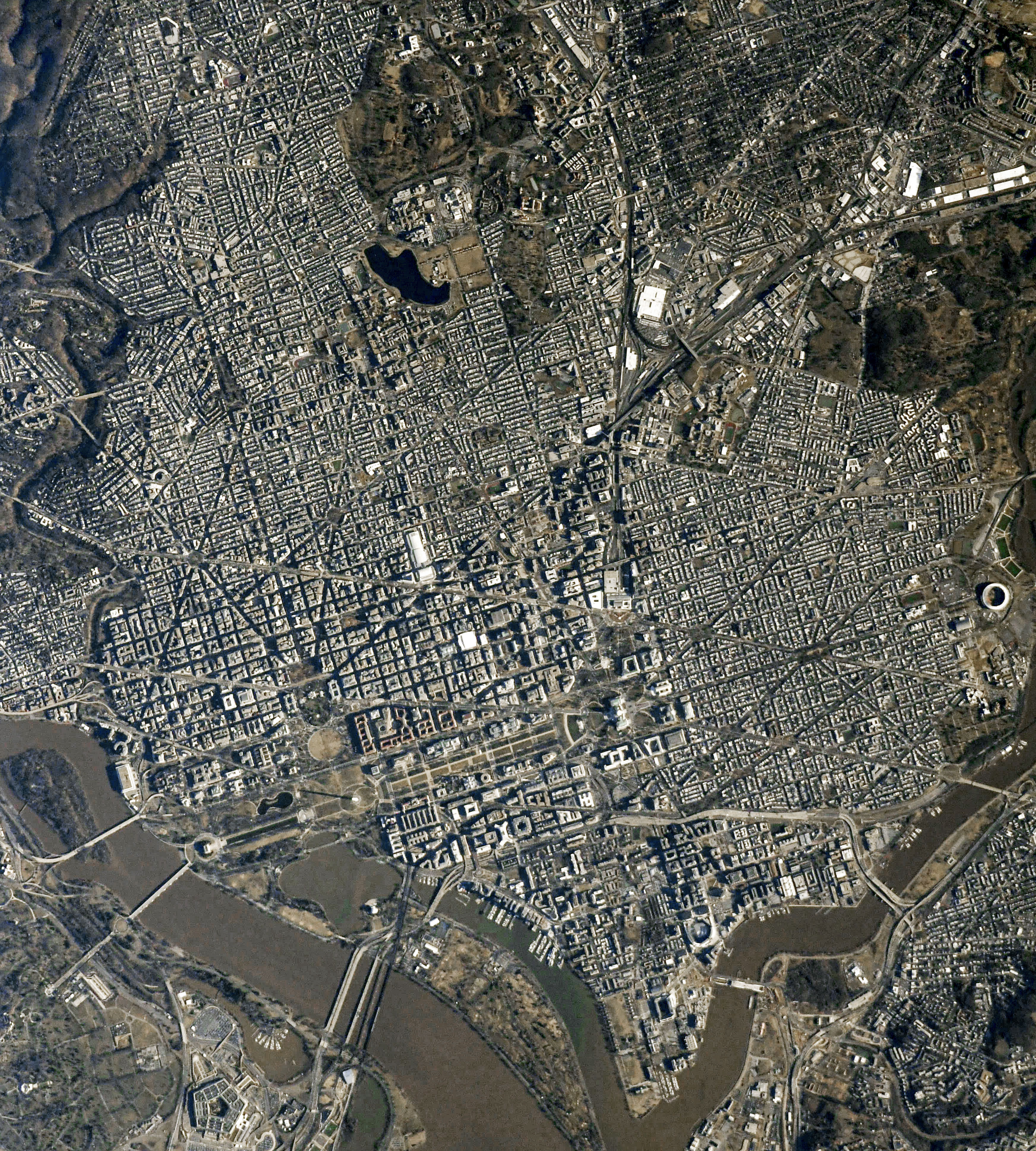
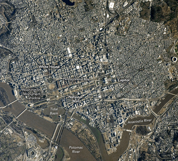


Photo center point: 38.9° N, 77.0° W
Photo center point by machine learning: 38.89° N, 77.02° W

Country or Geographic Name: | USA-VIRGINIA |
Features: | WASHINGTON DC, POTOMAC RIVER, ANACOSTIA RIVER, UNITED STATES CAPITOL, WASHINGTON MONUMENT, THE WHITE HOUSE |
| Features Found Using Machine Learning: | |
Cloud Cover Percentage: | 10 (1-10)% |
Sun Elevation Angle: | 20° |
Sun Azimuth: | 116° |
Camera: | Nikon D5 Electronic Still Camera |
Focal Length: | 1200mm |
Camera Tilt: | 11 degrees |
Format: | 5568E: 5568 x 3712 pixel CMOS sensor, 35.9 x 23.9 mm, total pixels: 21.33 million, Nikon FX format |
Film Exposure: | |
| Additional Information | Russian imagery |
| Width | Height | Annotated | Cropped | Purpose | Links |
|---|---|---|---|---|---|
| 3487 pixels | 3874 pixels | No | Yes | NASA's Earth Observatory web site | Download Image |
| 720 pixels | 650 pixels | Yes | Yes | NASA's Earth Observatory web site | Download Image |
| 5568 pixels | 3712 pixels | No | No | Download Image | |
| 640 pixels | 427 pixels | No | No | Download Image |
An explanation of the georeference file(s) above
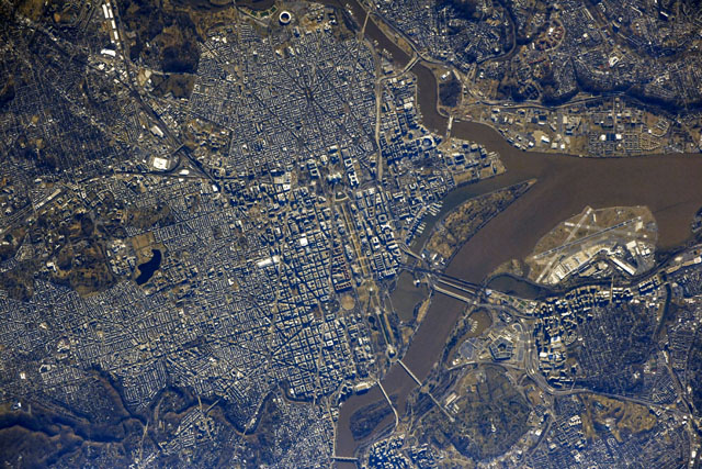
The original layout and design of Washington, D.C., comes to life in this springtime photograph taken by an astronaut on the International Space Station. The near-nadir, high resolution photo offers a view of the city's layout that its architects, Pierre (who also went by Peter) L'Enfant and Andrew Ellicott, could only imagine when they drew up plans for the District of Columbia in the 1790s. Nestled at the confluence of the Potomac and Anacostia rivers, today the city serves as both the seat of the U.S. government and as a tribute to the history of the nation.
From above, the city layout draws the eye to the Capitol. This was the architects' starting point, and the rest of the city was built in quadrants defined by axes extending in cardinal directions from this "center" of American government. These axes orient the rest of the D.C. street grid, with one notable exception. Wide, diagonal avenues radiate from the Capitol outward through the city, meeting with other diagonals to form parks and public spaces. These diagonals, named after the first states, are the main thoroughfares. The most famous of these avenues is a direct line between two branches of government - Pennsylvania Avenue physically links the White House with the Capitol.
L'Enfant left a mile long stretch west of the Capitol as a grand avenue for the public interest. It was not until the early 1900s that the National Mall and Tidal Basin had enough monuments and museums that it began to take the form that appears in the image. At the turn of the 20th century, the Washington Monument, seen here casting a long shadow, was the only monument completed within the National Mall. The next hundred years saw the construction of additional monuments, memorials, and museums that commemorate U.S. history and achievements.
