ISS063-E-76217
| NASA Photo ID | ISS063-E-76217 |
| Focal Length | 800mm |
| Date taken | 2020.08.20 |
| Time taken | 20:52:24 GMT |
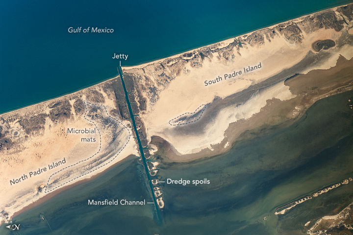
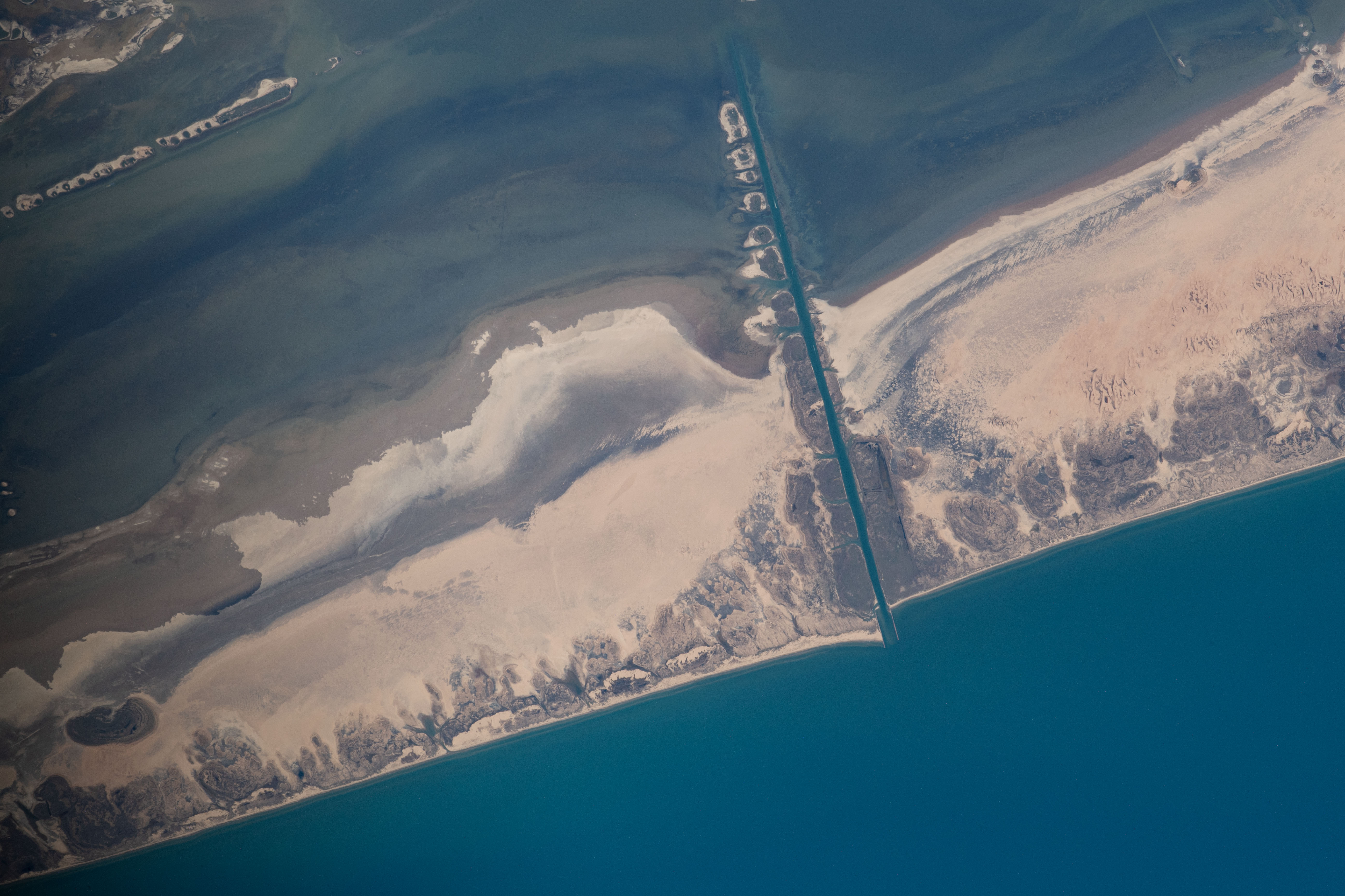

Photo center point: 26.5° N, 97.3° W
Photo center point by machine learning:
Country or Geographic Name: | USA-TEXAS |
Features: | PADRE ISLAND, GULF OF MEXICO, DUNES |
| Features Found Using Machine Learning: | |
Cloud Cover Percentage: | 10 (1-10)% |
Sun Elevation Angle: | 55° |
Sun Azimuth: | 251° |
Camera: | Nikon D5 Electronic Still Camera |
Focal Length: | 800mm |
Camera Tilt: | 21 degrees |
Format: | 5568E: 5568 x 3712 pixel CMOS sensor, 35.9 x 23.9 mm, total pixels: 21.33 million, Nikon FX format |
Film Exposure: | |
| Additional Information | |
| Width | Height | Annotated | Cropped | Purpose | Links |
|---|---|---|---|---|---|
| 720 pixels | 480 pixels | Yes | No | Download Image | |
| 5568 pixels | 3712 pixels | No | No | Download Image | |
| 640 pixels | 427 pixels | No | No | Download Image |
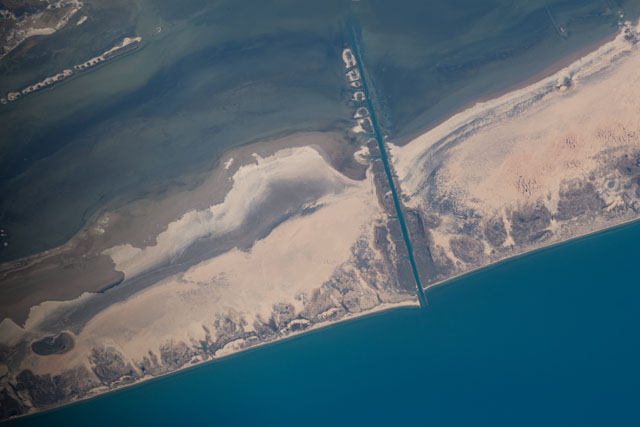
An astronaut on the International Space Station (ISS) shot this photograph of a portion of Padre Island, a long barrier island along the southern Texas coast.
Once an unbroken stretch of land, the island was separated into North and South Padre with the cutting of Mansfield Channel's first through private efforts in 1957, and then by the Army Corps of Engineers in 1962. The channel connected the fishing community of Port Mansfield to the Gulf of Mexico and established a new harbor between Corpus Christi and Brownsville.
Jetties mark the entrance from the Gulf into the channel, dredge spoils from the excavation line the southern side. Those jetties disrupt the natural
North and South Padre Islands are well known for attracting tourists and beachgoers, but they have also intrigued scientists. This photograph was taken in response to a request made by scientists to the NASA Crew Earth Observations team. Researchers are investigating changes in dune morphology and in the microorganisms that live on the surface of the island.
As is typical of many barrier islands, sand dunes line the coast of Padre, forming a natural barricade and mitigating inland damage from storms like hurricanes. Extensive microbial mats multi-layered sheets of microorganisms such as bacteria, take advantage of this natural protection and thrive in the protected tidal flats along the backshore of Padre Island. These areas of rich microbial life stand out as darker sections of beach in the photo. Microbial mats like these are among the oldest forms of life that have been identified within Earth's rock record. Many scientists believe that such mats are the best astrobiological analogues for how life might have existed on Mars.
