ISS063-E-107777

| NASA Photo ID | ISS063-E-107777 |
| Focal Length | 800mm |
| Date taken | 2020.10.14 |
| Time taken | 15:03:31 GMT |
720 x 480 pixels 720 x 480 pixels 720 x 480 pixels 5568 x 3712 pixels 640 x 427 pixels

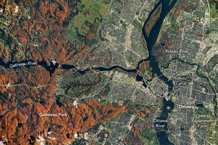

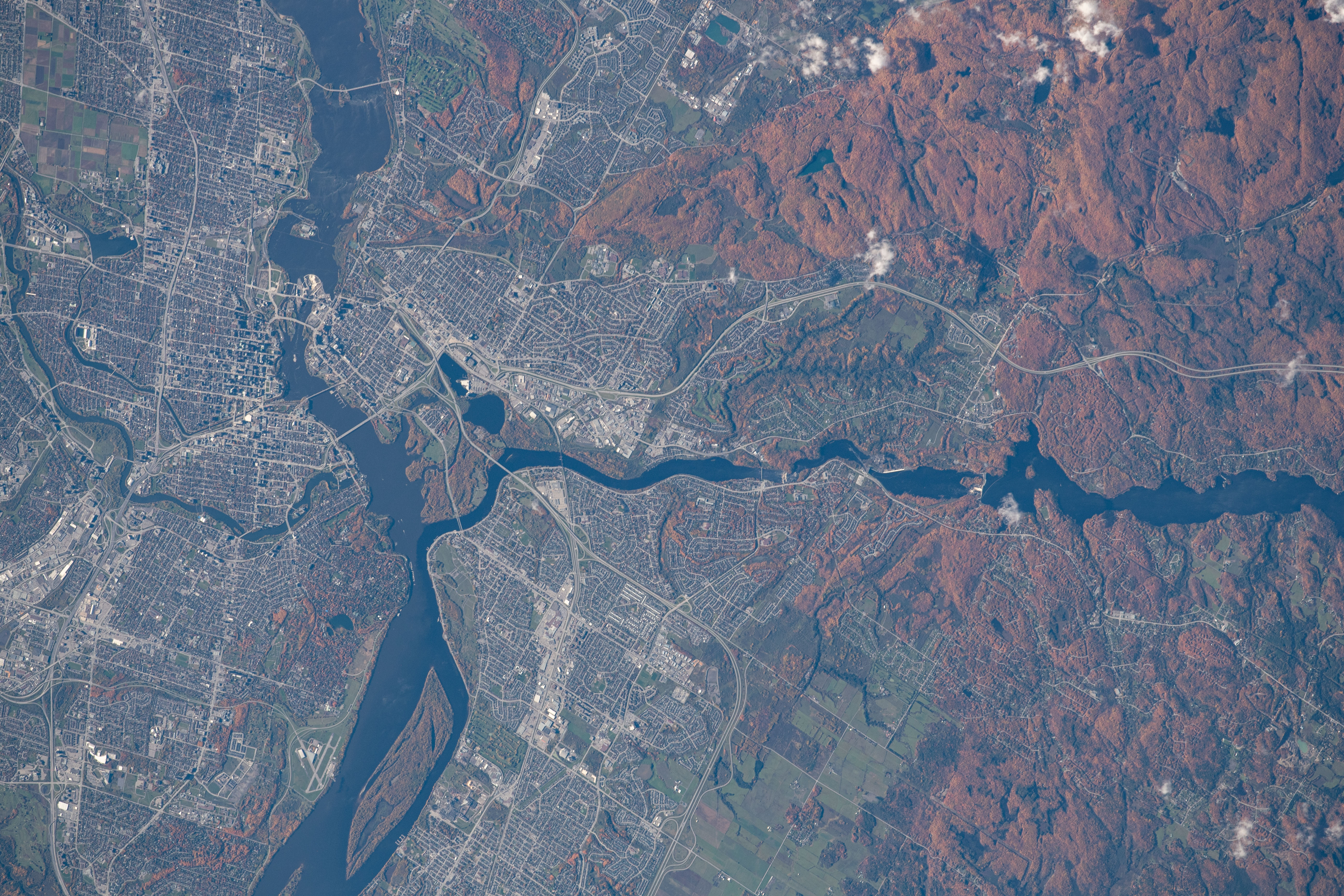


Photo center point: 45.5° N, 75.7° W
Photo center point by machine learning: 45.47° N, 75.74° W

Country or Geographic Name: | CANADA-Q |
Features: | GATINEAU RIVER, RIDEAU RIVER, OTTAWA RIVER, OTTAWA |
| Features Found Using Machine Learning: | |
Cloud Cover Percentage: | 10 (1-10)% |
Sun Elevation Angle: | 30° |
Sun Azimuth: | 149° |
Camera: | Nikon D5 Electronic Still Camera |
Focal Length: | 800mm |
Camera Tilt: | 16 degrees |
Format: | 5568E: 5568 x 3712 pixel CMOS sensor, 35.9 x 23.9 mm, total pixels: 21.33 million, Nikon FX format |
Film Exposure: | |
| Additional Information | |
| Width | Height | Annotated | Cropped | Purpose | Links |
|---|---|---|---|---|---|
| 720 pixels | 480 pixels | Yes | No | Download Image | |
| 720 pixels | 480 pixels | Yes | No | Download Image | |
| 720 pixels | 480 pixels | Yes | No | Download Image | |
| 5568 pixels | 3712 pixels | No | No | Download Image | |
| 640 pixels | 427 pixels | No | No | Download Image |
An astronaut onboard the International Space Station shot this photo of peak fall colors around Ottawa, the capital of Canada. West of downtown Ottawa lies Gatineau Park, where sugar maple leaves turn orange-red and hickories turn golden-bronze during the season, known regionally as "the Fall Rhapsody".
The city of Ottawa is located at the confluence of three important waterways: the Ottawa River, the Gatineau River, and Rideau Canal. The Ottawa River provides fresh drinking water to the region and joins the Saint-Lawrence River further east at Montreal. The Rideau Canal connects the Ottawa River to Lake Ontario, about 160 kilometers (100 miles) to the south.
In the early 1800s, the logging industry became prevalent in the Ottawa Valley due to a high demand for timber from the British Empire and, later, from the United States. Trees were cut in winter, as it was easier to transport logs to the river via sleds on frozen roads. In the spring, the timber rafts were floated down the Ottawa River. Logging was mainly concentrated along the river, where the topography was easier to navigate than the Gatineau Hills. Today, paper products produced from the Ottawa River Valley are an important export for Canada's economy.
Tucked within Ottawa's suburbs is the Central Experimental Farm, which was established in 1886. This research station was created to answer farm production questions related to all aspects of Canada's agriculture, including plant breeding, animal products, weather, and soils.
