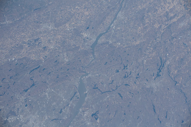
ISS062-E-45084
| NASA Photo ID | ISS062-E-45084 |
| Focal Length | 140mm |
| Date taken | 2020.02.21 |
| Time taken | 17:38:55 GMT |
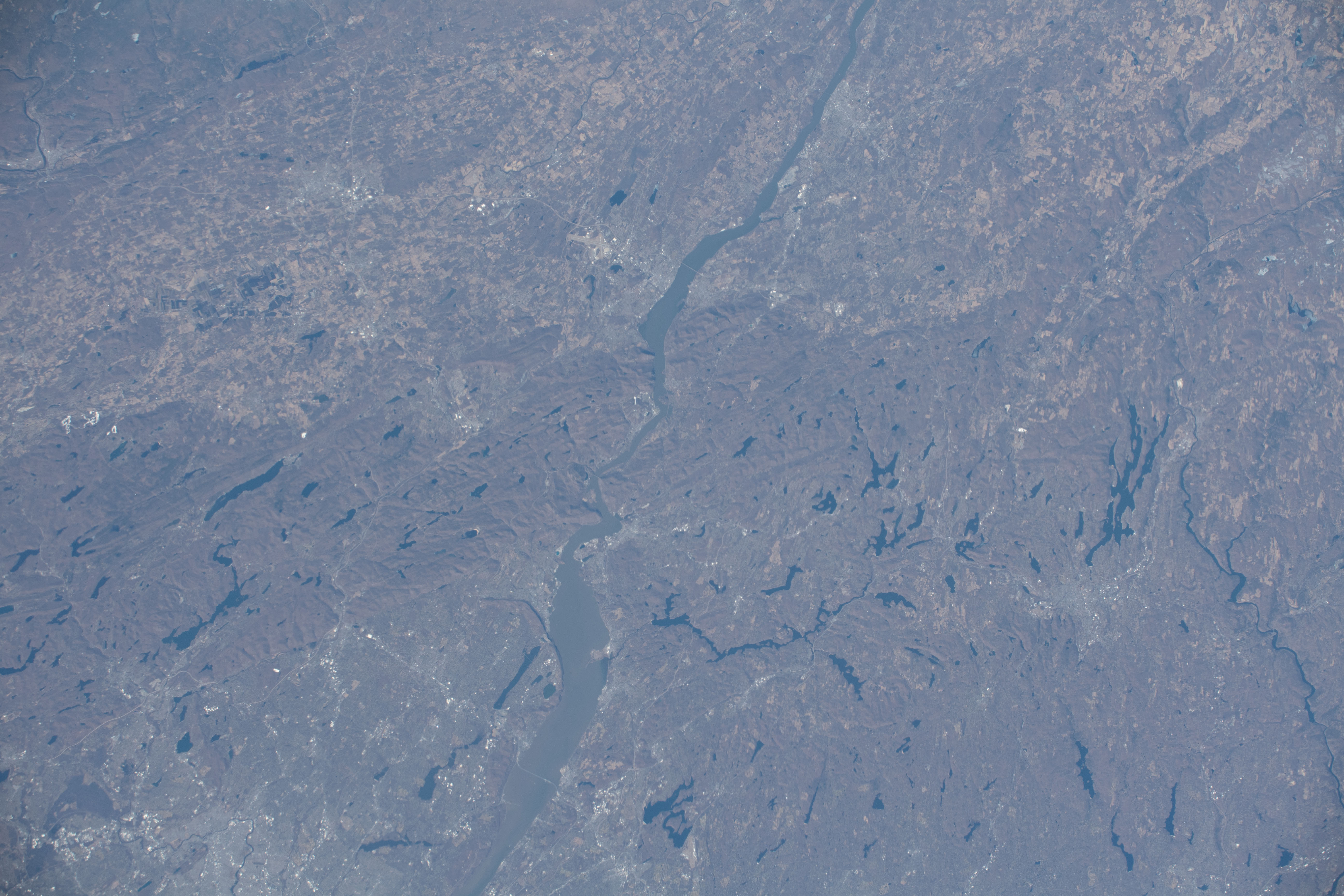


Spacecraft nadir point: 41.0° N, 74.4° W
Photo center point: 41.4° N, 73.9° W
Photo center point by machine learning: 41.37° N, 73.92° W
Photo center point: 41.4° N, 73.9° W
Photo center point by machine learning: 41.37° N, 73.92° W
Nadir to Photo Center: Northeast
Spacecraft Altitude: 225 nautical miles (417km)

Country or Geographic Name: | USA-NEW YORK |
Features: | HARRIMAN STATE PARK, WAWAYANDA STATE PARK, BEAR MOUNTAIN STATE PARK, HUDSON RIVER |
| Features Found Using Machine Learning: | |
Cloud Cover Percentage: | 10 (1-10)% |
Sun Elevation Angle: | 38° |
Sun Azimuth: | 189° |
Camera: | Nikon D5 Electronic Still Camera |
Focal Length: | 140mm |
Camera Tilt: | 09 degrees |
Format: | 5568E: 5568 x 3712 pixel CMOS sensor, 35.9 x 23.9 mm, total pixels: 21.33 million, Nikon FX format |
Film Exposure: | |
| Additional Information | |
| Width | Height | Annotated | Cropped | Purpose | Links |
|---|---|---|---|---|---|
| 5568 pixels | 3712 pixels | No | No | Download Image | |
| 640 pixels | 427 pixels | No | No | Download Image |
Download Packaged File
Download a Google Earth KML for this Image
View photo footprint information
Download a GeoTIFF for this photo
Image Caption: CATALOGED BY TEXAS STATE UNIVERSITY
