ISS062-E-136862

| NASA Photo ID | ISS062-E-136862 |
| Focal Length | 116mm |
| Date taken | 2020.04.05 |
| Time taken | 23:05:18 GMT |
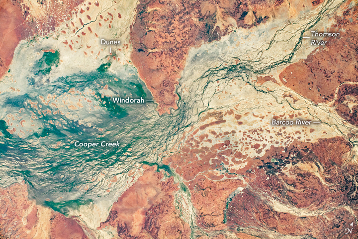
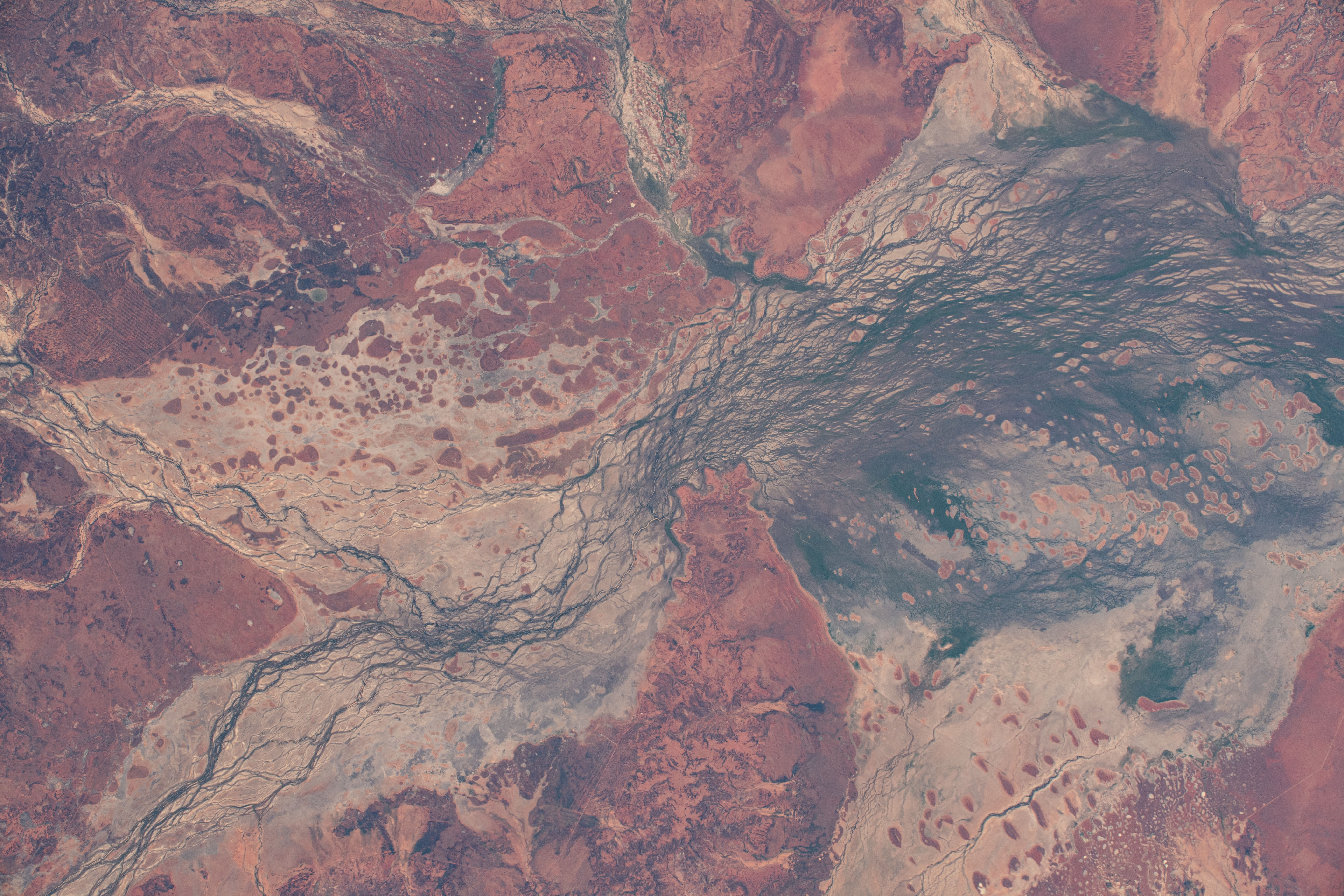


Photo center point: 25.4° S, 142.8° E
Photo center point by machine learning: 25.43° S, 142.76° E

Country or Geographic Name: | AUSTRALIA-Q |
Features: | COOPER CREEK, WINDORAH AIRPORT, WINDORAH |
| Features Found Using Machine Learning: | |
Cloud Cover Percentage: | 10 (1-10)% |
Sun Elevation Angle: | 29° |
Sun Azimuth: | 65° |
Camera: | Nikon D5 Electronic Still Camera |
Focal Length: | 116mm |
Camera Tilt: | 26 degrees |
Format: | 5568E: 5568 x 3712 pixel CMOS sensor, 35.9 x 23.9 mm, total pixels: 21.33 million, Nikon FX format |
Film Exposure: | |
| Additional Information | |
| Width | Height | Annotated | Cropped | Purpose | Links |
|---|---|---|---|---|---|
| 720 pixels | 480 pixels | Yes | No | NASA's Earth Observatory web site | Download Image |
| 5568 pixels | 3712 pixels | No | No | Download Image | |
| 640 pixels | 427 pixels | No | No | Download Image |
Red-tinted sands and dark green braided streams provide a colorful contrast within Australia's Channel Country. As the International Space Station (ISS) was passing over southwest Queensland, an astronaut took this photo of the Cooper Creek floodplain.
The Barcoo and Thomson rivers flow southwest and converge north of the town of Windorah to form Cooper Creek (//www.bom.gov.au/qld/flood/brochures/cooper/cooper.shtml), a major river system that flows toward Lake Yamma Yamma and Lake Eyre (both outside this frame). The broad, gently sloping floodplain - more than 50 kilometers (30 miles) wide in some areas - allows for the development of a complex network of shallow channels carved by seasonal floods. The region provides significant habitat for water birds and has been classified by the Australian government as an Important Bird Area.
Ancient linear dunes, trending in an east-west direction, rise above the floodplain. Their Mars-like red color comes from traces of iron that coat larger quartz grains. Known as paleodunes, these features point to a drier past climate during their formation and migration. As the climate in this region has become slightly wetter (but still arid), vegetation density has increased, reducing the impact of wind and water on the dunes and halting most of their migration. There is some reshaping of sediment at the top of the dunes due to winds.
The combination of stable, ancient dunes and water channels displaying both braided and cross-connecting patterns make this region a planetary analogue for Mars. Studying the physical features of an arid land, whether from orbit or ground level, can prepare humans for exploration of worlds beyond our own.
