ISS061-E-98033

| NASA Photo ID | ISS061-E-98033 |
| Focal Length | 800mm |
| Date taken | 2019.12.24 |
| Time taken | 17:14:12 GMT |

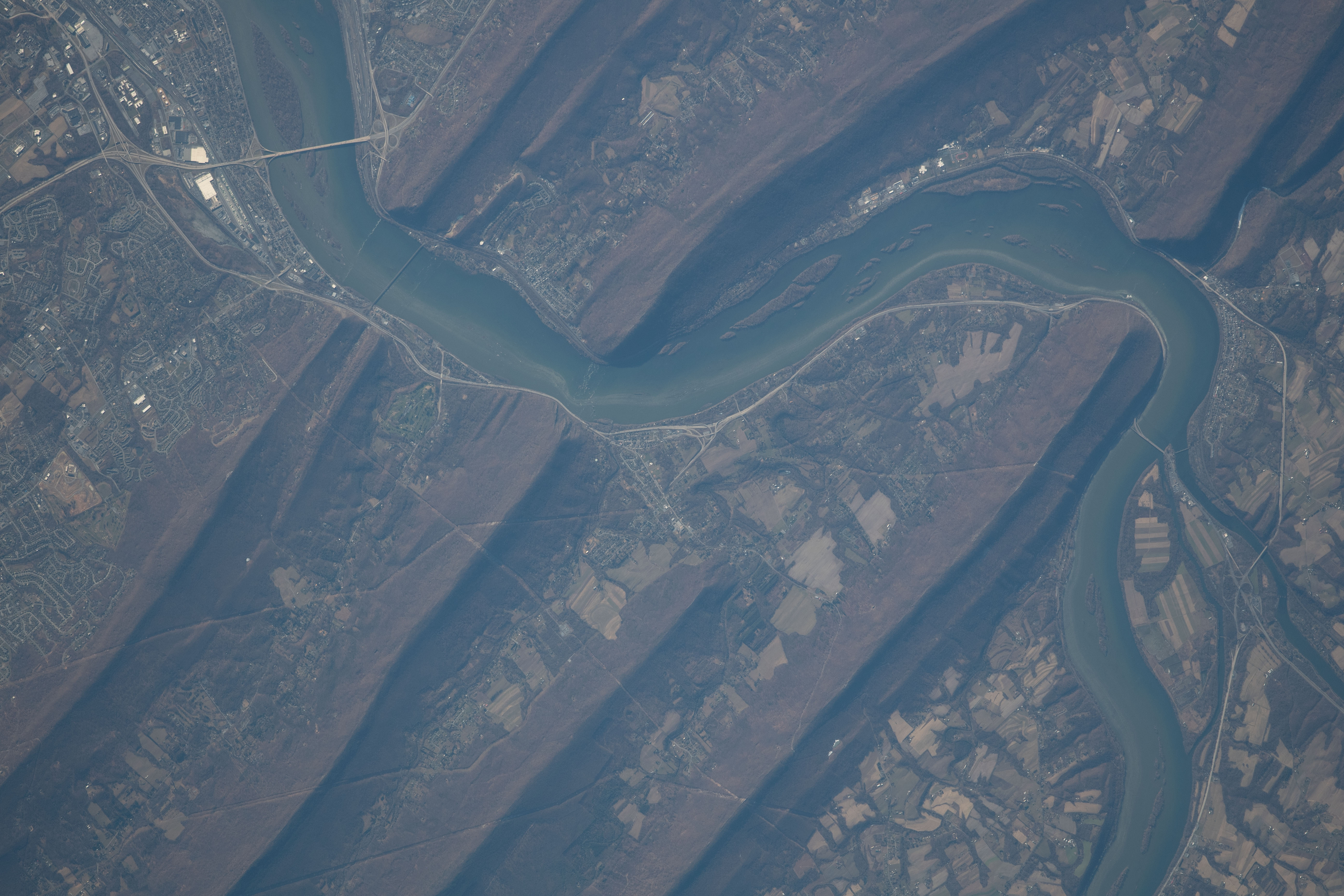


Photo center point: 40.4° N, 76.9° W
Photo center point by machine learning: 40.37° N, 76.94° W

Country or Geographic Name: | USA-PENNSYLVANIA |
Features: | HARRISBURG, SUSQUEHANNA RIVER, APPALACHIAN MOUNTAINS |
| Features Found Using Machine Learning: | |
Cloud Cover Percentage: | 10 (1-10)% |
Sun Elevation Angle: | 26° |
Sun Azimuth: | 181° |
Camera: | Nikon D5 Electronic Still Camera |
Focal Length: | 800mm |
Camera Tilt: | 14 degrees |
Format: | 5568E: 5568 x 3712 pixel CMOS sensor, 35.9 x 23.9 mm, total pixels: 21.33 million, Nikon FX format |
Film Exposure: | |
| Additional Information | |
| Width | Height | Annotated | Cropped | Purpose | Links |
|---|---|---|---|---|---|
| 720 pixels | 480 pixels | Yes | Yes | NASA's Earth Observatory web site | Download Image |
| 5568 pixels | 3712 pixels | No | No | Download Image | |
| 640 pixels | 427 pixels | No | No | Download Image |
The Susquehanna River cuts through the folds of the Valley-and-Ridge province of the Appalachian Mountains in this photograph taken by an astronaut onboard the International Space Station. Harrisburg, Pennsylvania, and a few smaller towns stand along the banks of the river.
The Valley-and-Ridge province is a section of the larger Appalachian Mountain Belt between the Appalachian Plateau and the Blue Ridge physiographic provinces. The northeast-southwest trending ridges are composed of Early Paleozoic sedimentary rocks. The valleys between them were made of softer rocks (limestone and shales) that were more susceptible to erosion; they are now occupied by farms. The Susquehanna River cuts through several ridges as it flows south.
The Susquehanna River flows 444 mi (714 kilometers) from upstate New York to Maryland, draining into Chesapeake Bay. The Susquehanna watershed covers more than 27,000 square miles (70,000 square kilometers) and is the source of more than half of the fresh water in the Bay. Farms like the ones in this photograph are a mainstay of Pennsylvania's economy. However, they also contribute a large influx of nutrient and sediment pollution flowing into the Bay.
