ISS060-E-36022

| NASA Photo ID | ISS060-E-36022 |
| Focal Length | 50mm |
| Date taken | 2019.08.14 |
| Time taken | 21:07:18 GMT |

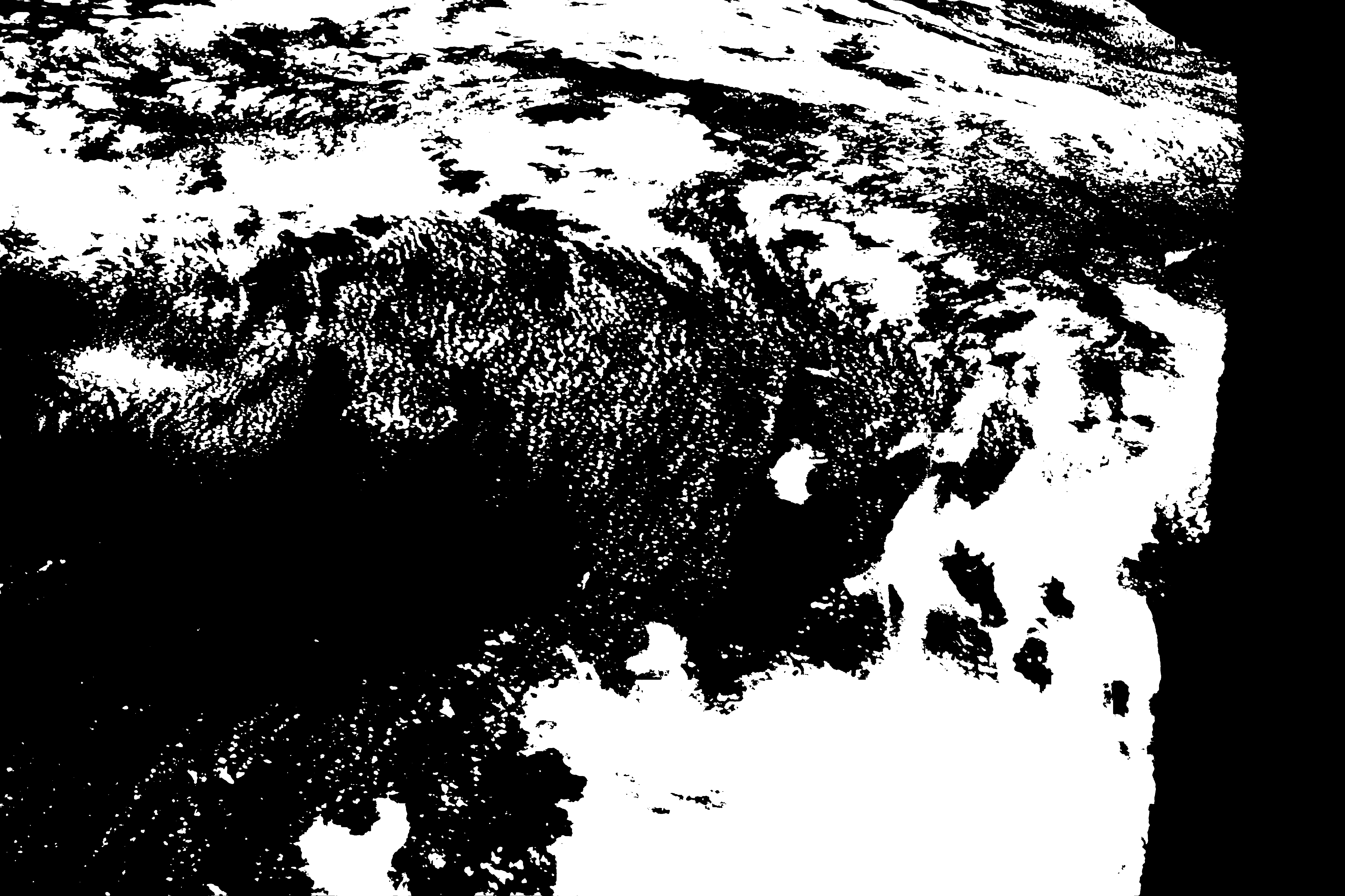

Spacecraft nadir point: 51.8° N, 121.3° W
Photo center point: 50.5° N, 106.0° W
Photo center point by machine learning:
Photo center point: 50.5° N, 106.0° W
Photo center point by machine learning:
Nadir to Photo Center: East
Spacecraft Altitude: 222 nautical miles (411km)
Country or Geographic Name: | CANADA-S |
Features: | DIEFENBAKER LAKE, SASKATCHEWAN |
| Features Found Using Machine Learning: | |
Cloud Cover Percentage: | 100 (76-100)% |
Sun Elevation Angle: | 51° |
Sun Azimuth: | 202° |
Camera: | Nikon D5 Electronic Still Camera |
Focal Length: | 50mm |
Camera Tilt: | High Oblique |
Format: | 5568E: 5568 x 3712 pixel CMOS sensor, 35.9 x 23.9 mm, total pixels: 21.33 million, Nikon FX format |
Film Exposure: | |
| Additional Information | |
This photo is one of the photos used to create this time-lapse video:
| Width | Height | Annotated | Cropped | Purpose | Links |
|---|---|---|---|---|---|
| 5568 pixels | 3712 pixels | No | No | Download Image | |
| 640 pixels | 427 pixels | No | No | Download Image |
Download Packaged File
Download a Google Earth KML for this Image
View photo footprint information
Download a GeoTIFF for this photo
Image Caption: none
