ISS059-E-67875

| NASA Photo ID | ISS059-E-67875 |
| Focal Length | 58mm |
| Date taken | 2019.05.19 |
| Time taken | 22:07:58 GMT |
5568 x 3712 pixels 720 x 480 pixels 5568 x 3712 pixels 640 x 427 pixels
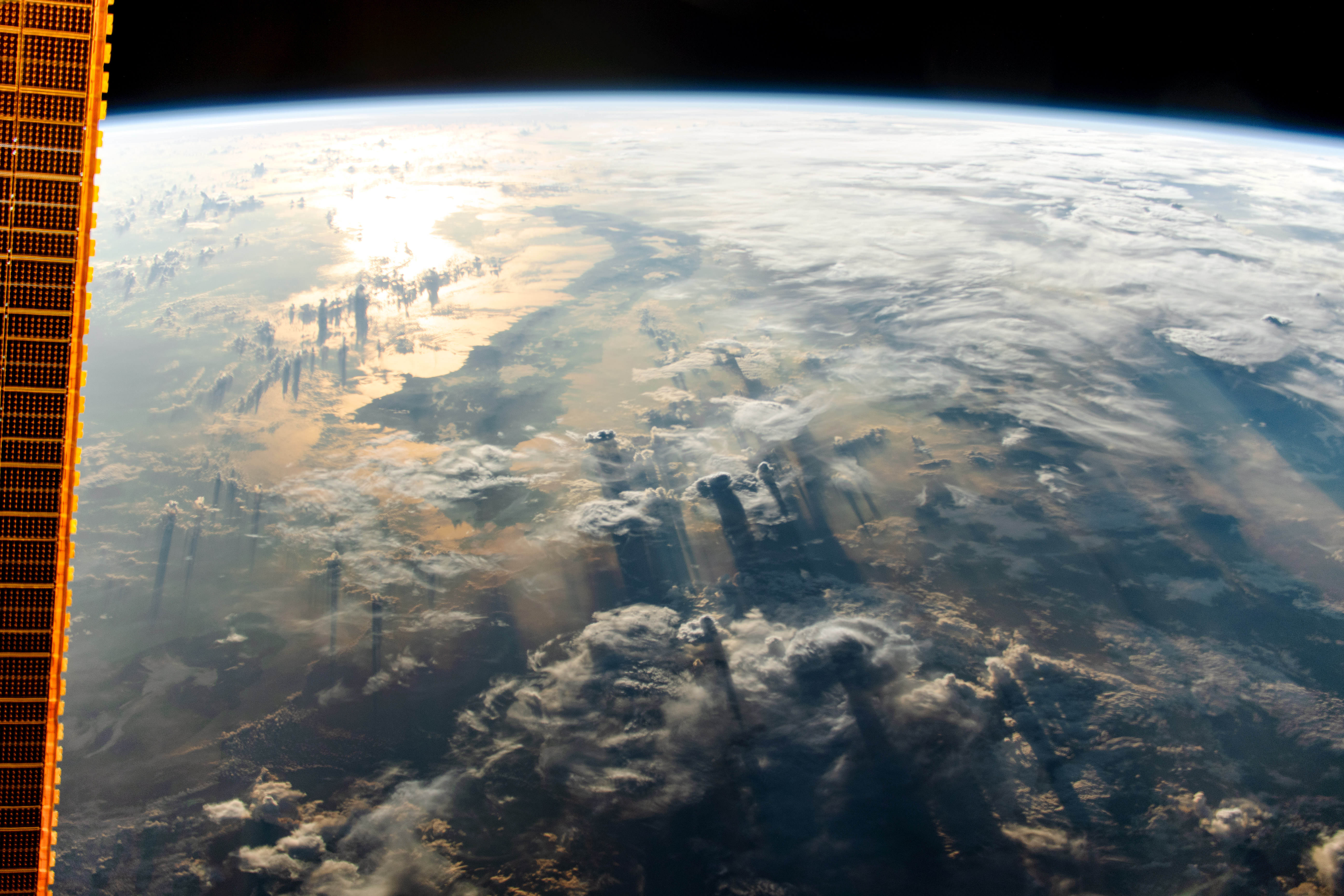

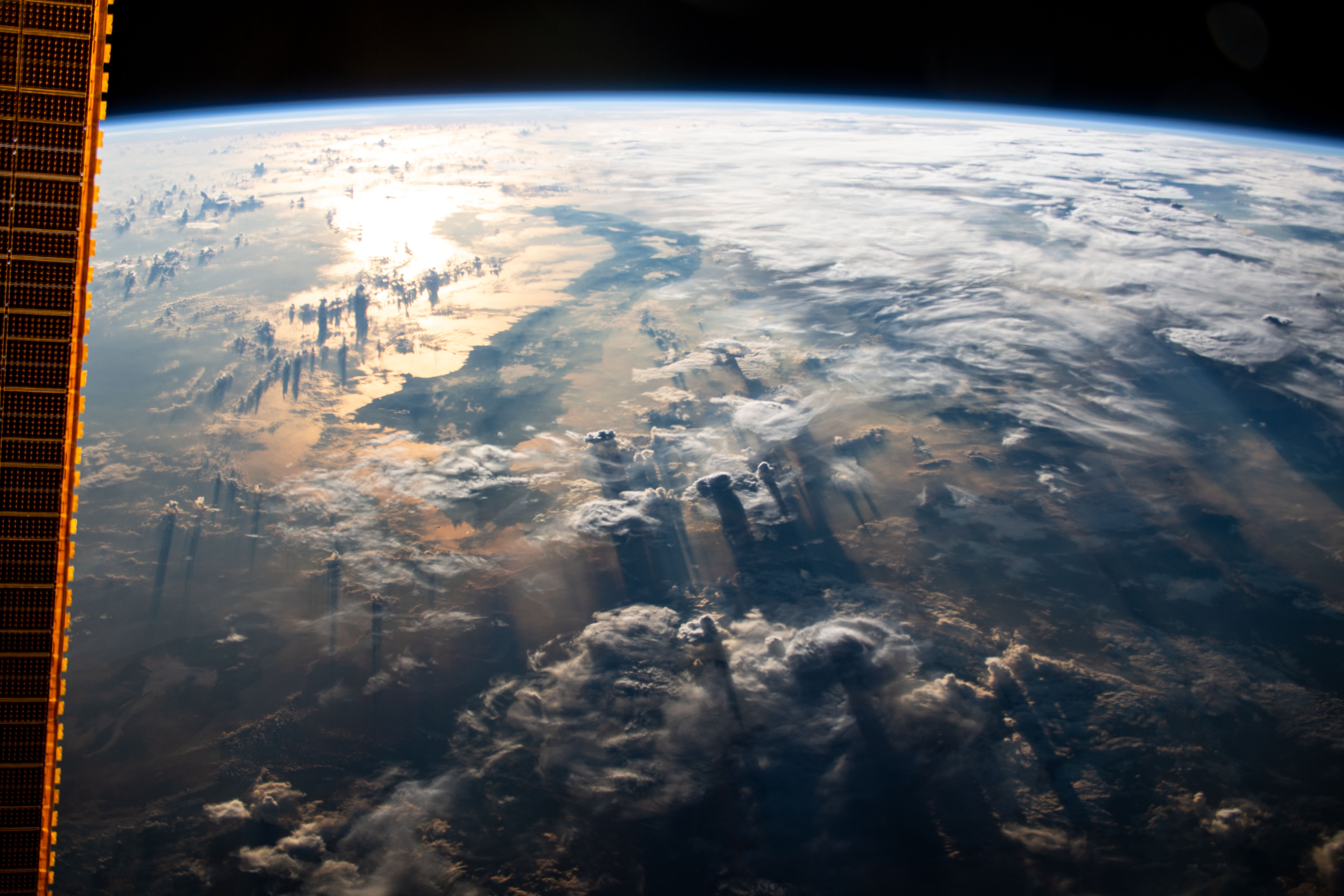
Photo center point:
Photo center point by machine learning:
Country or Geographic Name: | |
Features: | |
| Features Found Using Machine Learning: | |
Cloud Cover Percentage: | |
Sun Elevation Angle: | -5° |
Sun Azimuth: | 70° |
Camera: | NIKON D5 S/N: 3502403 |
Focal Length: | 58mm |
Camera Tilt: | |
Format: | |
Film Exposure: | |
| Additional Information | |
| Width | Height | Annotated | Cropped | Purpose | Links |
|---|---|---|---|---|---|
| 5568 pixels | 3712 pixels | No | No | NASA's Earth Observatory web site | Download Image |
| 720 pixels | 480 pixels | Yes | Yes | NASA's Earth Observatory web site | Download Image |
| 5568 pixels | 3712 pixels | No | No | Download Image | |
| 640 pixels | 427 pixels | No | No | Download Image |
The International Space Station was crossing over the equator when an astronaut looked east and took this photograph just after sunrise. The strip of land outlined by morning sunglint is the northern peninsula of the Indonesian island of Sulawesi. The darker areas in the lower portion of the photo mark the edge of the day-night line, also known as the terminator.
Indonesia sits in a notoriously cloudy region of the globe. In the image foreground, clouds cast long shadows as the Sun's rays strike at a low angle. Toward the horizon, clouds cast shorter shadows where the Sun is already higher in the sky.
Scientists who work with astronaut photos are well-practiced at identifying places on Earth through the perspective of an astronaut looking out from the ISS. However, consistently cloudy regions are more difficult to recognize. Sunglint helps by highlighting coastlines that are often obscured by clouds and aerosols. Yet those same clouds may have been exactly what inspired the astronaut to capture this scene.
