ISS059-E-64089
| NASA Photo ID | ISS059-E-64089 |
| Focal Length | 240mm |
| Date taken | 2019.05.18 |
| Time taken | 12:12:37 GMT |
5255 x 3503 pixels 720 x 480 pixels 5568 x 3712 pixels 640 x 427 pixels
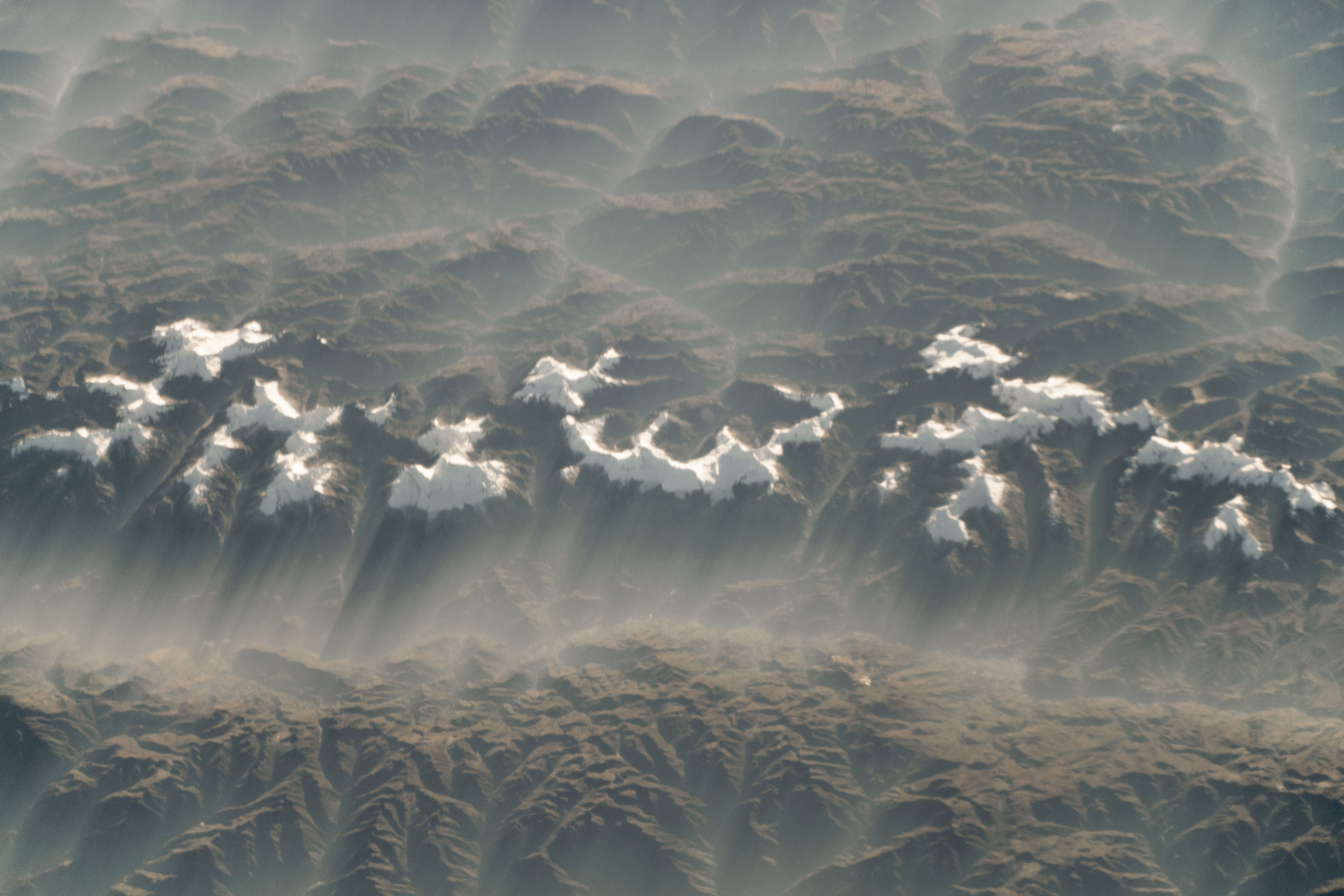
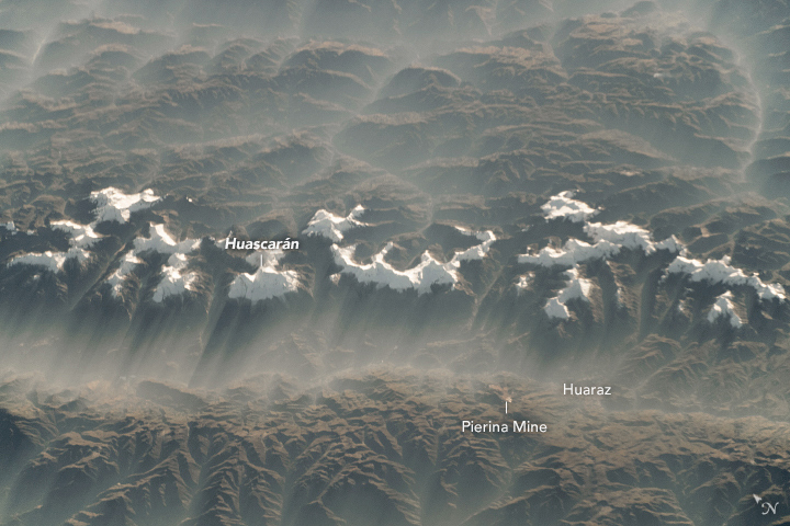
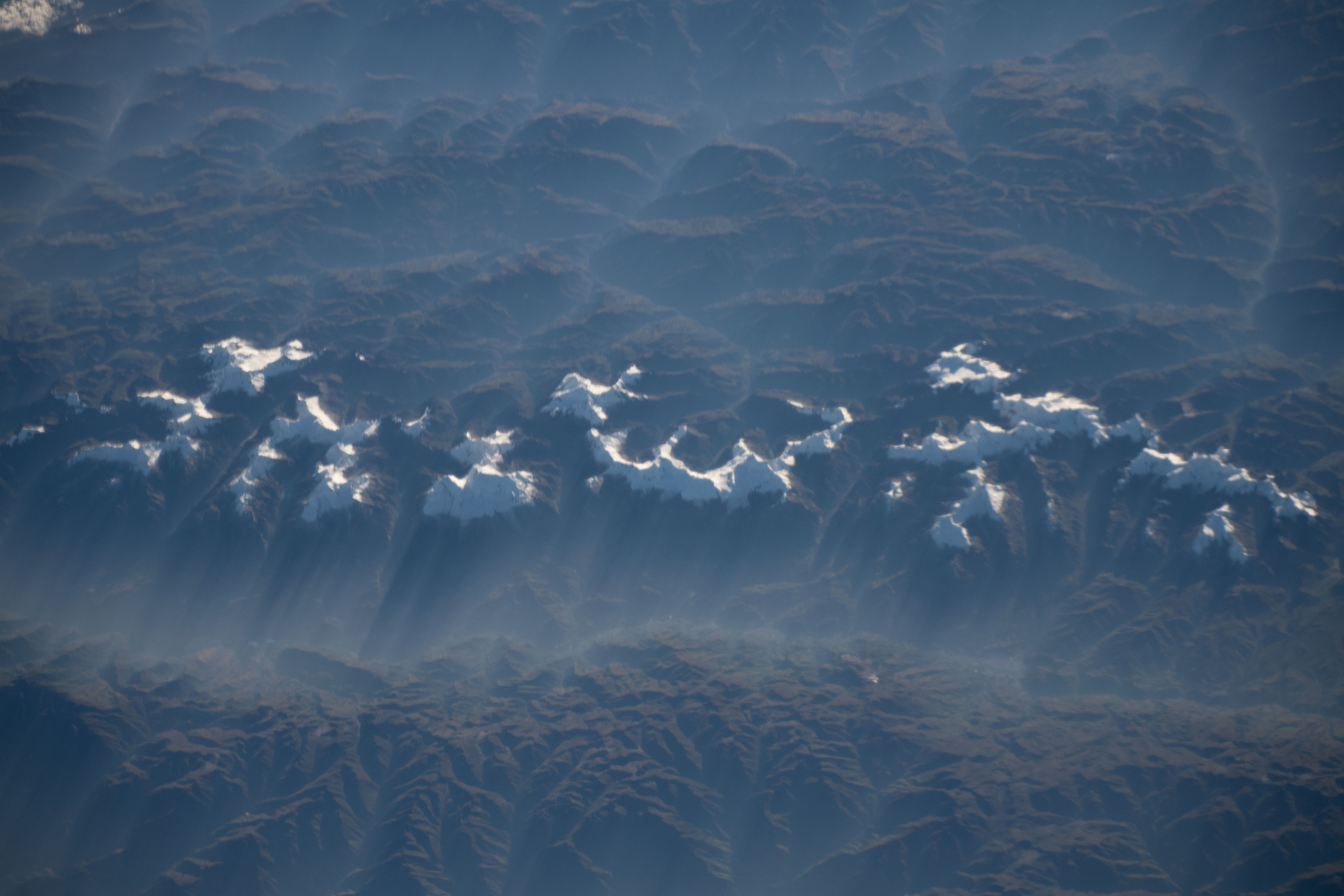

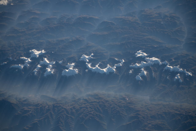
Photo center point: 9.2° S, 77.4° W
Photo center point by machine learning:
Country or Geographic Name: | PERU |
Features: | NEVADO HUASCARAN SUR, CARAZ, HUARAZ |
| Features Found Using Machine Learning: | |
Cloud Cover Percentage: | 10 (1-10)% |
Sun Elevation Angle: | 7° |
Sun Azimuth: | 69° |
Camera: | Nikon D5 Electronic Still Camera |
Focal Length: | 240mm |
Camera Tilt: | 54 degrees |
Format: | 5568E: 5568 x 3712 pixel CMOS sensor, 35.9 x 23.9 mm, total pixels: 21.33 million, Nikon FX format |
Film Exposure: | |
| Additional Information | |
| Width | Height | Annotated | Cropped | Purpose | Links |
|---|---|---|---|---|---|
| 5255 pixels | 3503 pixels | No | Yes | NASA's Earth Observatory web site | Download Image |
| 720 pixels | 480 pixels | Yes | Yes | NASA's Earth Observatory web site | Download Image |
| 5568 pixels | 3712 pixels | No | No | Download Image | |
| 640 pixels | 427 pixels | No | No | Download Image |
An explanation of the georeference file(s) above
When an astronaut took this oblique photograph of a misty winter morning over western Peru's Cordillera Blanca, snow-capped peaks cast long shadows over the valleys.
The highest mountains in Peru are visible, including Huascaran, which soars 6,768 meters (22,204 feet) above sea level. The peaks have been eroded by glaciers into steep curving ridges - known as cirques. With over 700 glaciers, the Cordillera Blanca holds much of the land ice in Peru.
Light fog filled the valleys as the Sun rose. High overnight relative humidity, low surface winds (visualized here), and the morning temperature inversion caused the fog in the lower altitudes. The major mining city of Huaraz is barely visible under the fog cover, but the light color of the Pierina Mine, an open pit gold mine, stands out from the darker land surrounding it.
