ISS059-E-36413

| NASA Photo ID | ISS059-E-36413 |
| Focal Length | 95mm |
| Date taken | 2019.04.27 |
| Time taken | 18:20:24 GMT |

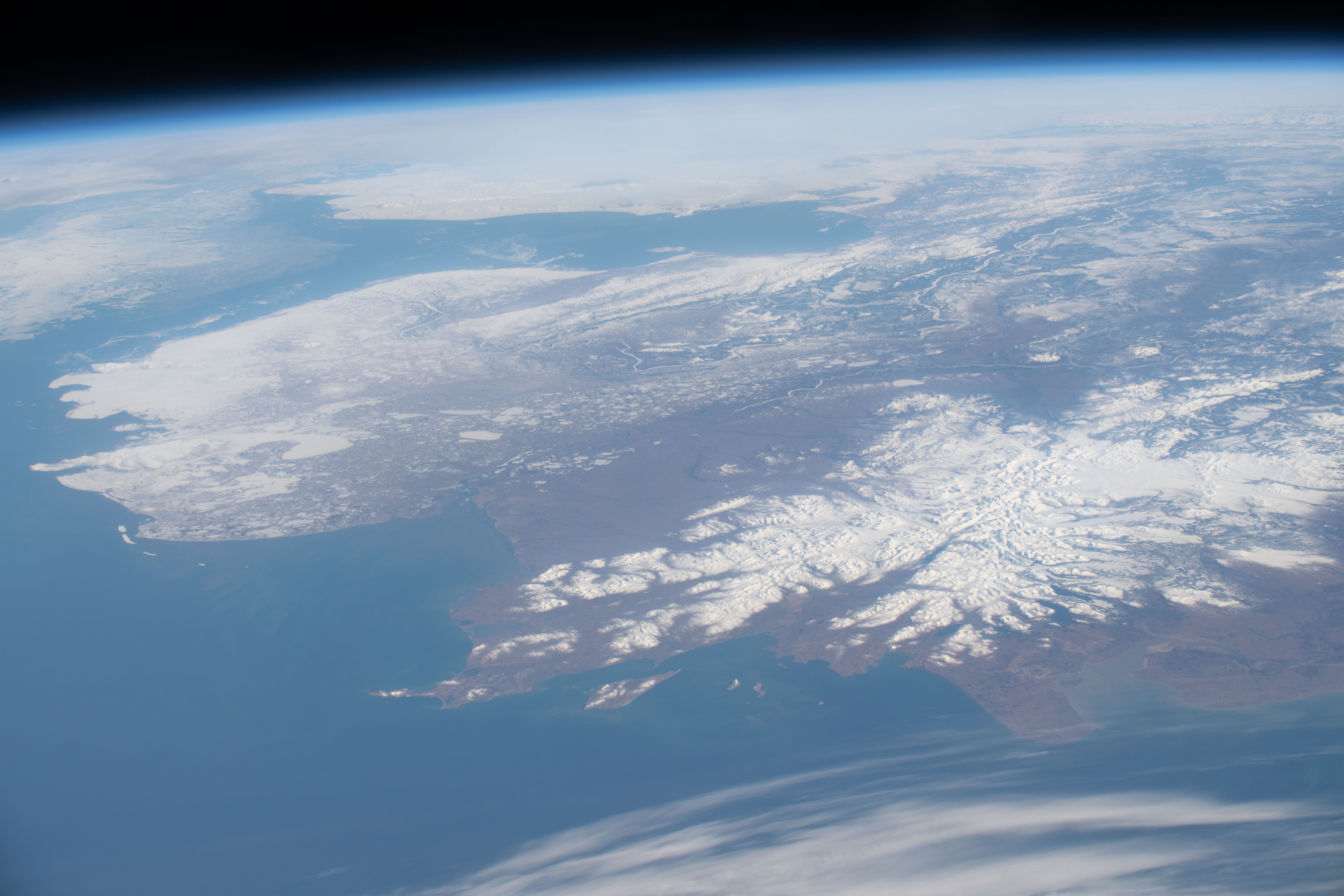

Photo center point: 61.4° N, 161.4° W
Photo center point by machine learning:
Country or Geographic Name: | USA-ALASKA |
Features: | BERING SEA, BRISTOL BAY, YUKON RIVER |
| Features Found Using Machine Learning: | |
Cloud Cover Percentage: | 50 (26-50)% |
Sun Elevation Angle: | 27° |
Sun Azimuth: | 102° |
Camera: | Nikon D5 Electronic Still Camera |
Focal Length: | 95mm |
Camera Tilt: | High Oblique |
Format: | 5568E: 5568 x 3712 pixel CMOS sensor, 35.9 x 23.9 mm, total pixels: 21.33 million, Nikon FX format |
Film Exposure: | |
| Additional Information | |
| Width | Height | Annotated | Cropped | Purpose | Links |
|---|---|---|---|---|---|
| 720 pixels | 480 pixels | Yes | Yes | NASA's Earth Observatory web site | Download Image |
| 5568 pixels | 3712 pixels | No | No | Download Image | |
| 640 pixels | 427 pixels | No | No | Download Image |
An astronaut took this photograph on a clear spring 2019 day while looking north toward mainland Alaska. At the time, the International Space Station (ISS) was located approximately 430 kilometers (270 miles) southeast of the Alaska Peninsula.
Clear views of Alaska from the ISS are uncommon due to frequent cloud cover and the limits of the ISS orbit trajectory. The spacecraft flies between 51.6 degrees; North and South, so regions near the Arctic Circle (66.5N), are difficult to photograph and often beyond an astronaut's field of view.
This oblique photograph offers a wide view toward the Seward Peninsula. The Bering Strait is visible with the easternmost reaches of Russia on the other side of the narrow waterway. Pack ice is floating through the strait toward the Bering Sea. The snow cover in this spring season photo highlights braided rivers, lakes, and the Ahklun Mountains.
Astronauts on some space shuttle missions had more direct views of Alaska for photography, such as this photo from mission STS042 that offers a different perspective on the Ahklun Mountains.
