ISS058-E-2651
| NASA Photo ID | ISS058-E-2651 |
| Focal Length | 56mm |
| Date taken | 2019.01.14 |
| Time taken | 01:17:45 GMT |


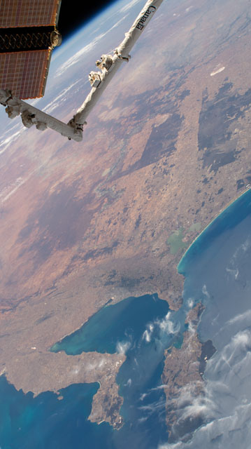
Spacecraft nadir point: 38.5° S, 133.9° E
Photo center point: 34.5° S, 139.5° E
Photo center point by machine learning:
Photo center point: 34.5° S, 139.5° E
Photo center point by machine learning:
Nadir to Photo Center: Northeast
Spacecraft Altitude: 221 nautical miles (409km)
Country or Geographic Name: | AUSTRALIA-SA |
Features: | PUBLIC INPUTS (from public image detectives, not NASA): O.,SOUTH AUSTRALIA,ISS,G.,PO.,PEN.,CY.,ADELAIDE CY,STR.,I.,CL.,S. |
| Features Found Using Machine Learning: | |
Cloud Cover Percentage: | 10 (1-10)% |
Sun Elevation Angle: | 60° |
Sun Azimuth: | 64° |
Camera: | Nikon D4 Electronic Still Camera |
Focal Length: | 56mm |
Camera Tilt: | High Oblique |
Format: | 4928E: 4928 x 3280 pixel CMOS sensor, 36.0mm x 23.9mm, total pixels: 16.6 million, Nikon FX format |
Film Exposure: | |
| Additional Information | Image acquired by ISS External High Definition Camera |
| Width | Height | Annotated | Cropped | Purpose | Links |
|---|---|---|---|---|---|
| 2768 pixels | 4928 pixels | No | No | Download Image | |
| 359 pixels | 640 pixels | No | No | Download Image |
Download Packaged File
Download a Google Earth KML for this Image
View photo footprint information
Download a GeoTIFF for this photo
Image Caption: none
