ISS052-E-8449

| NASA Photo ID | ISS052-E-8449 |
| Focal Length | 1150mm |
| Date taken | 2017.06.25 |
| Time taken | 13:05:35 GMT |
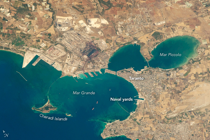
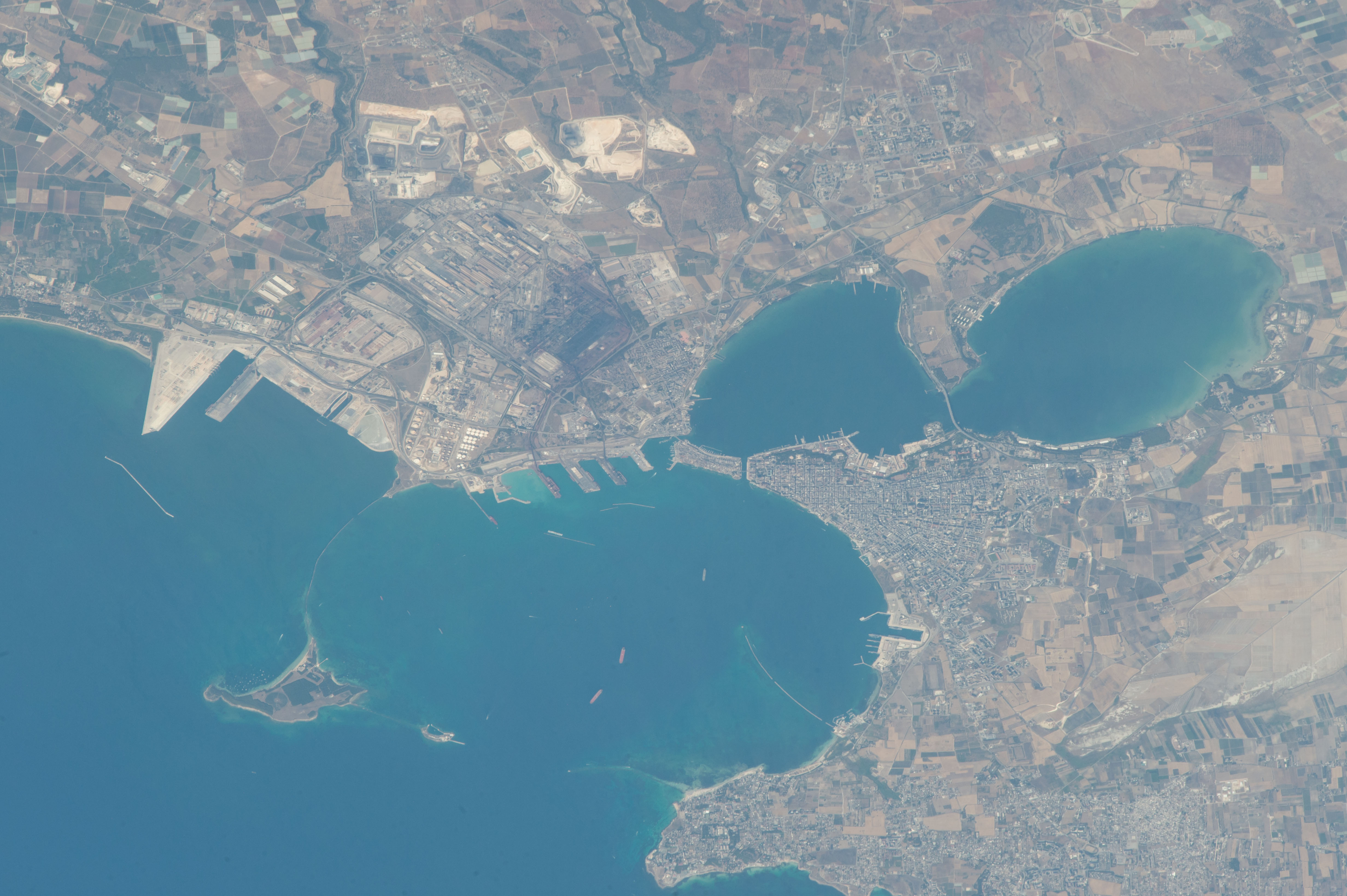


Photo center point: 40.5° N, 17.2° E
Photo center point by machine learning:
Country or Geographic Name: | ITALY |
Features: | MARE PICCOLO, TARANTO, IONIAN SEA |
| Features Found Using Machine Learning: | |
Cloud Cover Percentage: | 10 (1-10)% |
Sun Elevation Angle: | 55° |
Sun Azimuth: | 248° |
Camera: | Nikon D4 Electronic Still Camera |
Focal Length: | 1150mm |
Camera Tilt: | 43 degrees |
Format: | 4928E: 4928 x 3280 pixel CMOS sensor, 36.0mm x 23.9mm, total pixels: 16.6 million, Nikon FX format |
Film Exposure: | |
| Additional Information | |
| Width | Height | Annotated | Cropped | Purpose | Links |
|---|---|---|---|---|---|
| 720 pixels | 480 pixels | Yes | No | NASA's Earth Observatory web site | Download Image |
| 4928 pixels | 3280 pixels | No | No | Download Image | |
| 640 pixels | 426 pixels | No | No | Download Image |
Looking down from the International Space Station on the Italian coastline through a powerful (1150 millimeter) zoom lens, an astronaut shot this detailed photograph of the city of Taranto. It is Italy's major southern port and naval base. These facilities face into the outer bay, locally known as the Mar Grande, where ships are anchored. The Cheradi Islands form a small archipelago that encircles the Mar Grande.
From docks on the north side of Mar Grande, the city exports petroleum and steel products from a nearby industrial zone. The naval yards lie on the east side. The old town, dating from Roman times, occupies the tip of the promontory that separates Taranto's outer bay from the inner bay, Mar Piccolo.
A wider view from 2014 shows Taranto's location in the northern angle of the Gulf of Taranto.
