ISS052-E-20541

| NASA Photo ID | ISS052-E-20541 |
| Focal Length | 500mm |
| Date taken | 2017.07.26 |
| Time taken | 20:48:18 GMT |
Resolutions offered for this image:
4928 x 3280 pixels 720 x 480 pixels 4928 x 3280 pixels 640 x 426 pixels
4928 x 3280 pixels 720 x 480 pixels 4928 x 3280 pixels 640 x 426 pixels
Cloud masks available for this image:
Spacecraft nadir point: 17.3° N, 109.6° E
Photo center point: 16.2° N, 122.9° E
Photo center point by machine learning:
Photo center point: 16.2° N, 122.9° E
Photo center point by machine learning:
Nadir to Photo Center: East
Spacecraft Altitude: 217 nautical miles (402km)
Country or Geographic Name: | PHILIPPINES |
Features: | PAN- SUNRISE |
| Features Found Using Machine Learning: | PAN- |
Cloud Cover Percentage: | 10 (1-10)% |
Sun Elevation Angle: | -21° |
Sun Azimuth: | 61° |
Camera: | Nikon D4 Electronic Still Camera |
Focal Length: | 500mm |
Camera Tilt: | High Oblique |
Format: | 4928E: 4928 x 3280 pixel CMOS sensor, 36.0mm x 23.9mm, total pixels: 16.6 million, Nikon FX format |
Film Exposure: | |
| Additional Information | |
| Width | Height | Annotated | Cropped | Purpose | Links |
|---|---|---|---|---|---|
| 4928 pixels | 3280 pixels | No | No | NASA's Earth Observatory web site | Download Image |
| 720 pixels | 480 pixels | No | No | NASA's Earth Observatory web site | Download Image |
| 4928 pixels | 3280 pixels | No | No | Download Image | |
| 640 pixels | 426 pixels | No | No | Download Image |
Download Packaged File
Download a Google Earth KML for this Image
View photo footprint information
Download a GeoTIFF for this photo
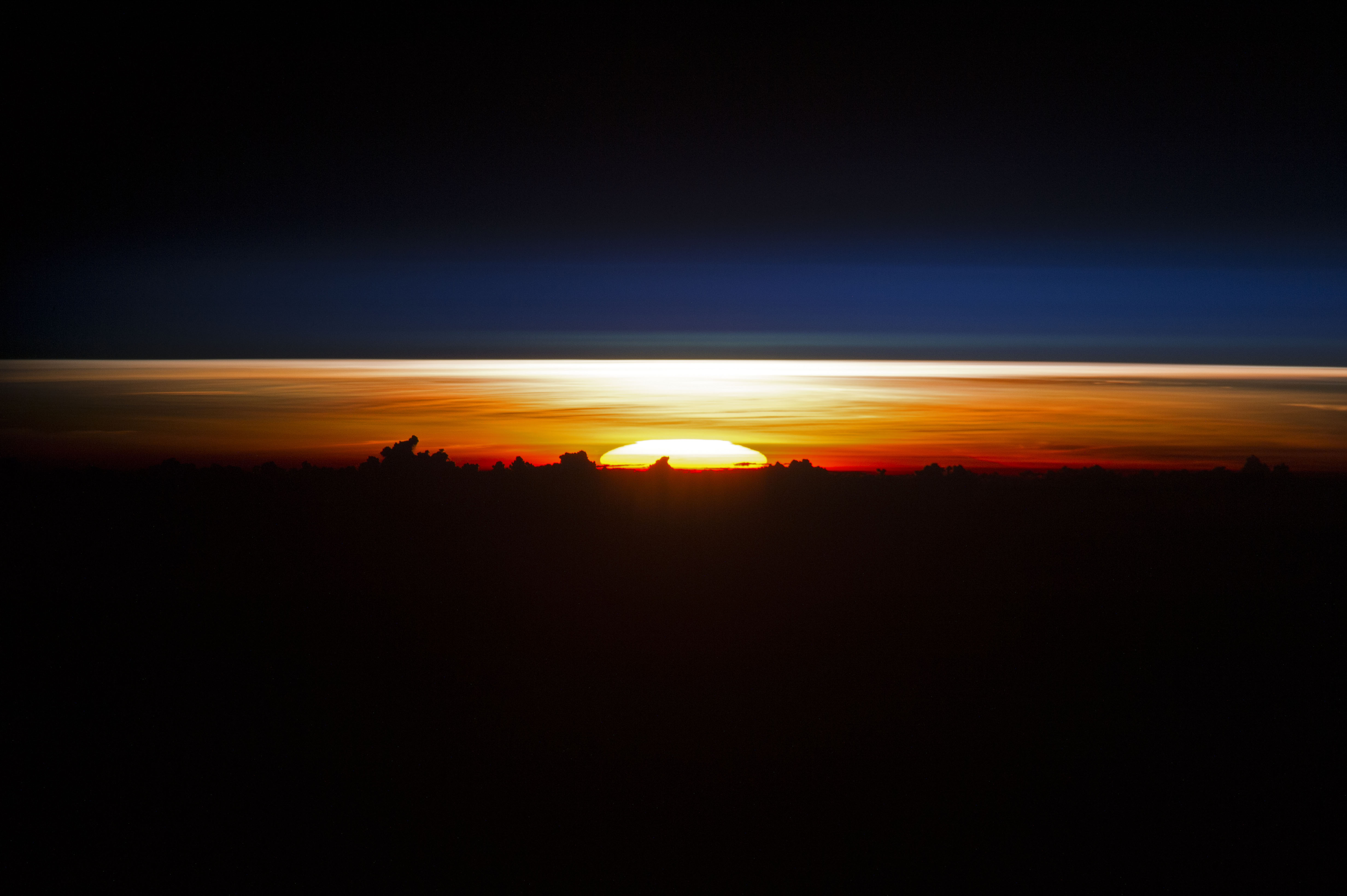
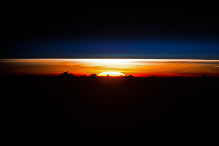
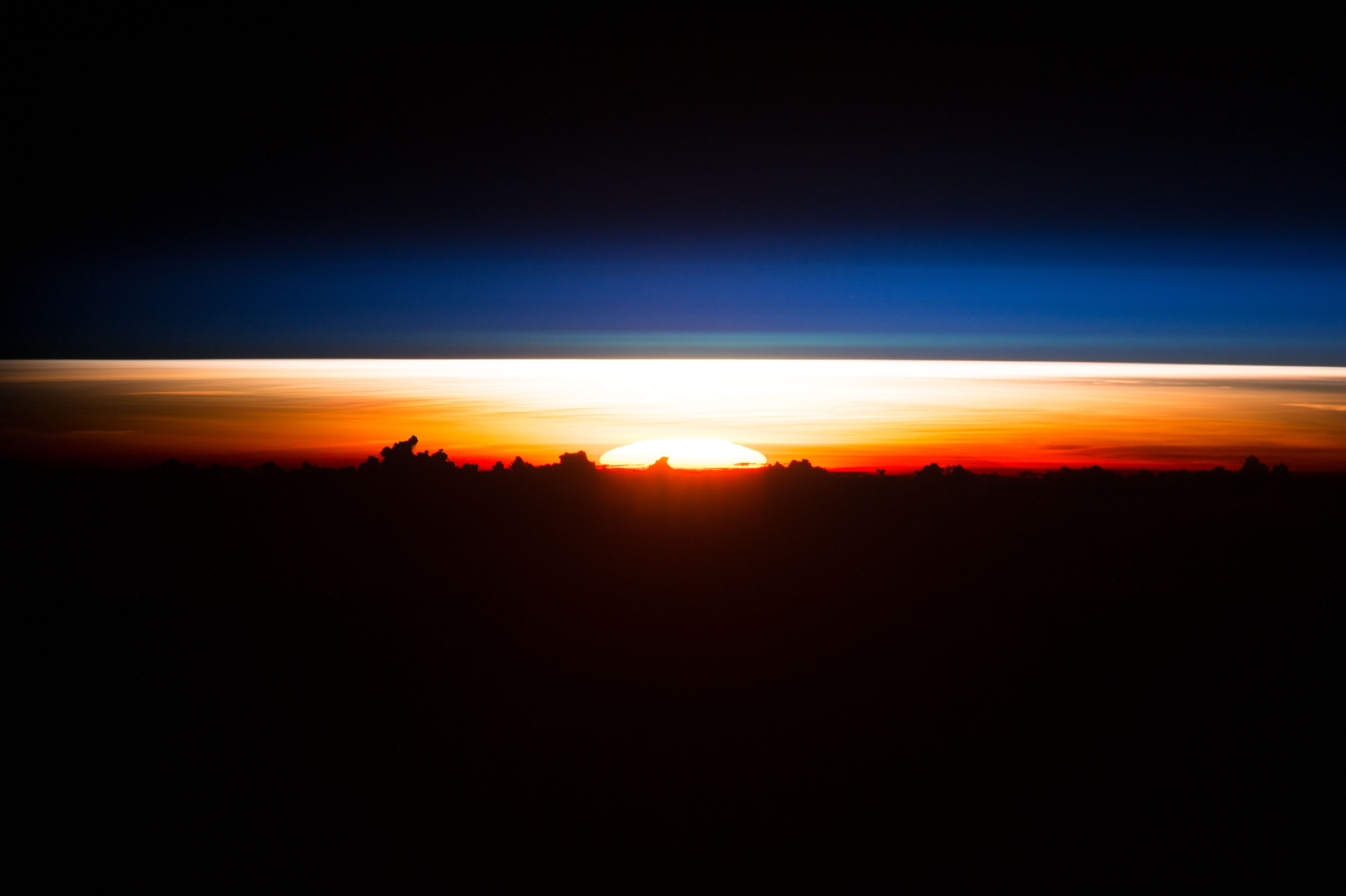
Image Caption: Sunrise over the Philippine Sea
An astronaut aboard the International Space Station (ISS) took this photograph of the partial disc of the Sun just as it began to rise, creating a sheet of light across the horizon. Silhouetted clouds give the sense of a jumbled mountain range. Numerous individual layers of the atmosphere appear above the Sun from this perspective.
An astronaut aboard the International Space Station (ISS) took this photograph of the partial disc of the Sun just as it began to rise, creating a sheet of light across the horizon. Silhouetted clouds give the sense of a jumbled mountain range. Numerous individual layers of the atmosphere appear above the Sun from this perspective.
The photo was taken when the ISS was located over the coast of Vietnam. But as seen from about 400 kilometers (250 miles) above the surface of the Earth, the sunrise was actually rising over the Philippine Sea, far to the east of the Philippine archipelago.
Astronauts see sixteen sunrises every 24 hours. While it is never a good idea to look at the Sun directly without proper eye protection (either on Earth or from space), digital camera images such as this allow us the luxury of seeing this spectacle as the astronauts do.
