ISS052-E-12924

| NASA Photo ID | ISS052-E-12924 |
| Focal Length | 170mm |
| Date taken | 2017.07.07 |
| Time taken | 13:34:35 GMT |
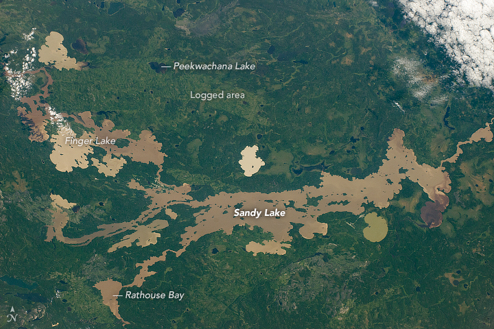
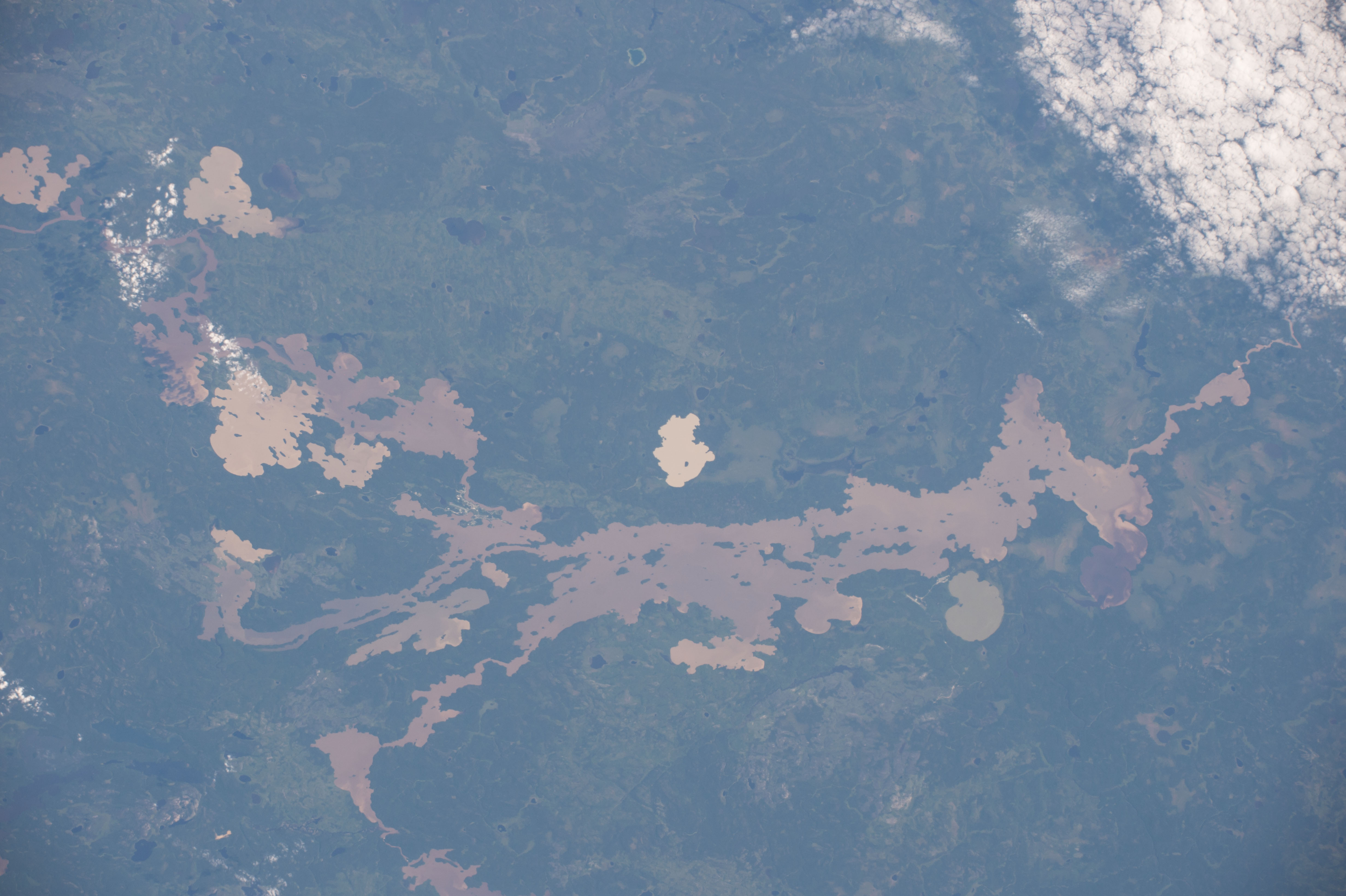

Photo center point: 53.0° N, 93.1° W
Photo center point by machine learning:
Country or Geographic Name: | CANADA-O |
Features: | SANDY LAKE, FINGER LAKE, LOGGED AREA |
| Features Found Using Machine Learning: | |
Cloud Cover Percentage: | 10 (1-10)% |
Sun Elevation Angle: | 29° |
Sun Azimuth: | 89° |
Camera: | Nikon D4 Electronic Still Camera |
Focal Length: | 170mm |
Camera Tilt: | 28 degrees |
Format: | 4928E: 4928 x 3280 pixel CMOS sensor, 36.0mm x 23.9mm, total pixels: 16.6 million, Nikon FX format |
Film Exposure: | |
| Additional Information | |
| Width | Height | Annotated | Cropped | Purpose | Links |
|---|---|---|---|---|---|
| 720 pixels | 480 pixels | Yes | No | NASA's Earth Observatory web site | Download Image |
| 4928 pixels | 3280 pixels | No | No | Download Image | |
| 640 pixels | 426 pixels | No | No | Download Image |
Out of thousands of lakes in the glaciated landscapes of the Canadian Shield, the color and size of Sandy Lake attracted the attention of an astronaut flying over on the International Space Station. Located in a remote region of northwest Ontario (north-northeast of Winnipeg), the lake and its milky, mocha-colored neighbors lie within a zone known as the "Clay Plains." Fine clay sediment was long ago laid down here in the beds of glacial lakes (such as Lake Agassiz) during the retreat of North America's continental ice sheet.
Those old sediments now add color to Sandy Lake, Finger Lake, and Rathouse Bay. Many lakes in this region are so shallow that sediment from the lake floor is easily stirred up by currents and wind. Sediment with the strongest coloring, especially along the northeast shore of Finger Lake, is also delivered by small rivers. Sandy Lake and its neighbors are larger than other lakes because they lie on the major Severn River drainage line that flows to Hudson Bay.
Some of the smaller, surrounding lakes (such as Peekwachana) are very dark by comparison because they do not have muddy sediment suspended in the water.
Logging north of Sandy Lake has created a lighter green, straight-edged zone in Opasquia Provincial Park. With one road into the area - and it is only open for about six weeks during winter - the region relies on aircraft transport. Small, fly-in communities can be identified by their airfields (which are easier to spot in the large, downloadable image).
