ISS051-E-13172
| NASA Photo ID | ISS051-E-13172 |
| Focal Length | 1150mm |
| Date taken | 2017.04.14 |
| Time taken | 19:55:39 GMT |
4928 x 3280 pixels 720 x 480 pixels 4928 x 3280 pixels 640 x 426 pixels
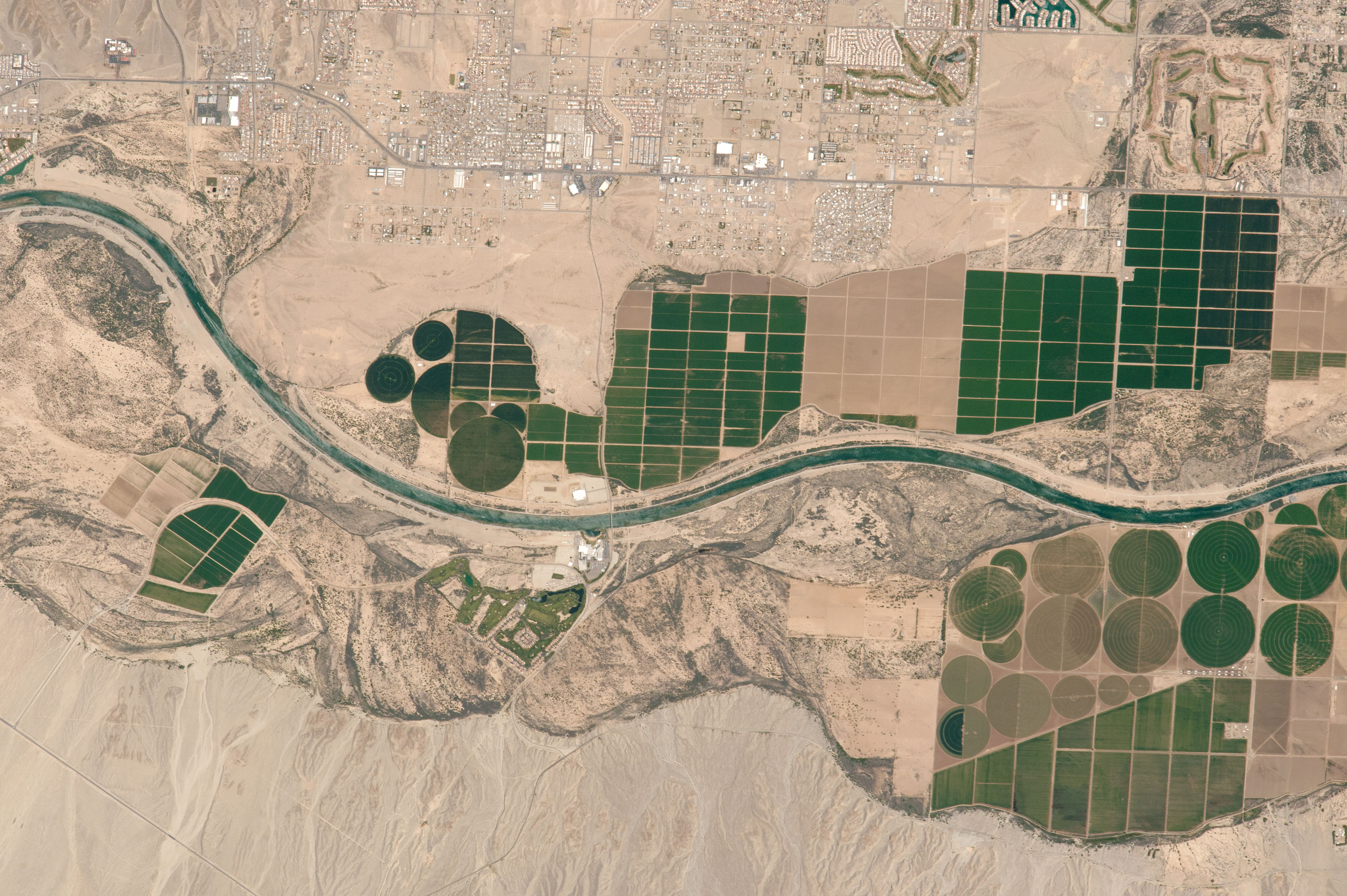
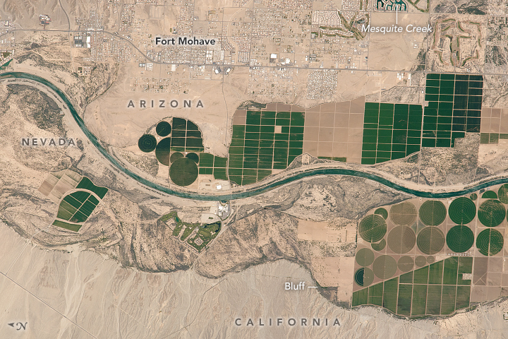
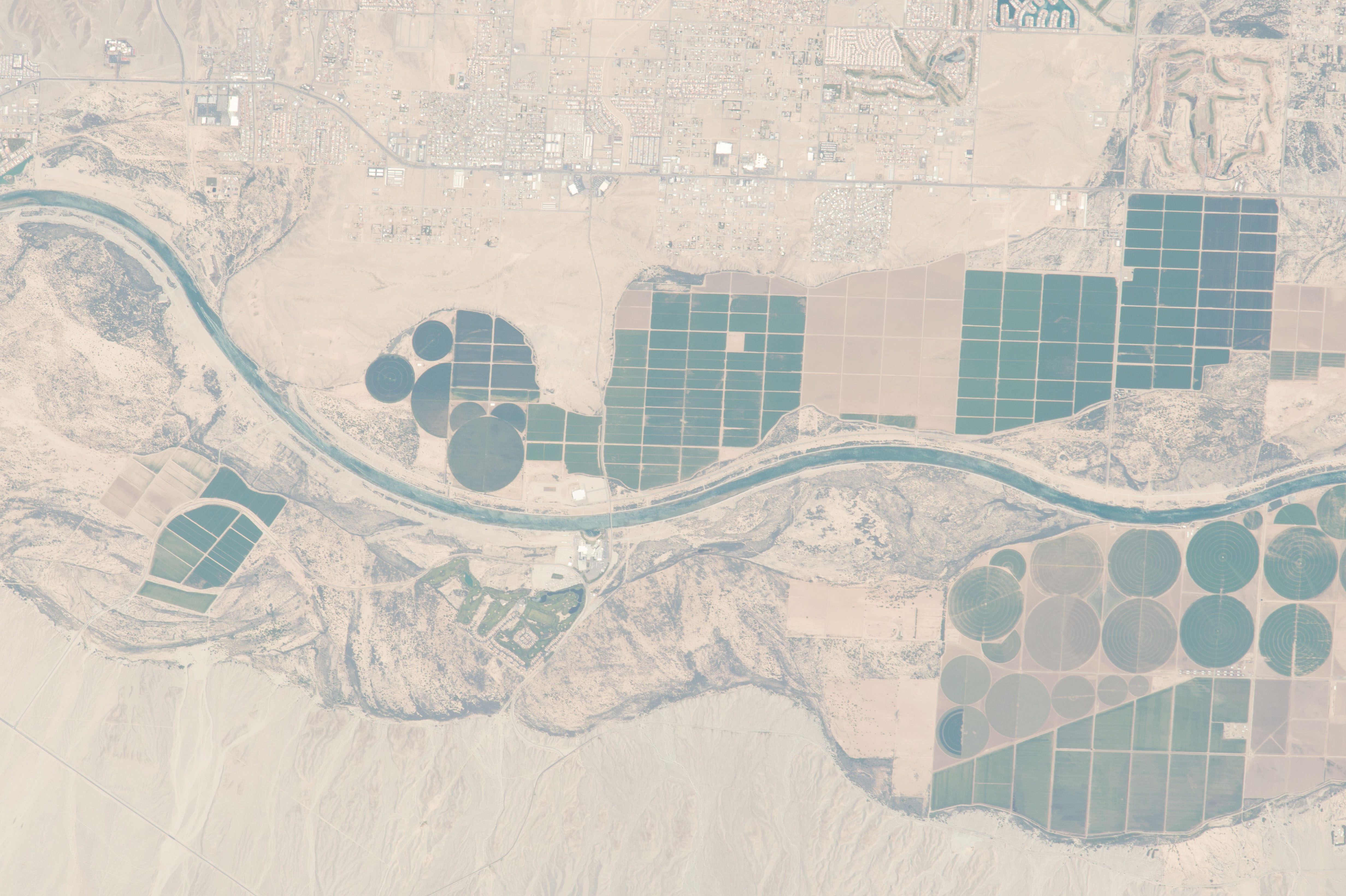


Photo center point: 35.0° N, 114.6° W
Photo center point by machine learning:
Country or Geographic Name: | USA-NEVADA |
Features: | FORT MOHAVE, MESQUITE CREEK, COLORADO R., AGR. |
| Features Found Using Machine Learning: | |
Cloud Cover Percentage: | 0 (no clouds present) |
Sun Elevation Angle: | 64° |
Sun Azimuth: | 192° |
Camera: | Nikon D4 Electronic Still Camera |
Focal Length: | 1150mm |
Camera Tilt: | 19 degrees |
Format: | 4928E: 4928 x 3280 pixel CMOS sensor, 36.0mm x 23.9mm, total pixels: 16.6 million, Nikon FX format |
Film Exposure: | |
| Additional Information | |
| Width | Height | Annotated | Cropped | Purpose | Links |
|---|---|---|---|---|---|
| 4928 pixels | 3280 pixels | No | No | NASA's Earth Observatory web site | Download Image |
| 720 pixels | 480 pixels | Yes | No | NASA's Earth Observatory web site | Download Image |
| 4928 pixels | 3280 pixels | No | No | Download Image | |
| 640 pixels | 426 pixels | No | No | Download Image |
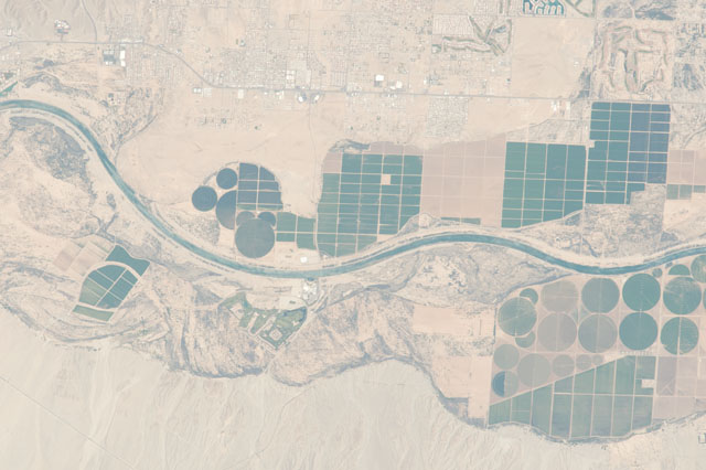
Looking down on the desert vistas of the southwestern United States, an astronaut took this photograph of a short section of the Colorado River. This reach of the river is marked by dark-toned agricultural fields, both rectangular and round, restricted to the narrow zone of arable land on the floodplain close to the river. For scale, the larger crop circles are 750 meters in diameter. Note that from the astronaut's perspective here, north is to the left.
The towns of Fort Mohave and Mesquite Creek are more difficult to see and occupy slightly higher ground - separated from the floodplain by steep bluffs that appear along the lower margin of the image. This area lies within the Fort Mojave Indian Reservation; it is also where the state boundaries of Arizona, Nevada, and California meet. The Mojave people have leased much of the reservation to agribusinesses for cultivation of commodity crops such as alfalfa, corn, and soybeans. This has led to an influx of non-native people, such that the Mojave now make up less than half of the population of the reservation.
