ISS051-E-13155
| NASA Photo ID | ISS051-E-13155 |
| Focal Length | 1150mm |
| Date taken | 2017.04.14 |
| Time taken | 19:55:10 GMT |
4928 x 3280 pixels 720 x 480 pixels 4928 x 3280 pixels 640 x 426 pixels
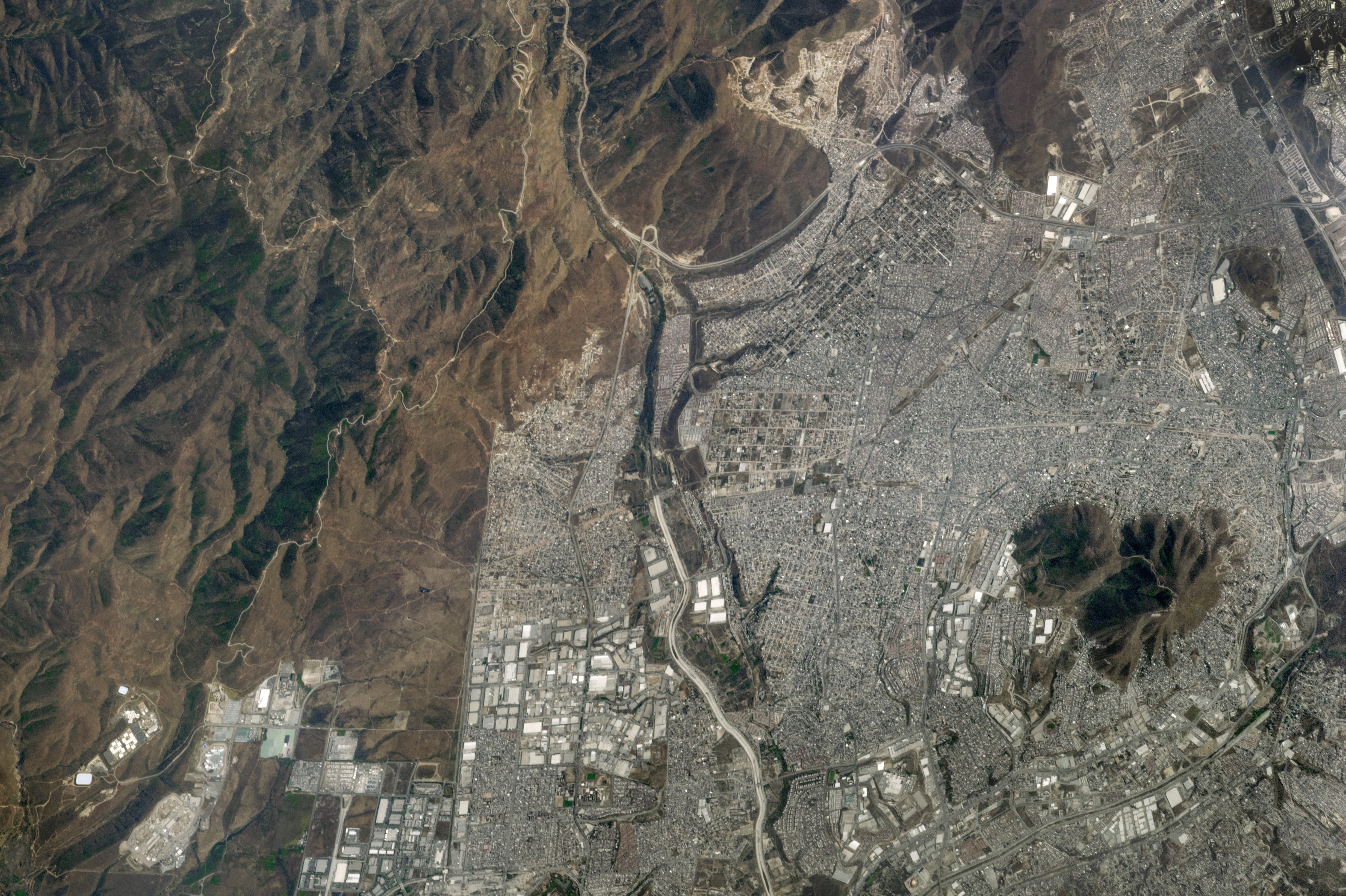
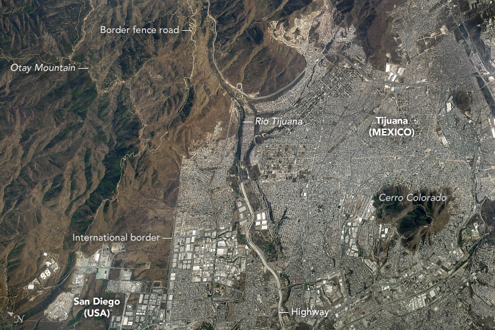
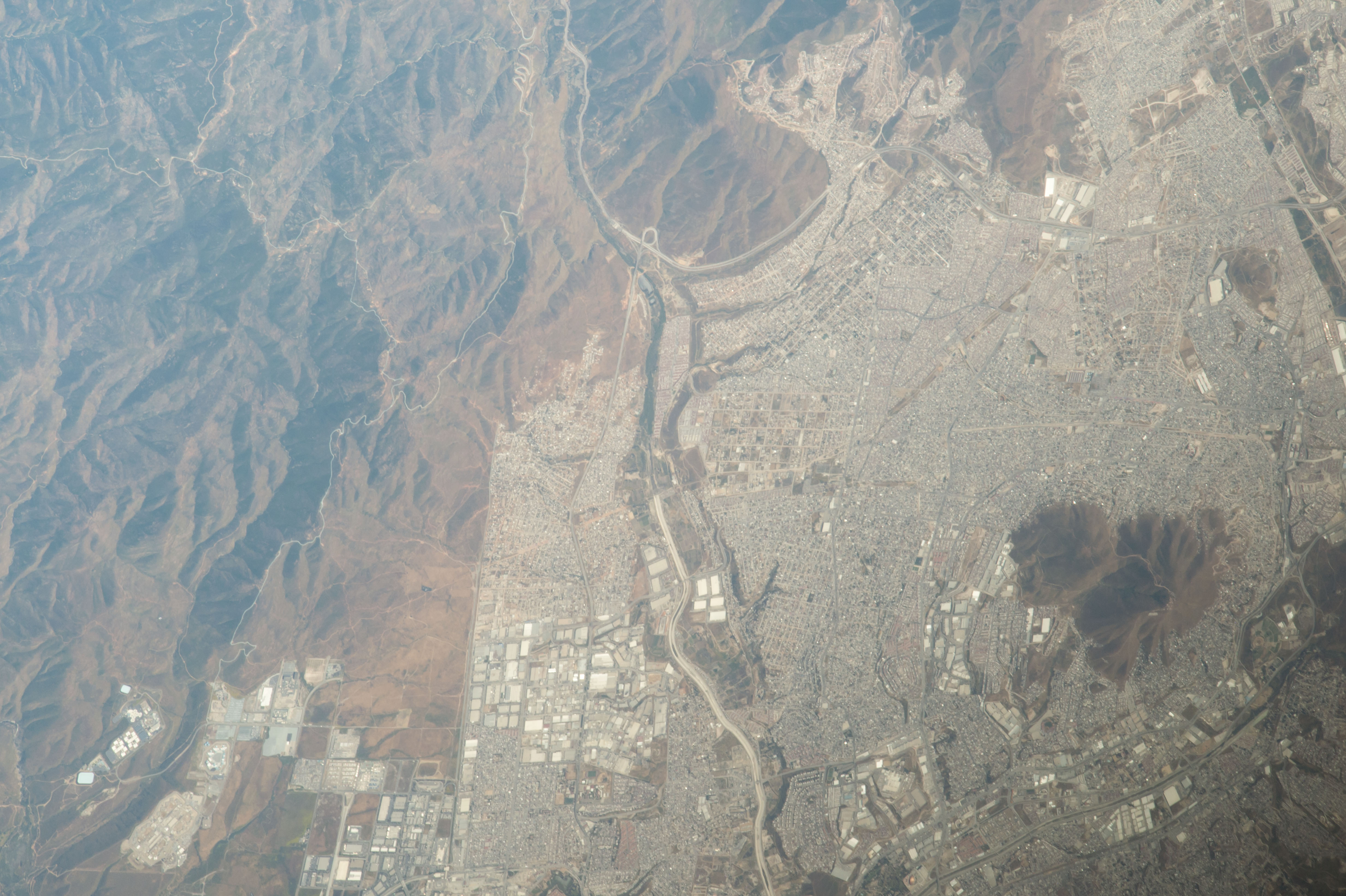


Photo center point: 32.5° N, 116.9° W
Photo center point by machine learning:
Country or Geographic Name: | MEXICO |
Features: | TIJUANA, INTERNATIONAL BORDER, OTAY MT. |
| Features Found Using Machine Learning: | |
Cloud Cover Percentage: | 0 (no clouds present) |
Sun Elevation Angle: | 65° |
Sun Azimuth: | 188° |
Camera: | Nikon D4 Electronic Still Camera |
Focal Length: | 1150mm |
Camera Tilt: | 36 degrees |
Format: | 4928E: 4928 x 3280 pixel CMOS sensor, 36.0mm x 23.9mm, total pixels: 16.6 million, Nikon FX format |
Film Exposure: | |
| Additional Information | |
| Width | Height | Annotated | Cropped | Purpose | Links |
|---|---|---|---|---|---|
| 4928 pixels | 3280 pixels | No | No | NASA's Earth Observatory web site | Download Image |
| 720 pixels | 480 pixels | Yes | No | NASA's Earth Observatory web site | Download Image |
| 4928 pixels | 3280 pixels | No | No | Download Image | |
| 640 pixels | 426 pixels | No | No | Download Image |
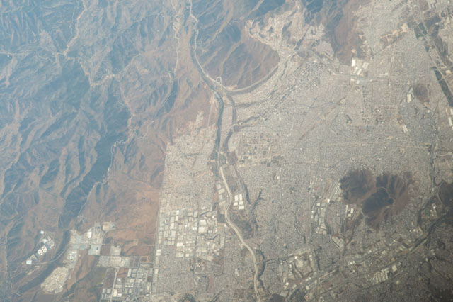
An astronaut aboard the International Space Station (ISS) took this photograph of the eastern parts of Tijuana, located in the Mexican state of Baja California about 20 kilometers (12 miles) inland from the Pacific Ocean. Tijuana is one of the fastest growing metropolitan areas in Mexico.
Note the sharp demarcation between Mexico and the United States. Tijuana shares this international border with its sister city San Diego, California, and it is the busiest land-border crossing in the world, with more than 300,000 crossings every day. The population of entire Tijuana-San Diego metropolitan region was estimated in 2012 to be about 4.9 million people.
The image shows Tijuana's rugged terrain, which includes canyons and steep-sided hills such as Cerro Colorado (Red Hill). The photo is detailed enough to show individual roads and highways. The largest visible in the view is the double highway that follows the Rio Tijuana along both its banks. The Mexicali-Tijuana highway (top center) curves around a mountain near the border. Switchbacks of a steep dirt road wind up the side of a canyon, leading to the border fence road and to the peak of Otay Mountain.
