ISS050-E-51946

| NASA Photo ID | ISS050-E-51946 |
| Focal Length | 1150mm |
| Date taken | 2017.02.19 |
| Time taken | 10:31:13 GMT |
4928 x 3280 pixels 720 x 480 pixels 4928 x 3280 pixels 640 x 426 pixels
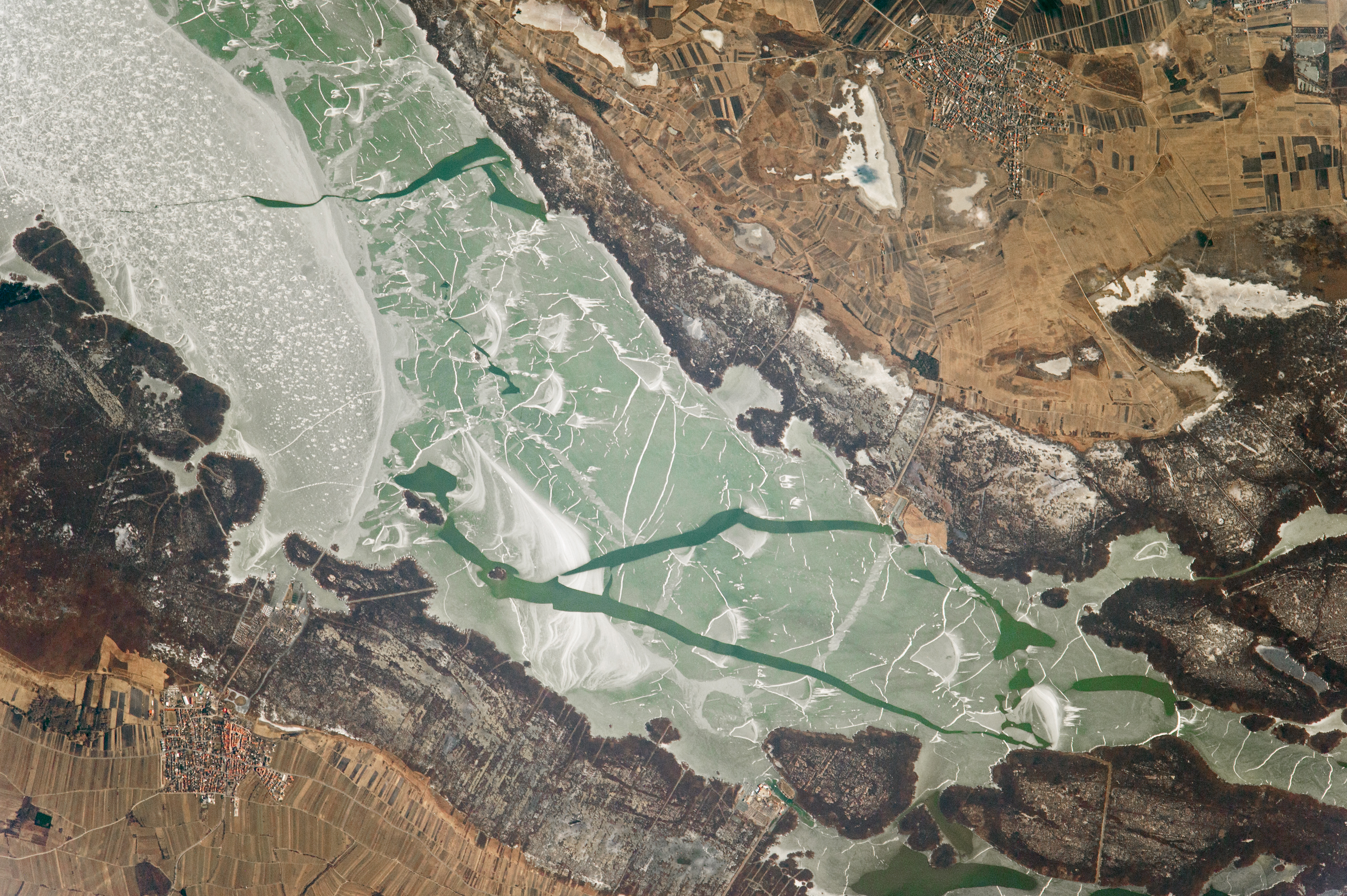
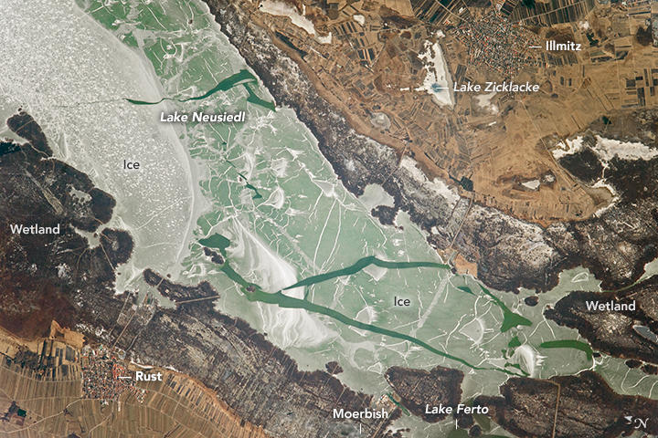
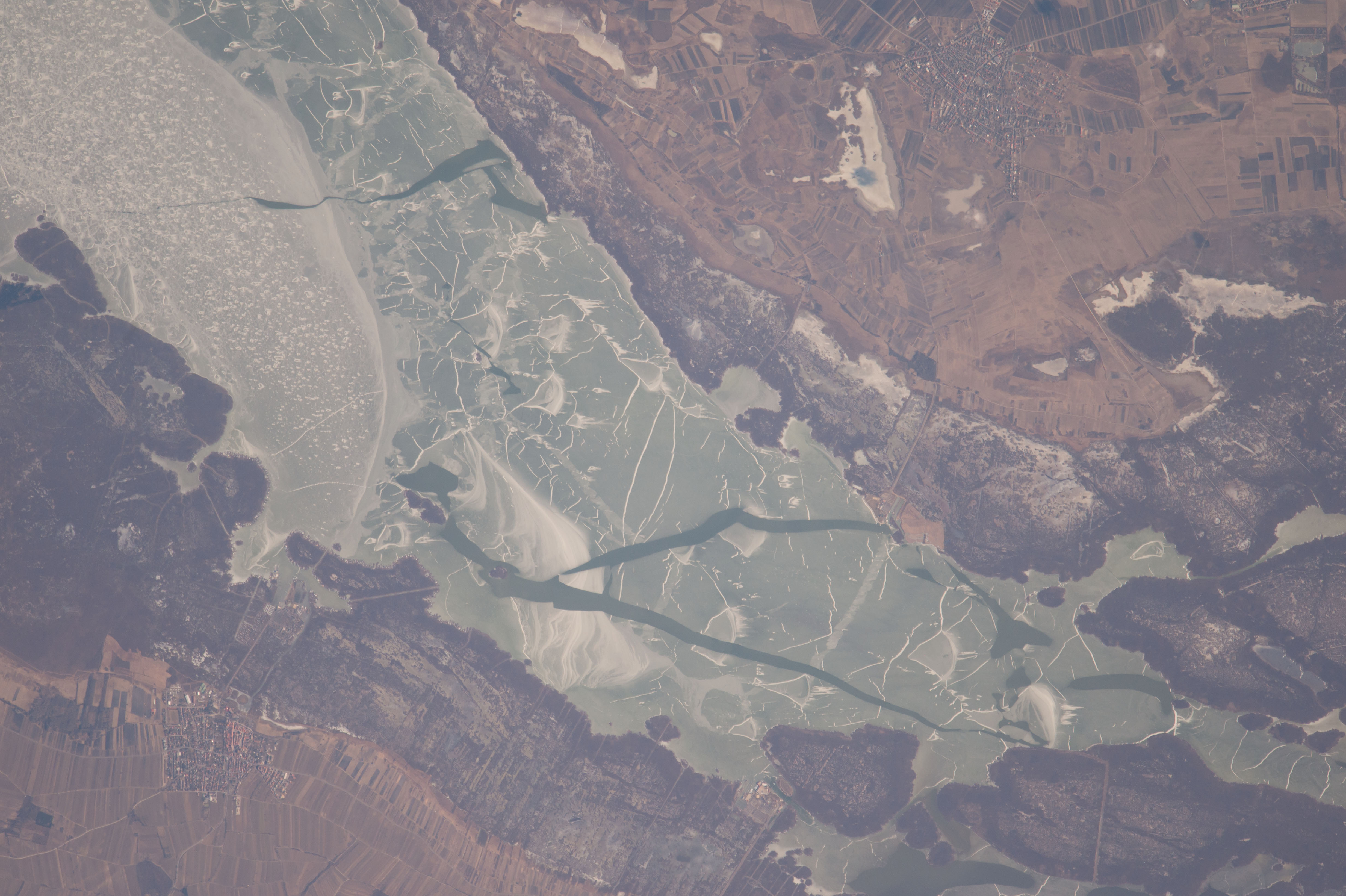
Photo center point: 47.8° N, 16.7° E
Photo center point by machine learning:
Country or Geographic Name: | AUSTRIA |
Features: | LAKE NEUSIEDL, ICE, WETLANDS |
| Features Found Using Machine Learning: | |
Cloud Cover Percentage: | 10 (1-10)% |
Sun Elevation Angle: | 31° |
Sun Azimuth: | 172° |
Camera: | Nikon D4 Electronic Still Camera |
Focal Length: | 1150mm |
Camera Tilt: | 34 degrees |
Format: | 4928E: 4928 x 3280 pixel CMOS sensor, 36.0mm x 23.9mm, total pixels: 16.6 million, Nikon FX format |
Film Exposure: | |
| Additional Information | |
| Width | Height | Annotated | Cropped | Purpose | Links |
|---|---|---|---|---|---|
| 4928 pixels | 3280 pixels | No | No | NASA's Earth Observatory web site | Download Image |
| 720 pixels | 480 pixels | Yes | No | NASA's Earth Observatory web site | Download Image |
| 4928 pixels | 3280 pixels | No | No | Download Image | |
| 640 pixels | 426 pixels | No | No | Download Image |
An astronaut aboard the International Space Station took this photograph of the south end of Lake Neusiedl, which spans the border between Austria and Hungary. (It is known as Lake Ferto in Hungary.) The pattern of open-water cracks amidst the ice hint at the beginning of a spring warm-up in the middle of this 30 kilometer- (20-mile) long lake.
In summer, the lake is a popular vacation locale, situated about 45 kilometers southeast of Vienna, Austria. Lake Neusiedl is also known as the "Sea of the Viennese." Extensive boating facilities line the shore, based primarily near the villages of Rust and Moerbisch.
At just 2 meters maximum depth, the lake is one of the shallowest in Central Europe. One well-known event for vacationers is the "annual freestyle mass crossing" of the lake from the village of Moerbisch to the village of Illmitz.
The wide, reed-covered wetland that fringes the lake is crossed by drainage canals and agricultural fields. Historical records indicate that these reed beds have been entirely under water at times because the lake size varies greatly with weather conditions. For example, the lake expanded to double its present size in 1768. More dramatically, the lake has dried up completely on several occasions: 1740-1742, 1811-1813, and 1866-1871. At very low stages, the lake has been described as a swamp because the reeds dominated the middle of the lake. Small depressions like Lake Zicklacke (upper center) dry up and fill on shorter time spans.
