ISS050-E-51538
| NASA Photo ID | ISS050-E-51538 |
| Focal Length | 1150mm |
| Date taken | 2017.02.20 |
| Time taken | 17:19:48 GMT |
3280 x 4928 pixels 720 x 480 pixels 4928 x 3280 pixels 640 x 426 pixels
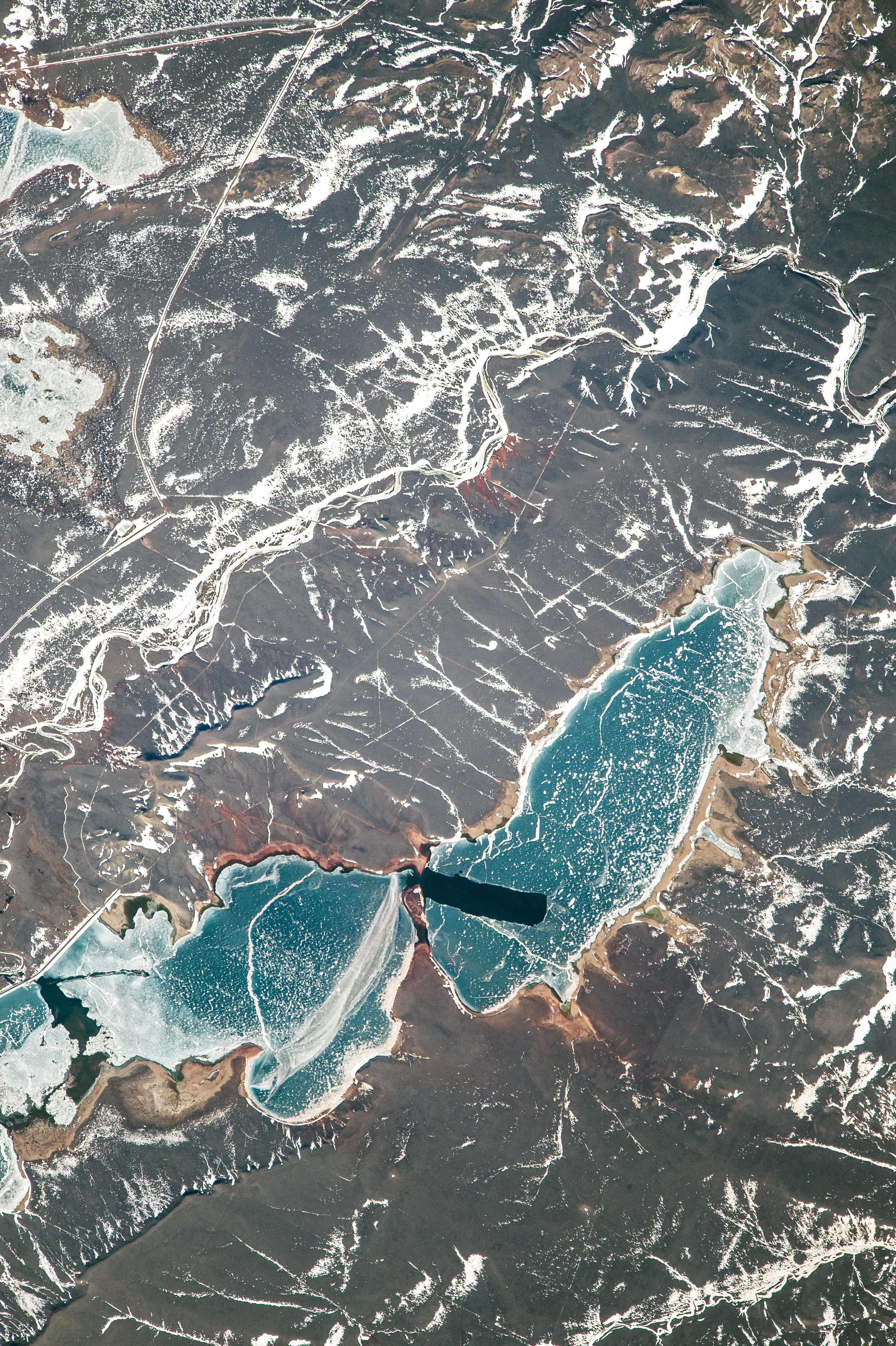
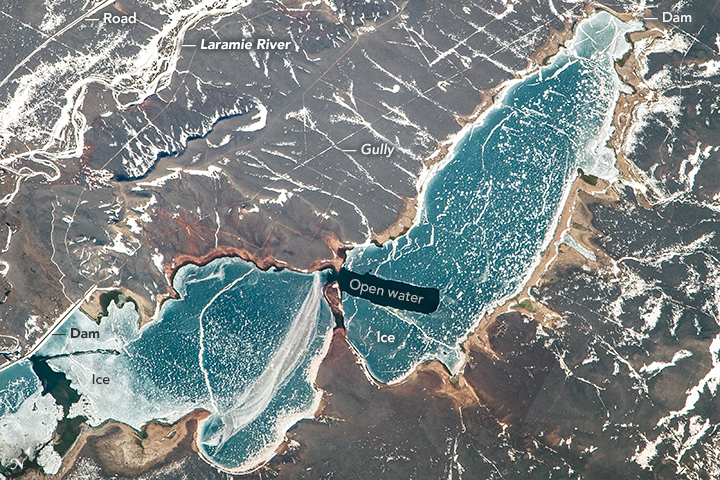


Photo center point: 41.9° N, 105.6° W
Photo center point by machine learning:
Country or Geographic Name: | USA-WYOMING |
Features: | WHEATLAND RESERVOIR NO 2 WITH ICE |
| Features Found Using Machine Learning: | |
Cloud Cover Percentage: | 10 (1-10)% |
Sun Elevation Angle: | 31° |
Sun Azimuth: | 146° |
Camera: | Nikon D4 Electronic Still Camera |
Focal Length: | 1150mm |
Camera Tilt: | 11 degrees |
Format: | 4928E: 4928 x 3280 pixel CMOS sensor, 36.0mm x 23.9mm, total pixels: 16.6 million, Nikon FX format |
Film Exposure: | |
| Additional Information | |
| Width | Height | Annotated | Cropped | Purpose | Links |
|---|---|---|---|---|---|
| 3280 pixels | 4928 pixels | No | Yes | NASA's Earth Observatory web site | Download Image |
| 720 pixels | 480 pixels | Yes | Yes | NASA's Earth Observatory web site | Download Image |
| 4928 pixels | 3280 pixels | No | No | Download Image | |
| 640 pixels | 426 pixels | No | No | Download Image |
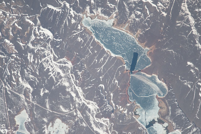
This photograph, taken in February 2017 from the International Space Station, shows an ice-covered reservoir in the windy high country of Wyoming, about 60 kilometers (40 miles) north of Laramie. The mile-wide reservoir stands at an elevation of more than 2000 meters (almost 7,000 feet) and feeds water into the upper Laramie River (top left). Lines of snow mark the small stream beds, roads, and low cliffs, and the floodplain of the river is almost unrecognizable under the snow patches.
Wheatland Reservoir No. 2 stores irrigation water for the farms of a community located 55 kilometers (34 miles) to the northeast. The reservoir was built when the town of Wheatland was founded in the 1880s, and it is unique in having two dam walls - the longer one in the south and the shorter one in the north. Spillways near these dam walls allow some water to make its way into the Laramie River.
Shallow water freezes faster and more readily, so the shorelines have the thickest ice and appear whiter than the middle of the reservoir.Two ice-free patches may be places where the water is moving towards outlets - that is, through narrows at the center of the lake toward the upper dam wall, and toward the other outlet at the longer dam wall. Another explanation is that the strong winds that blow across the high country of Wyoming have pushed the surface ice and opened up patches. Many small patches of ice appear to have been blown to the east side of the lake by the dominant westerly winds.
