ISS049-E-33726
| NASA Photo ID | ISS049-E-33726 |
| Focal Length | 1600mm |
| Date taken | 2016.10.06 |
| Time taken | 13:13:09 GMT |
4928 x 3280 pixels 720 x 480 pixels 4928 x 3280 pixels 640 x 426 pixels
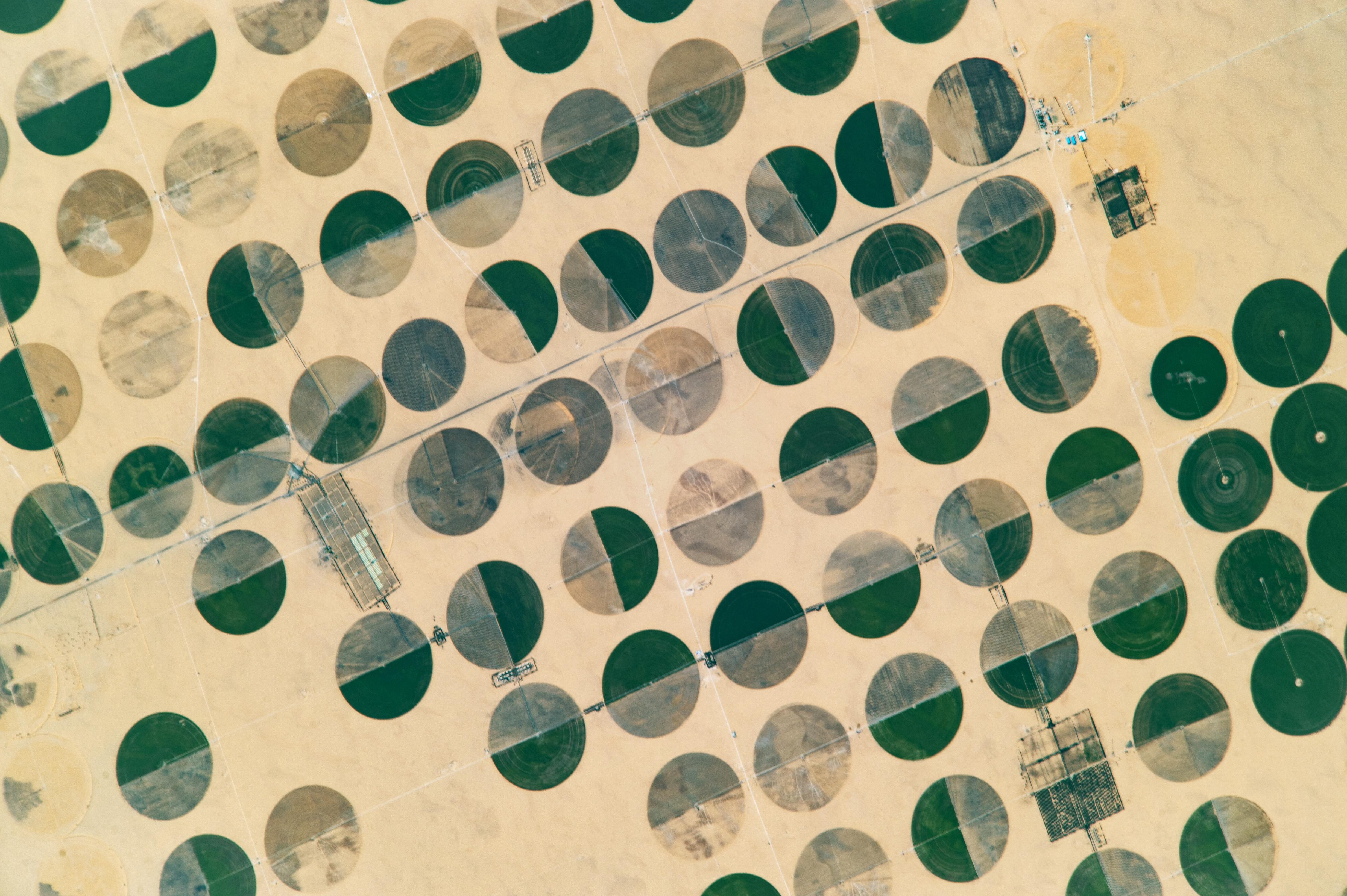

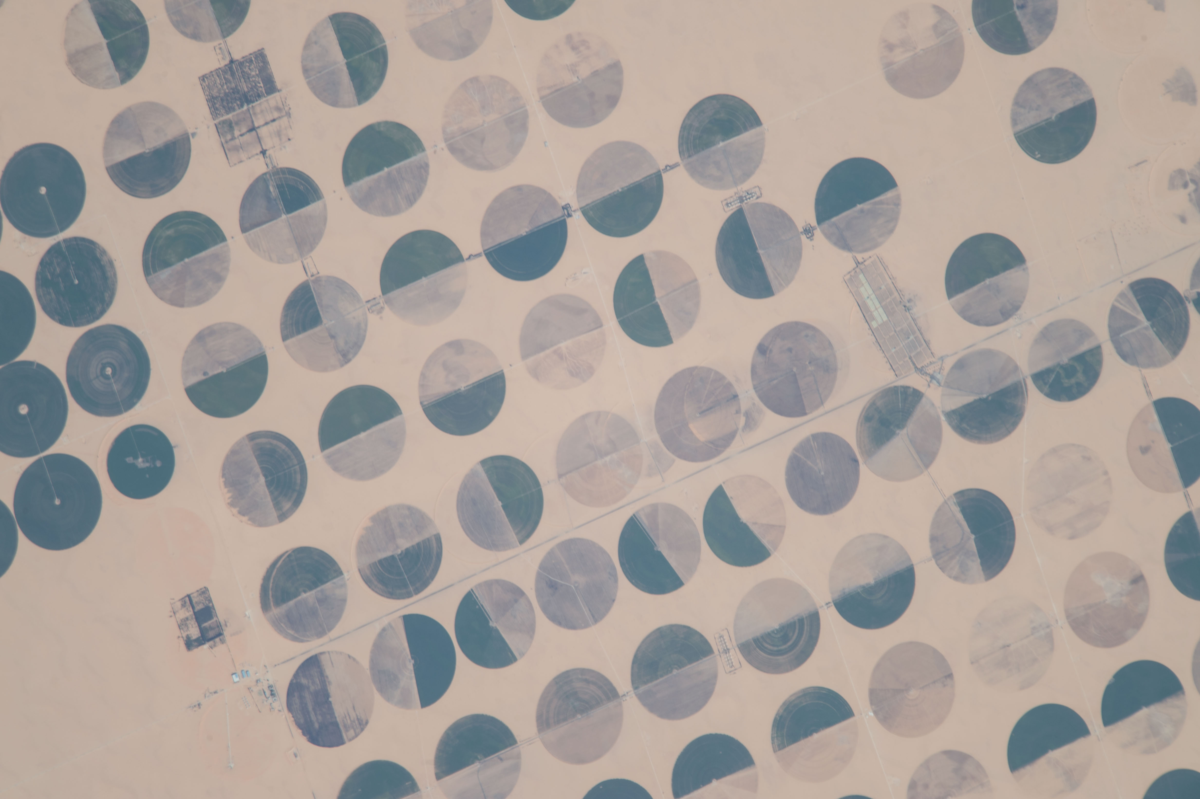


Photo center point: 22.7° N, 28.5° E
Photo center point by machine learning:
Country or Geographic Name: | EGYPT |
Features: | AGR., PIVOT IRRIGATION, POTATO FIELDS, GREEN HOUSES, SHARQ EL OWAINAT |
| Features Found Using Machine Learning: | |
Cloud Cover Percentage: | 0 (no clouds present) |
Sun Elevation Angle: | 32° |
Sun Azimuth: | 246° |
Camera: | Nikon D4 Electronic Still Camera |
Focal Length: | 1600mm |
Camera Tilt: | 31 degrees |
Format: | 4928E: 4928 x 3280 pixel CMOS sensor, 36.0mm x 23.9mm, total pixels: 16.6 million, Nikon FX format |
Film Exposure: | |
| Additional Information | |
| Width | Height | Annotated | Cropped | Purpose | Links |
|---|---|---|---|---|---|
| 4928 pixels | 3280 pixels | No | No | NASA's Earth Observatory web site | Download Image |
| 720 pixels | 480 pixels | Yes | No | NASA's Earth Observatory web site | Download Image |
| 4928 pixels | 3280 pixels | No | No | Download Image | |
| 640 pixels | 426 pixels | No | No | Download Image |
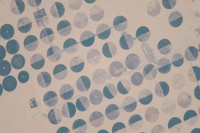
An astronaut aboard the International Space Station captured this photograph of circular farming patterns in Sharq El Owainat in southwest Egypt. The remote agricultural outpost in the Sahara Desert lies approximately 290 kilometers (180 miles) from the nearest city and 210 kilometers (130 miles) from the Toshka lakes.
The Nubian Sandstone Aquifer System, buried beneath the sand, allows patches of agriculture to survive in the middle of the desert. The aquifer is the only source of water for Egyptians living away from the Nile River. More than 95 percent of Egypt is uninhabitable desert with an average annual precipitation of 0 millimeters.
The crop circles are a result of center-pivot irrigation, an efficient method for water conservation in agriculture. Groundwater from the Nubian aquifer is drawn up from wells in the center of the circles, and it is sprayed or dripped out of long, rotating pipes that pivot around the center.
Most of the crops pictured here are likely potatoes (darker green circles), wheat (lighter brown circles), or medicinal and aromatic plants such as chamomile. The light, tan-colored crop circles likely have undergone controlled burning to remove excess plant matter and essentially clean up the land for the next crop. Catering to the populace of the New Valley Governate, these crops are transported on a desert road that leads to Abu Simbel (about 200 miles to the east), Dakhla Oasis (200 miles north), and the Sharq El Owainat Airport.
