ISS049-E-1116
| NASA Photo ID | ISS049-E-1116 |
| Focal Length | 800mm |
| Date taken | 2016.09.10 |
| Time taken | 17:35:18 GMT |
4928 x 3280 pixels 720 x 480 pixels 4928 x 3280 pixels 640 x 426 pixels
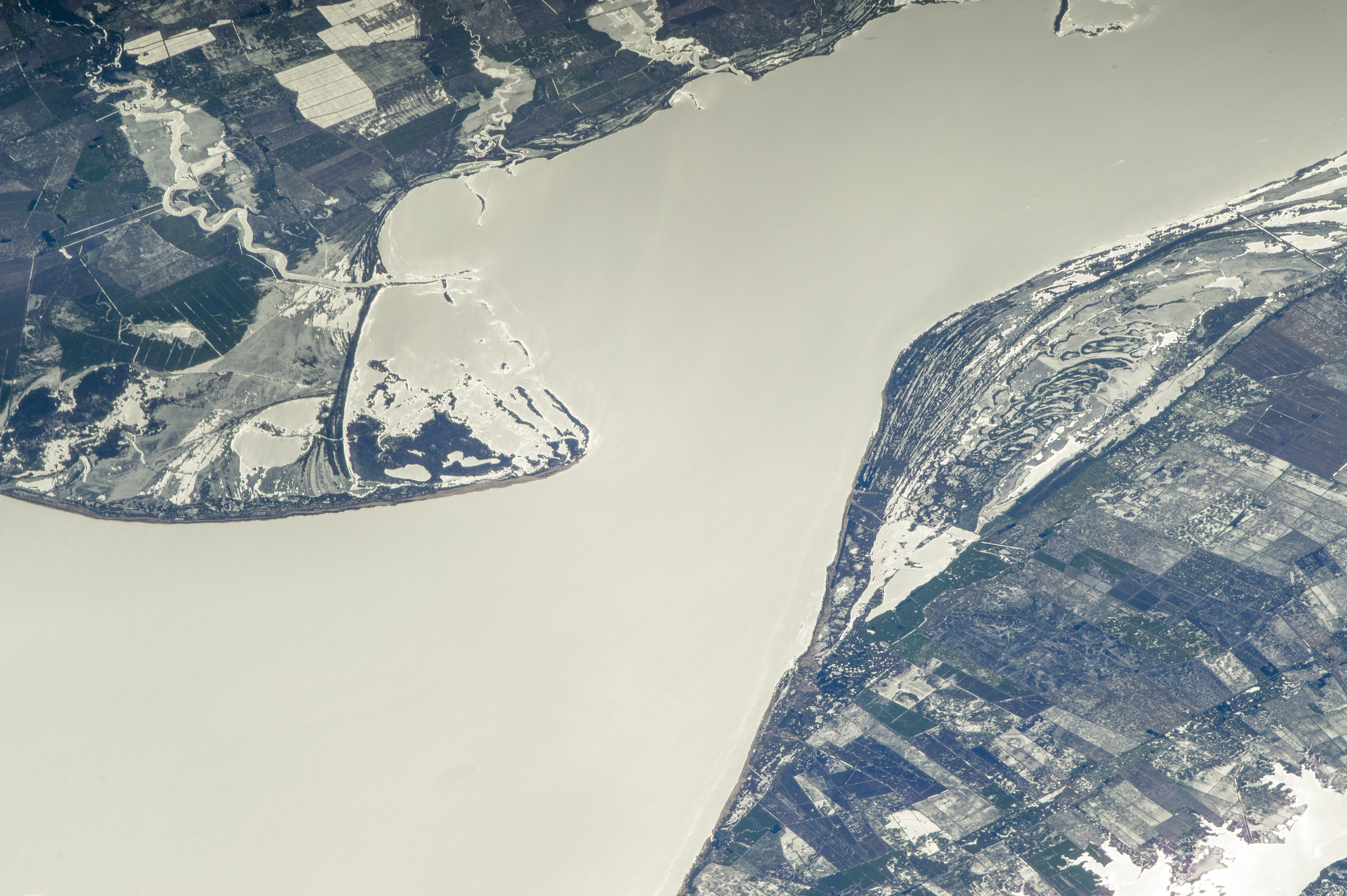


Photo center point: 32.4° S, 52.7° W
Photo center point by machine learning: 32.36° S, 52.71° W

Country or Geographic Name: | BRAZIL |
Features: | L. MIRIM, BEACH RIDGES, GLINT, AGR. |
| Features Found Using Machine Learning: | |
Cloud Cover Percentage: | 10 (1-10)% |
Sun Elevation Angle: | 36° |
Sun Azimuth: | 311° |
Camera: | Nikon D4 Electronic Still Camera |
Focal Length: | 800mm |
Camera Tilt: | High Oblique |
Format: | 4928E: 4928 x 3280 pixel CMOS sensor, 36.0mm x 23.9mm, total pixels: 16.6 million, Nikon FX format |
Film Exposure: | |
| Additional Information | |
| Width | Height | Annotated | Cropped | Purpose | Links |
|---|---|---|---|---|---|
| 4928 pixels | 3280 pixels | No | No | NASA's Earth Observatory web site | Download Image |
| 720 pixels | 480 pixels | Yes | No | NASA's Earth Observatory web site | Download Image |
| 4928 pixels | 3280 pixels | No | No | Download Image | |
| 640 pixels | 426 pixels | No | No | Download Image |
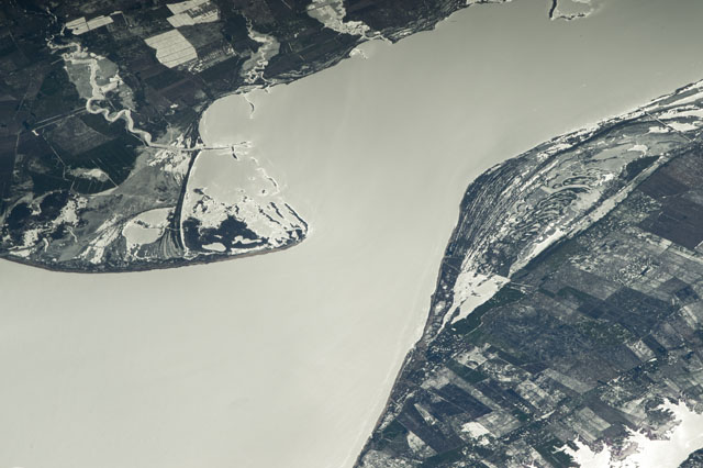
An astronaut aboard the International Space Station captured this photograph of the north end of Lagoa Mirim, a 180-kilometer-long coastal lagoon straddling the border of Brazil and Uruguay.
Three rivers enter the lagoon (top), and rectangular agricultural fields (dark tones in the image) cover nearly all of the dry land in the scene. In contrast, the water has a bright grey, mirror-like appearance due to sunlight reflected off the surface directly back to the camera. This sunglint emphasizes the meandering courses of the rivers and reveals a group of recently inundated fields (top left) that are mainly used for rice farming.
Around 400,000 years ago, sea level was higher and the Atlantic Ocean covered this part of Brazil's coast. The lagoons on the southern coast of Brazil, including Lagoa Mirim, were formed by the natural rise and fall of sea level over time, a process geologists call the transgression-regression cycle. Eventually the connection between the lagoon and the Atlantic Ocean closed up, and the main source of water became the rivers draining the Brazilian interior - making Lagoa Mirim a freshwater lagoon.
On both sides of the narrow part of the lagoon (center), ancient beach ridges are visible as a set of curved stripes and islands. Water circulation formed these ridges, which were built up over the past thousand years as waves and currents moved sediment along the shoreline.
