ISS048-E-72996

| NASA Photo ID | ISS048-E-72996 |
| Focal Length | 17mm |
| Date taken | 2016.09.05 |
| Time taken | 10:49:06 GMT |
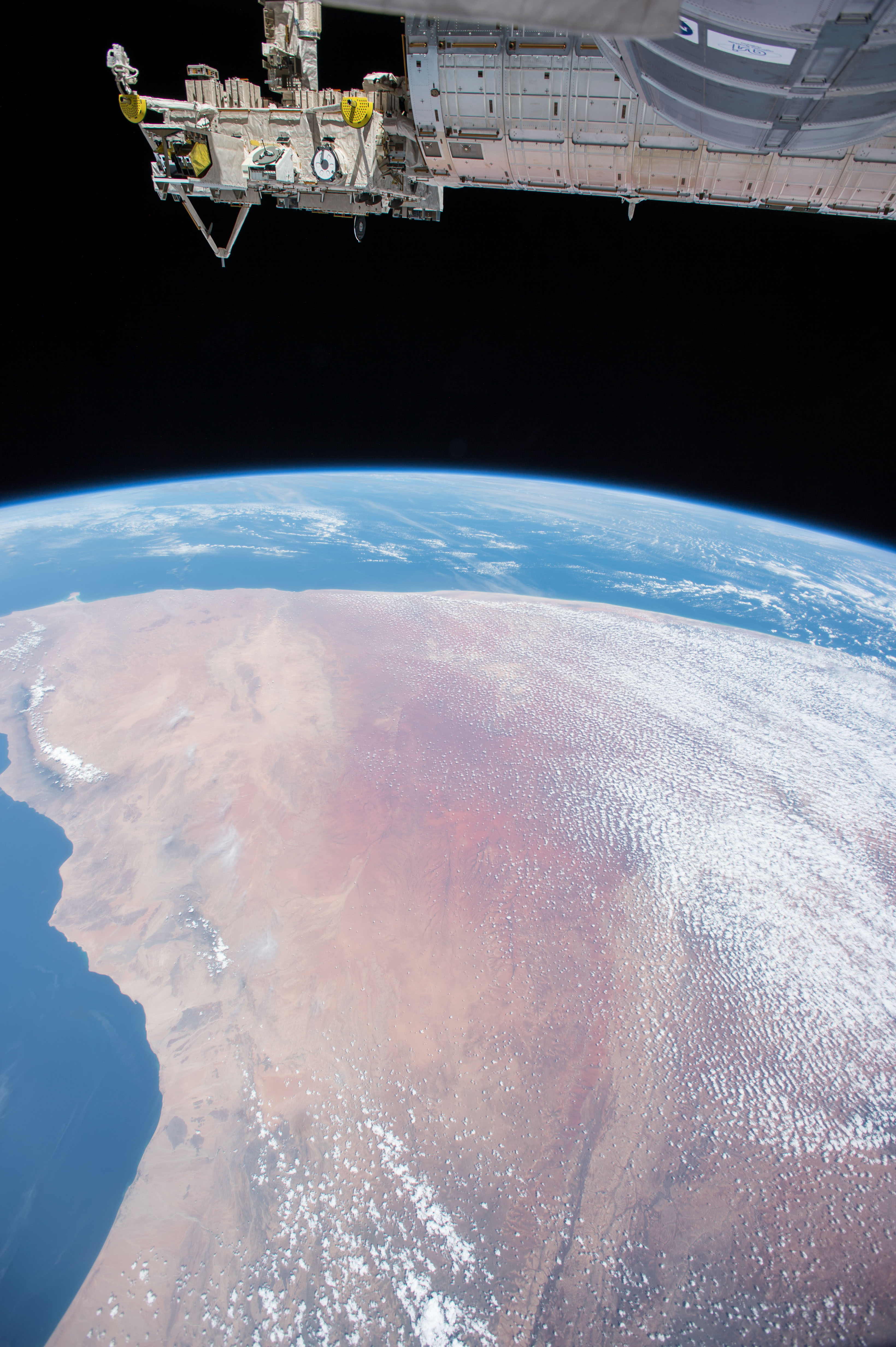
Spacecraft nadir point: 7.5° N, 44.4° E
Photo center point: 6.5° N, 49.0° E
Photo center point by machine learning:
Photo center point: 6.5° N, 49.0° E
Photo center point by machine learning:
Nadir to Photo Center: East
Spacecraft Altitude: 218 nautical miles (404km)
Country or Geographic Name: | SOMALIA |
Features: | BUDBUD, DABOROW, CEEL DHAHANAAN, CEEL BACDUUR, RAAS CABAAD, ARABIAN SEA, CLOUDS |
| Features Found Using Machine Learning: | PAN- |
Cloud Cover Percentage: | 50 (26-50)% |
Sun Elevation Angle: | 63° |
Sun Azimuth: | 270° |
Camera: | Nikon D4 Electronic Still Camera |
Focal Length: | 17mm |
Camera Tilt: | 52 degrees |
Format: | 4928E: 4928 x 3280 pixel CMOS sensor, 36.0mm x 23.9mm, total pixels: 16.6 million, Nikon FX format |
Film Exposure: | |
| Additional Information | |
| Width | Height | Annotated | Cropped | Purpose | Links |
|---|---|---|---|---|---|
| 3280 pixels | 4928 pixels | No | No | Download Image | |
| 426 pixels | 640 pixels | No | No | Download Image |
Download Packaged File
Download a Google Earth KML for this Image
View photo footprint information
Download a GeoTIFF for this photo
Image Caption: CATALOGED BY TEXAS STATE UNIVERSITY
