ISS046-E-3699
| NASA Photo ID | ISS046-E-3699 |
| Focal Length | 28mm |
| Date taken | 2015.12.29 |
| Time taken | 22:14:18 GMT |
1000 x 666 pixels 450 x 300 pixels 4928 x 3280 pixels 720 x 480 pixels 4928 x 3280 pixels 640 x 426 pixels
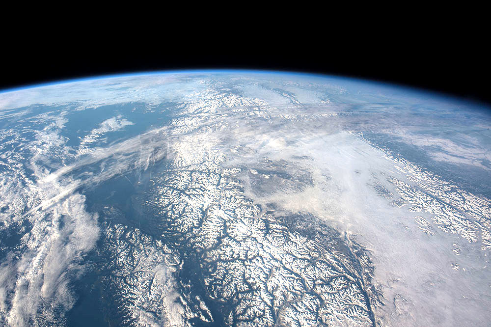
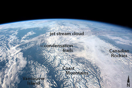
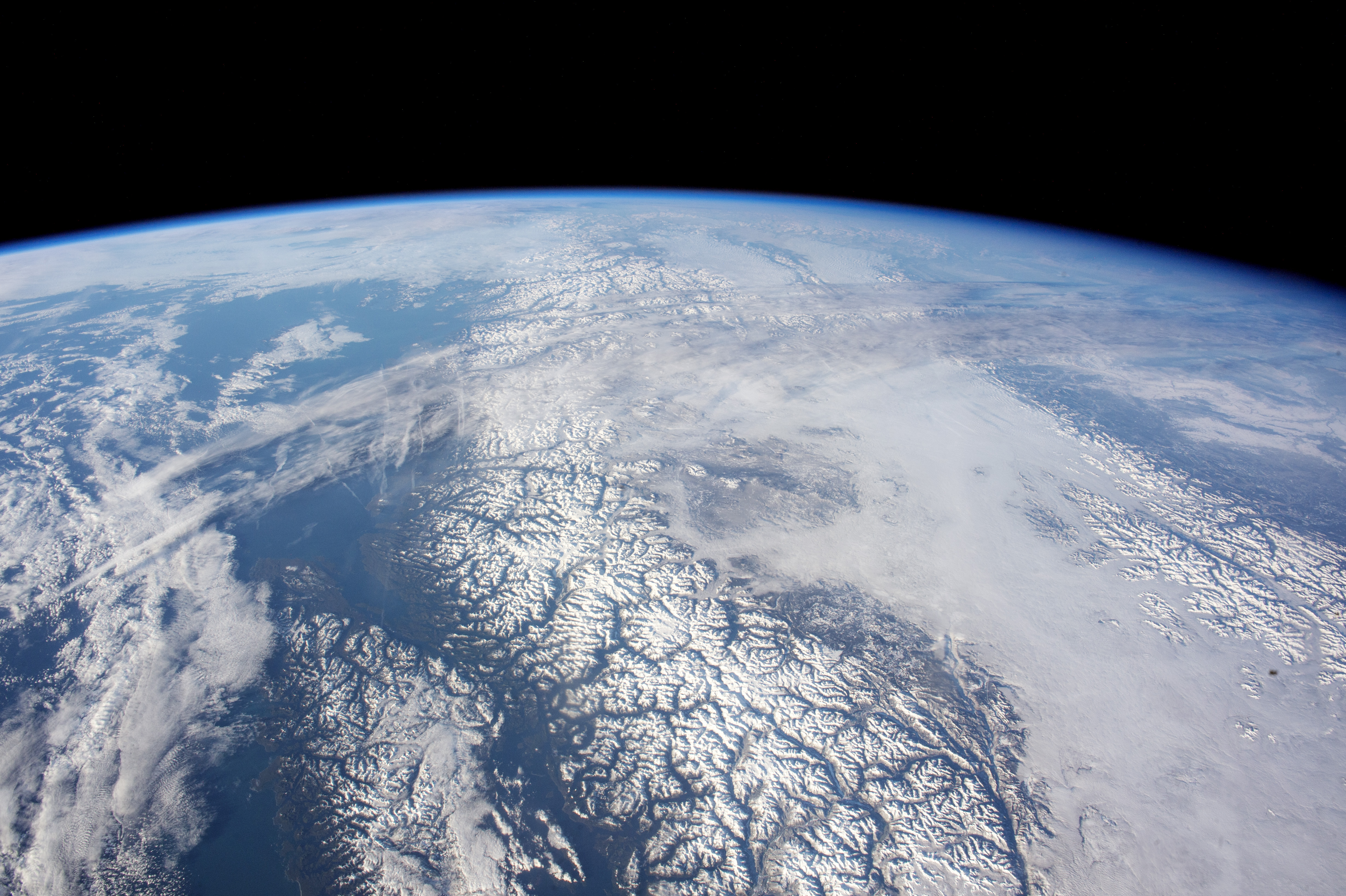

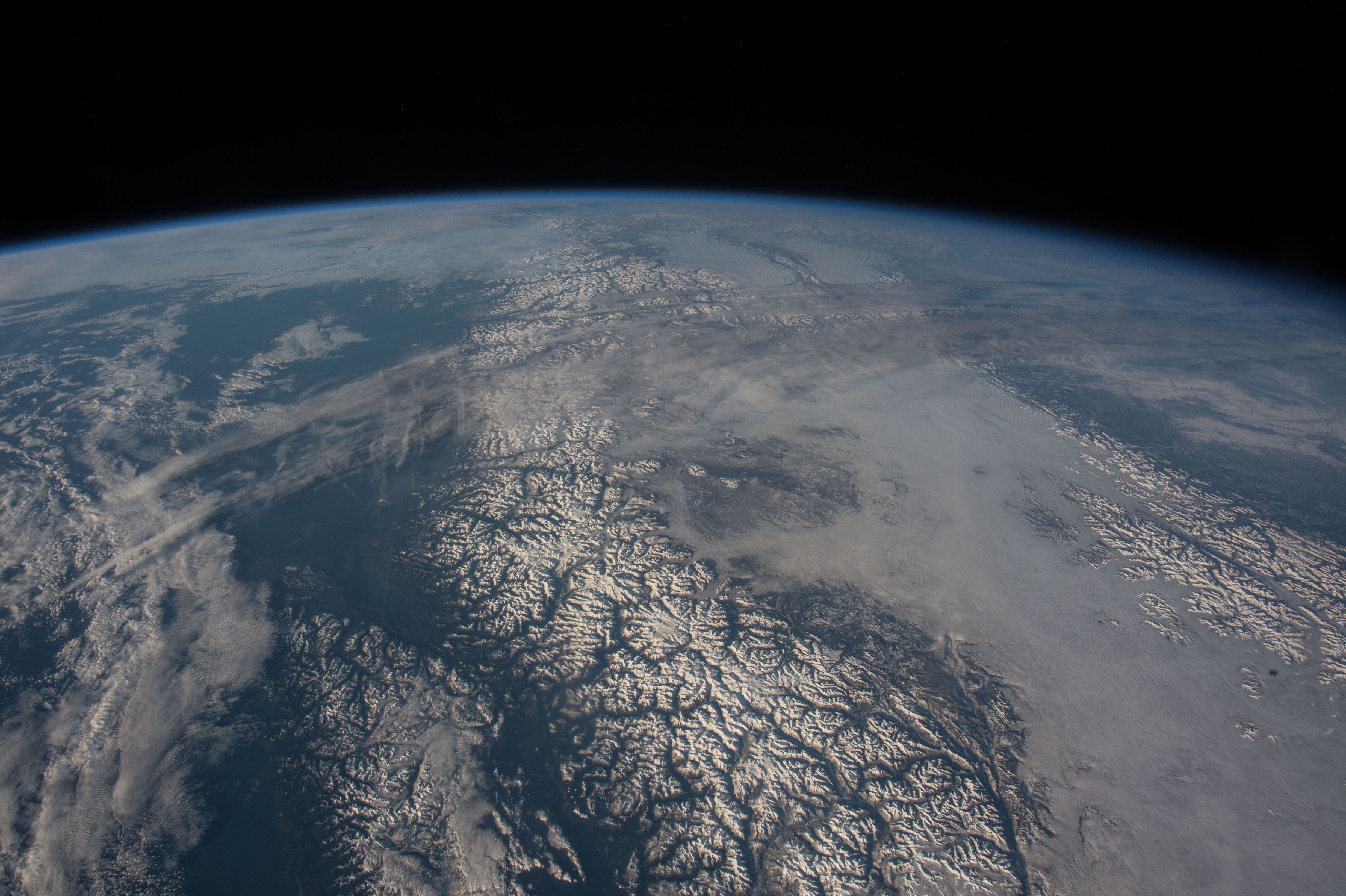
Photo center point: 52.5° N, 124.5° W
Photo center point by machine learning:
Country or Geographic Name: | CANADA-BC |
Features: | PAN-COAST MTS., VANCOUVER I., JET STREAM CLOUDS |
| Features Found Using Machine Learning: | PAN- |
Cloud Cover Percentage: | 25 (11-25)% |
Sun Elevation Angle: | 15° |
Sun Azimuth: | 210° |
Camera: | Nikon D4 Electronic Still Camera |
Focal Length: | 28mm |
Camera Tilt: | High Oblique |
Format: | 4928E: 4928 x 3280 pixel CMOS sensor, 36.0mm x 23.9mm, total pixels: 16.6 million, Nikon FX format |
Film Exposure: | |
| Additional Information | |
| Width | Height | Annotated | Cropped | Purpose | Links |
|---|---|---|---|---|---|
| 1000 pixels | 666 pixels | No | No | Earth From Space collection | Download Image |
| 450 pixels | 300 pixels | Yes | No | Earth From Space collection | Download Image |
| 4928 pixels | 3280 pixels | No | No | NASA's Earth Observatory web site | Download Image |
| 720 pixels | 480 pixels | Yes | No | NASA's Earth Observatory web site | Download Image |
| 4928 pixels | 3280 pixels | No | No | Download Image | |
| 640 pixels | 426 pixels | No | No | Download Image |
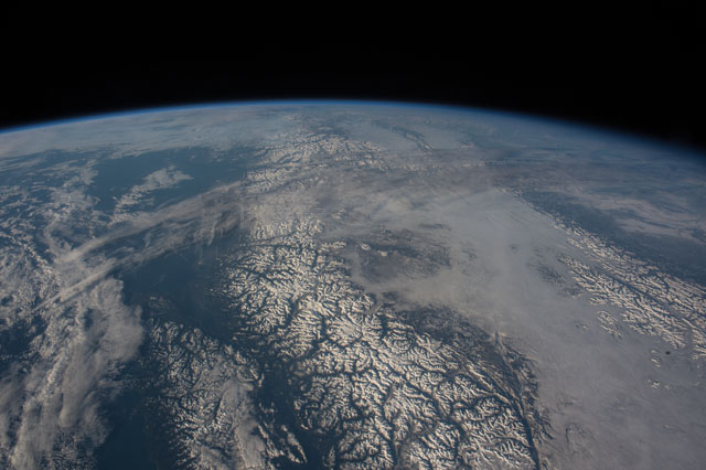
Orbiting over the Gulf of Alaska towards the west coast of the US, an astronaut aboard the International Space Station took this panorama looking north toward the snow-covered landscape of Canada's Coast Mountains (image center), the Canadian Rockies (far right) and Vancouver Island (lower left). Brilliant snow and ice caps on the mountain crests, even in the low light of a northern winter, contrast with the network of dark valleys, in shadow or below the snow line. These deep valleys were enlarged by eroding glaciers repeatedly in the ice ages (the last 2-3 million years).
A long cloud band slants across the entire image. Meteorologists think this may be the remnants of a jet stream cloud band. These cloud bands indicate the general position of fast winds--"rivers of air" that can reach speeds of more than 275 mph (239 kts / 442 kp/h). This specific band is the typical position and orientation of the Animated maps of the Polar Jet, for the days before this image, show a dying branch of the jet over western Canada.
Even in this distant view several thin contrails disrupt the cloud band where aircraft were flying near the jet stream. Aircraft often take advantage of these fast jets as tail winds to shorten flight times--when flying in the same direction as the jet stream (west to east).
Images taken just before and just after this image show changing view angles of the jet stream cloud (ISS046-E-3678 to ISS046-E-3707), giving the sense of the astronaut experience of flying across the planet. An arc of lower-level cloud is a cold front approaching Vancouver Island (far left side of image).
