ISS045-E-55907
| NASA Photo ID | ISS045-E-55907 |
| Focal Length | 1150mm |
| Date taken | 2015.10.10 |
| Time taken | 13:38:11 GMT |
1000 x 666 pixels 540 x 360 pixels 4928 x 3280 pixels 720 x 480 pixels 4928 x 3280 pixels 640 x 426 pixels
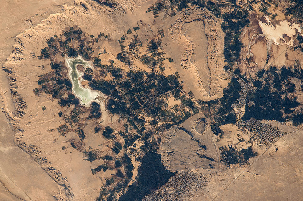
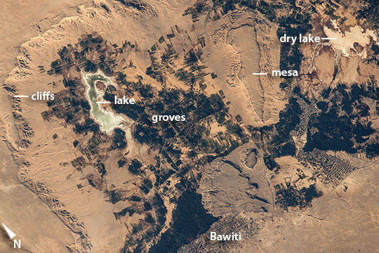
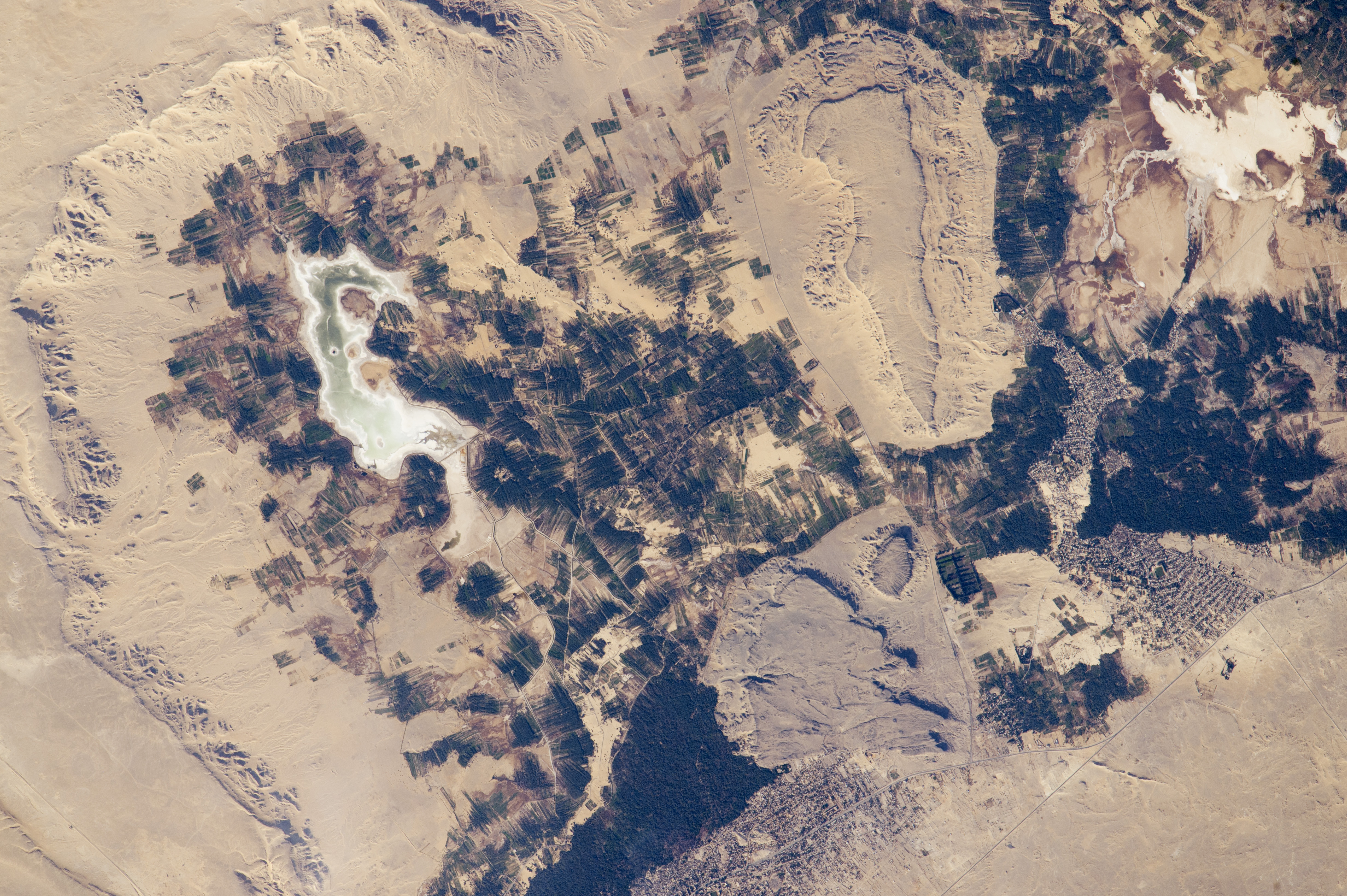
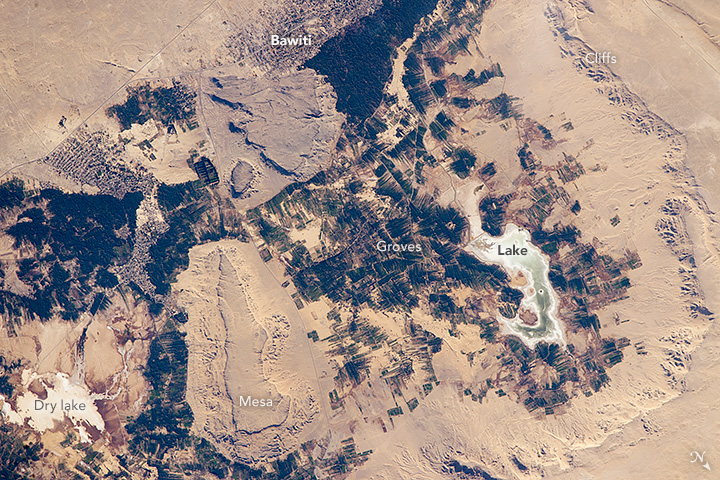
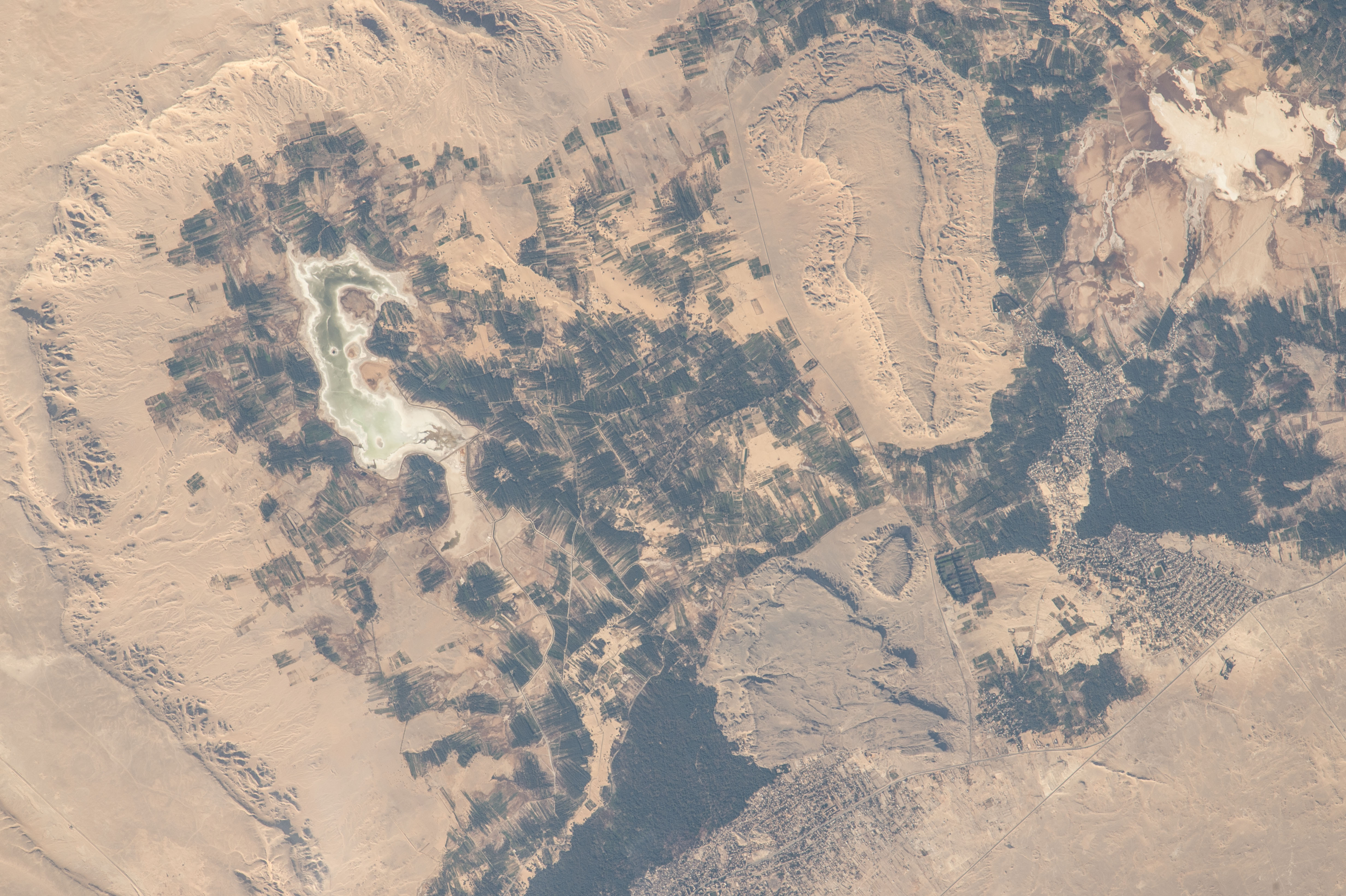


Photo center point: 28.4° N, 28.9° E
Photo center point by machine learning:
Country or Geographic Name: | EGYPT |
Features: | BAWITI OASIS |
| Features Found Using Machine Learning: | |
Cloud Cover Percentage: | 10 (1-10)% |
Sun Elevation Angle: | 24° |
Sun Azimuth: | 247° |
Camera: | Nikon D4 Electronic Still Camera |
Focal Length: | 1150mm |
Camera Tilt: | 24 degrees |
Format: | 4928E: 4928 x 3280 pixel CMOS sensor, 36.0mm x 23.9mm, total pixels: 16.6 million, Nikon FX format |
Film Exposure: | |
| Additional Information | |
| Width | Height | Annotated | Cropped | Purpose | Links |
|---|---|---|---|---|---|
| 1000 pixels | 666 pixels | No | No | Earth From Space collection | Download Image |
| 540 pixels | 360 pixels | Yes | No | Earth From Space collection | Download Image |
| 4928 pixels | 3280 pixels | No | No | NASA's Earth Observatory web site | Download Image |
| 720 pixels | 480 pixels | Yes | No | NASA's Earth Observatory web site | Download Image |
| 4928 pixels | 3280 pixels | No | No | Download Image | |
| 640 pixels | 426 pixels | No | No | Download Image |
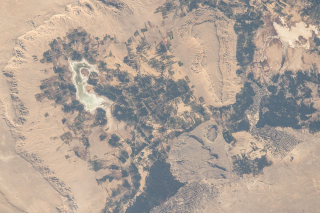
Scanning the monotonous tan-colored surface of the Sahara Desert, an astronaut aboard the International Space Station saw small dark patches next to a long, ragged cliff in Egypt's Western Desert. The dark patches are date and olive groves in the Bahariya Oasis (population 27,000), one of several small places in Egypt's deserts beyond the Nile Valley where people can live. The steep cliffs surround a depression in the desert surface, at the bottom of which lies a small lake (at image upper left). The depression is punctuated by a flat-topped hill (mesa) surrounded by lower cliffs. The town of Bawiti where most people live (at image lower center margin) is harder to detect. Bahariya is one of several large depressions west of the River Nile in what is known as the Western Desert that are deep enough to reach underground water.
The oasis has a rich history, going back at least to Egypt's Middle Kingdom (2000-1800 BCE, from which time agricultural products have been exported to the Nile Valley. Alexander the Great may have passed through this oasis even though it is so remote (380 km southwest of Cairo). The Valley of the Golden Mummies in Bahariya may hold up to 10,000 undisturbed mummies of Roman and Greek aristocrats, dating from 332 B.C. to 395 A.D. Roman aqueducts are still used to lead water to the fields. Now, modern life has arrived with a good road established between the oasis and Cairo resulting in significant tourist traffic as people come to see remnants of the ancient life of a desert oasis. A nearby iron mine supports many people from Bahariya.
In this wider astronaut view [ISS016-E-10073], the groves of the oasis appear as small dark patches at image center, against the wider, vegetationless desert surfaces. In a panoramic view of the Nile delta and Mediterranean Sea [ISS028-E-12612], the specks of the Bahariya date and olive groves (at image lower left corner) almost disappear in the Western Desert, far to the southwest of the delta.
