ISS043-E-156572

| NASA Photo ID | ISS043-E-156572 |
| Focal Length | 140mm |
| Date taken | 2015.04.29 |
| Time taken | 16:58:33 GMT |
1000 x 666 pixels 540 x 360 pixels 720 x 480 pixels 4928 x 3280 pixels 640 x 426 pixels
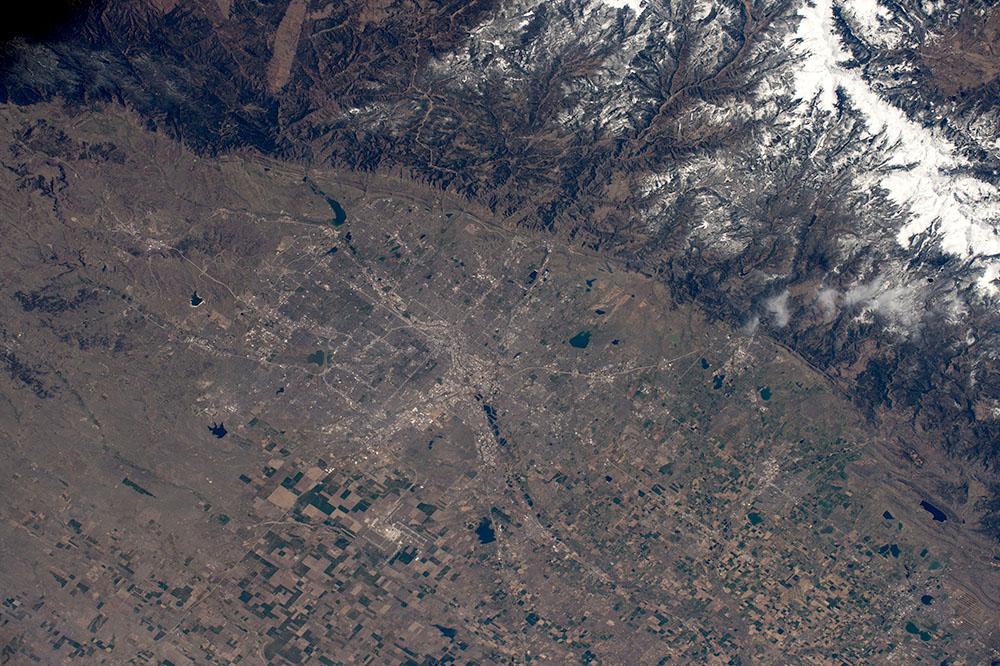
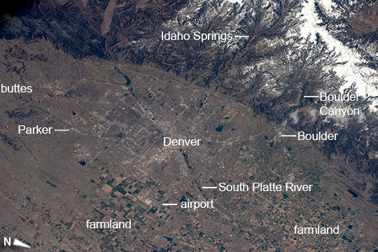
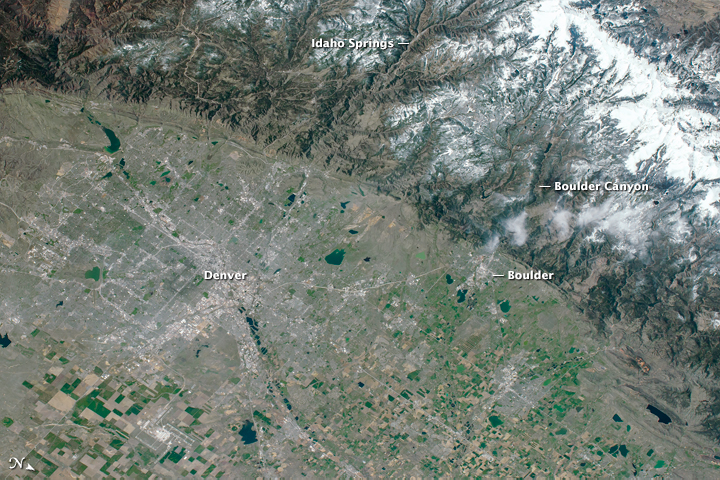
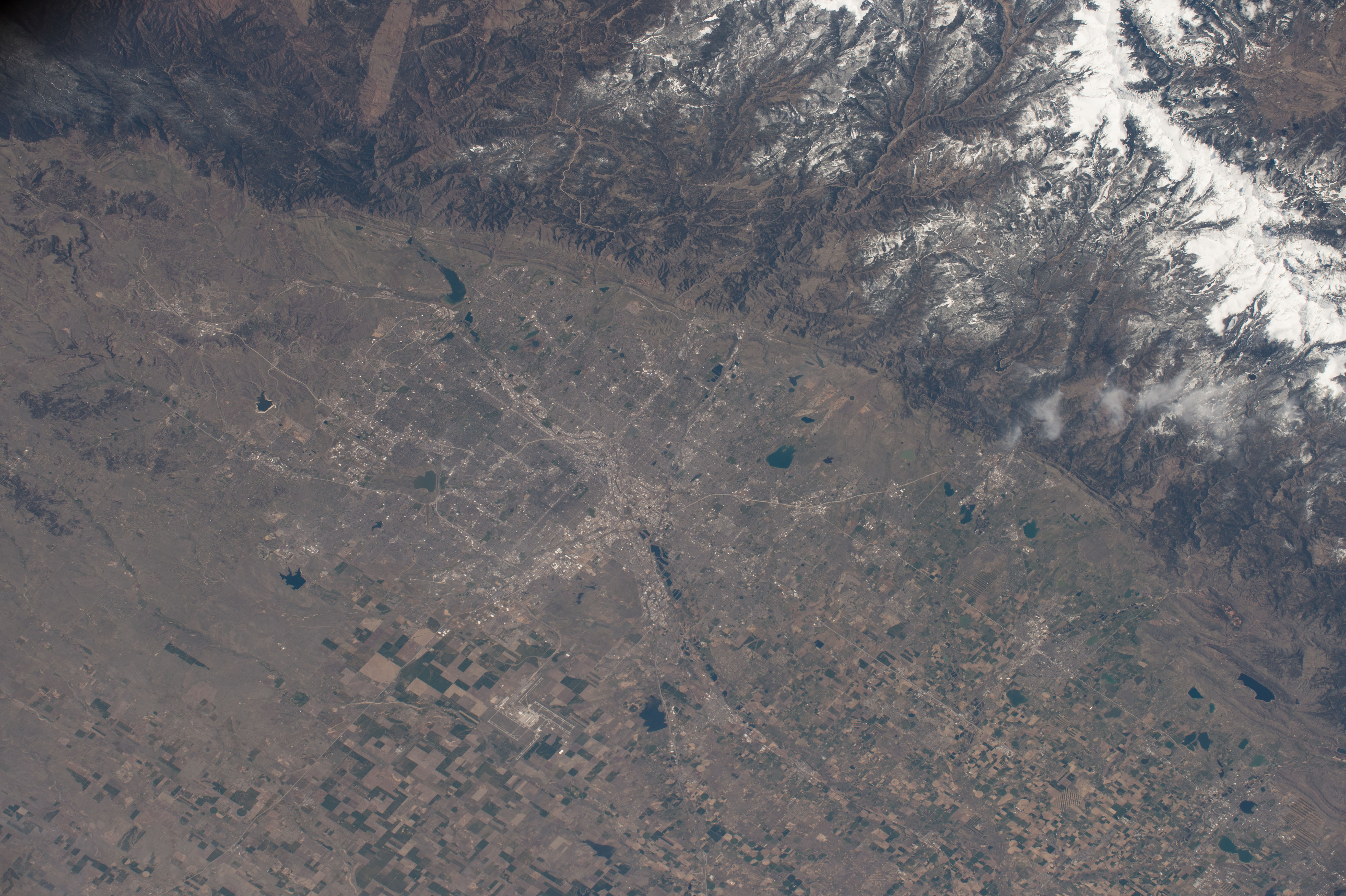


Photo center point: 39.8° N, 105.1° W
Photo center point by machine learning:
Country or Geographic Name: | USA-COLORADO |
Features: | DENVER, BOULDER, FRONT RANGE, S. PLATTE R. |
| Features Found Using Machine Learning: | |
Cloud Cover Percentage: | 10 (1-10)% |
Sun Elevation Angle: | 53° |
Sun Azimuth: | 122° |
Camera: | Nikon D4 Electronic Still Camera |
Focal Length: | 140mm |
Camera Tilt: | 34 degrees |
Format: | 4928E: 4928 x 3280 pixel CMOS sensor, 36.0mm x 23.9mm, total pixels: 16.6 million, Nikon FX format |
Film Exposure: | |
| Additional Information | |
| Width | Height | Annotated | Cropped | Purpose | Links |
|---|---|---|---|---|---|
| 1000 pixels | 666 pixels | No | No | Earth From Space collection | Download Image |
| 540 pixels | 360 pixels | Yes | No | Earth From Space collection | Download Image |
| 720 pixels | 480 pixels | No | Yes | NASA's Earth Observatory web site | Download Image |
| 4928 pixels | 3280 pixels | No | No | Download Image | |
| 640 pixels | 426 pixels | No | No | Download Image |
Georeferenced by human interaction - exported 2016-08-24-003623-UTC
Georeferenced by human interaction - exported 2018-01-16-153356-UTC
An explanation of the georeference file(s) above
Astronauts on board the International Space Station recognized the smooth, broad bend that separates mountains and plains as the Front Range of the Rocky Mountains. This sudden break between plains and mountains makes Denver one of the most spectacular cities in the US. Here canyons cut through the snow-covered mountains to the plains. Boulder Canyon has provided water to the city of Boulder, and tourists exploring the Rocky Mountains pass through Idaho Springs in the Clear Creek valley (image top and top right). The ten urban counties centered on Denver have an estimated population of 2.7 million.
The plains fronting the mountains are now heavily populated in a series of cities centered on Denver. The rectangular plat of highways and main roads of this extensive cityscape has a blocky appearance --a pattern that has spread southward more than 25 miles (40 km) to the wooded hills south of the town of Parker (image left). Rich farmland competes with city landuse areas north of Denver in the fertile Platte River valley and surrounding plains (image lower right). This intensively farmed area appears from space as a pattern of numerous smaller plots. Less intensive landuse areas such as spring and winter wheat are marked by much larger plots of land, as seen around Denver's international airport (image lower left).
