ISS043-E-101645

| NASA Photo ID | ISS043-E-101645 |
| Focal Length | 1150mm |
| Date taken | 2015.04.11 |
| Time taken | 11:06:37 GMT |
Resolutions offered for this image:
1000 x 666 pixels 540 x 360 pixels 2464 x 1640 pixels 720 x 480 pixels 4928 x 3280 pixels 640 x 426 pixels
1000 x 666 pixels 540 x 360 pixels 2464 x 1640 pixels 720 x 480 pixels 4928 x 3280 pixels 640 x 426 pixels


Spacecraft nadir point: 23.6° N, 71.5° E
Photo center point: 23.9° N, 69.6° E
Photo center point by machine learning:
Photo center point: 23.9° N, 69.6° E
Photo center point by machine learning:
Nadir to Photo Center: West
Spacecraft Altitude: 217 nautical miles (402km)
Country or Geographic Name: | INDIA |
Features: | RANN OF KUTCH, CANALS, AGRICULTURE |
| Features Found Using Machine Learning: | |
Cloud Cover Percentage: | 10 (1-10)% |
Sun Elevation Angle: | 33° |
Sun Azimuth: | 265° |
Camera: | Nikon D4 Electronic Still Camera |
Focal Length: | 1150mm |
Camera Tilt: | 28 degrees |
Format: | 4928E: 4928 x 3280 pixel CMOS sensor, 36.0mm x 23.9mm, total pixels: 16.6 million, Nikon FX format |
Film Exposure: | |
| Additional Information | |
| Width | Height | Annotated | Cropped | Purpose | Links |
|---|---|---|---|---|---|
| 1000 pixels | 666 pixels | No | No | Earth From Space collection | Download Image |
| 540 pixels | 360 pixels | Yes | No | Earth From Space collection | Download Image |
| 2464 pixels | 1640 pixels | No | No | NASA's Earth Observatory web site | Download Image |
| 720 pixels | 480 pixels | Yes | No | NASA's Earth Observatory web site | Download Image |
| 4928 pixels | 3280 pixels | No | No | Download Image | |
| 640 pixels | 426 pixels | No | No | Download Image |
Download Packaged File
Download a Google Earth KML for this Image
View photo footprint information
Download a GeoTIFF for this photo
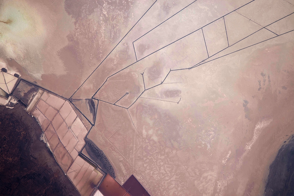
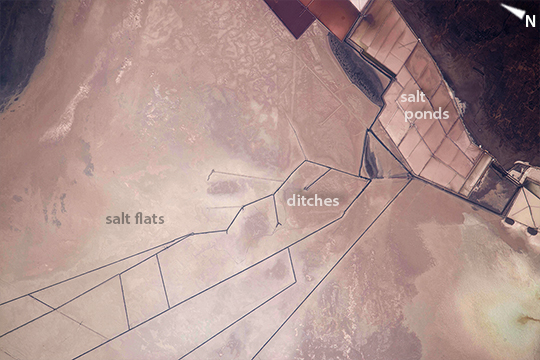
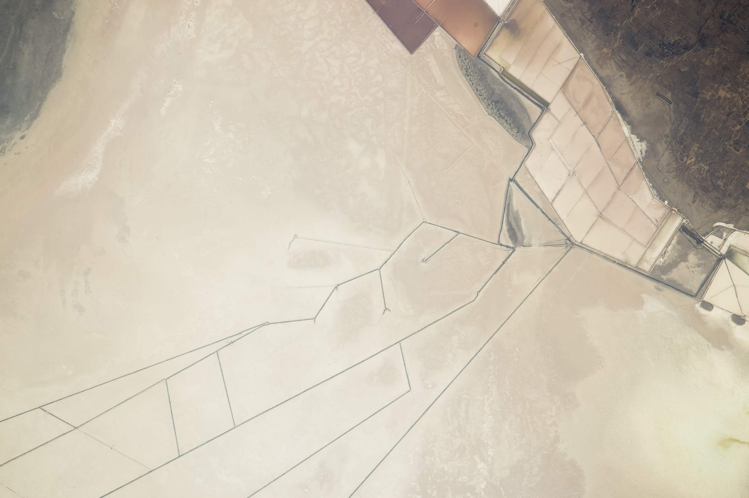
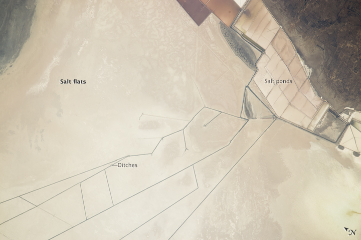
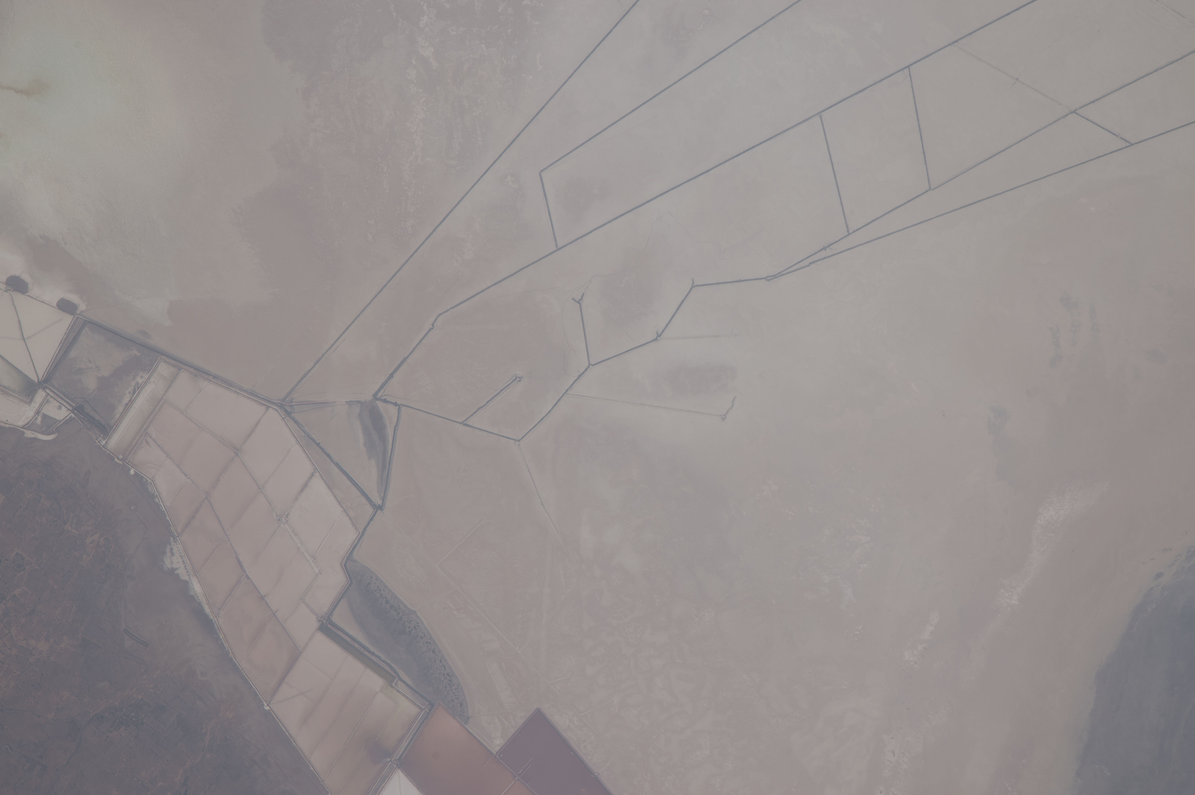
Image Caption: Salt ponds, Rann of Kutch, India
The Rann of Kutch is a long, narrow salt flat that stretches from the Arabian Sea coast 325 km (200 mi) inland in an almost straight line (rann comes from a Hindi word meaning desert). Situated in westernmost India along the Pakistani border, the Rann is famous for its marshy salt flats which become snow white (image lower left) after the shallow monsoon flood water dries up. Angular evaporating ponds along the floor of the Rann (image top right) are the heart of a major salt-producing industry. The straight lines across much of the image are ditches dug to help control the flow of salt-rich water. Scale is difficult to judge in this landscape of abstract shapes--here the image width represents 16 km (10 mi), illustrating the great extent of the drainage ditches. The light green tint lower right is very shallow water from a small river draining dark-toned farmland (image top right).
This inhospitable but resource-rich lowland--it also contains natural gas deposits--has been at the center of a border dispute between India and Pakistan.
Thousands of years ago the Rann was a shallow arm of the Arabian Sea. Land uplift caused by tectonic forces then closed off the connection with the sea, creating a vast lake that was still navigable during the time of Alexander the Great.
