ISS042-E-1170
| NASA Photo ID | ISS042-E-1170 |
| Focal Length | 100mm |
| Date taken | 2014.11.09 |
| Time taken | 11:00:25 GMT |
Resolutions offered for this image:
1000 x 666 pixels 540 x 360 pixels 4928 x 3280 pixels 720 x 480 pixels 4928 x 3280 pixels 640 x 426 pixels
1000 x 666 pixels 540 x 360 pixels 4928 x 3280 pixels 720 x 480 pixels 4928 x 3280 pixels 640 x 426 pixels


Spacecraft nadir point: 21.0° N, 48.2° E
Photo center point: 24.0° N, 46.7° E
Photo center point by machine learning:
Photo center point: 24.0° N, 46.7° E
Photo center point by machine learning:
Nadir to Photo Center: North
Spacecraft Altitude: 223 nautical miles (413km)
Camera: | Nikon D4 Electronic Still Camera |
Focal Length: | 100mm |
Camera Tilt: | 42 degrees |
Format: | 4928E: 4928 x 3280 pixel CMOS sensor, 36.0mm x 23.9mm, total pixels: 16.6 million, Nikon FX format |
Film Exposure: | |
| Additional Information | |
| Width | Height | Annotated | Cropped | Purpose | Links |
|---|---|---|---|---|---|
| 1000 pixels | 666 pixels | No | No | Earth From Space collection | Download Image |
| 540 pixels | 360 pixels | Yes | No | Earth From Space collection | Download Image |
| 4928 pixels | 3280 pixels | No | No | NASA's Earth Observatory web site | Download Image |
| 720 pixels | 480 pixels | Yes | No | NASA's Earth Observatory web site | Download Image |
| 4928 pixels | 3280 pixels | No | No | Download Image | |
| 640 pixels | 426 pixels | No | No | Download Image |
Download Packaged File
Download a Google Earth KML for this Image
View photo footprint information
Download a GeoTIFF for this photo
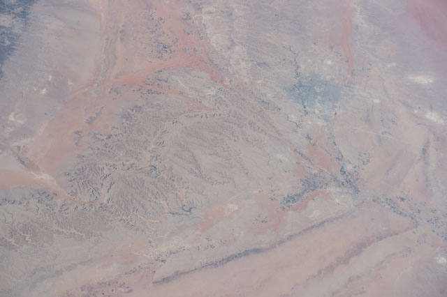
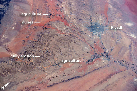
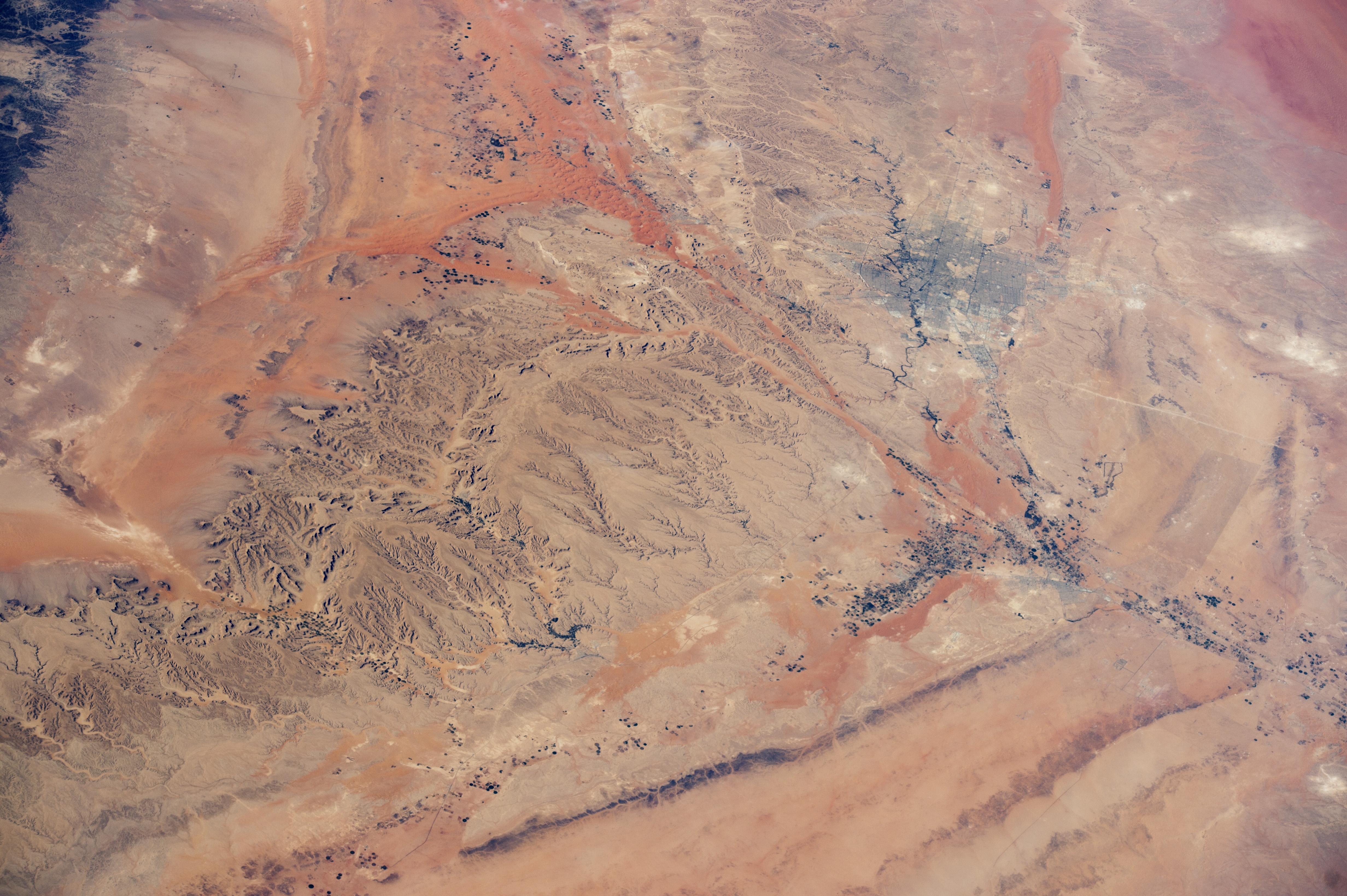
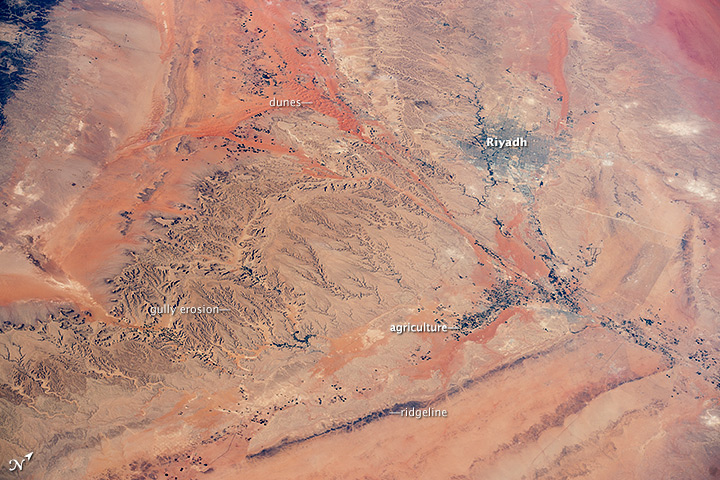
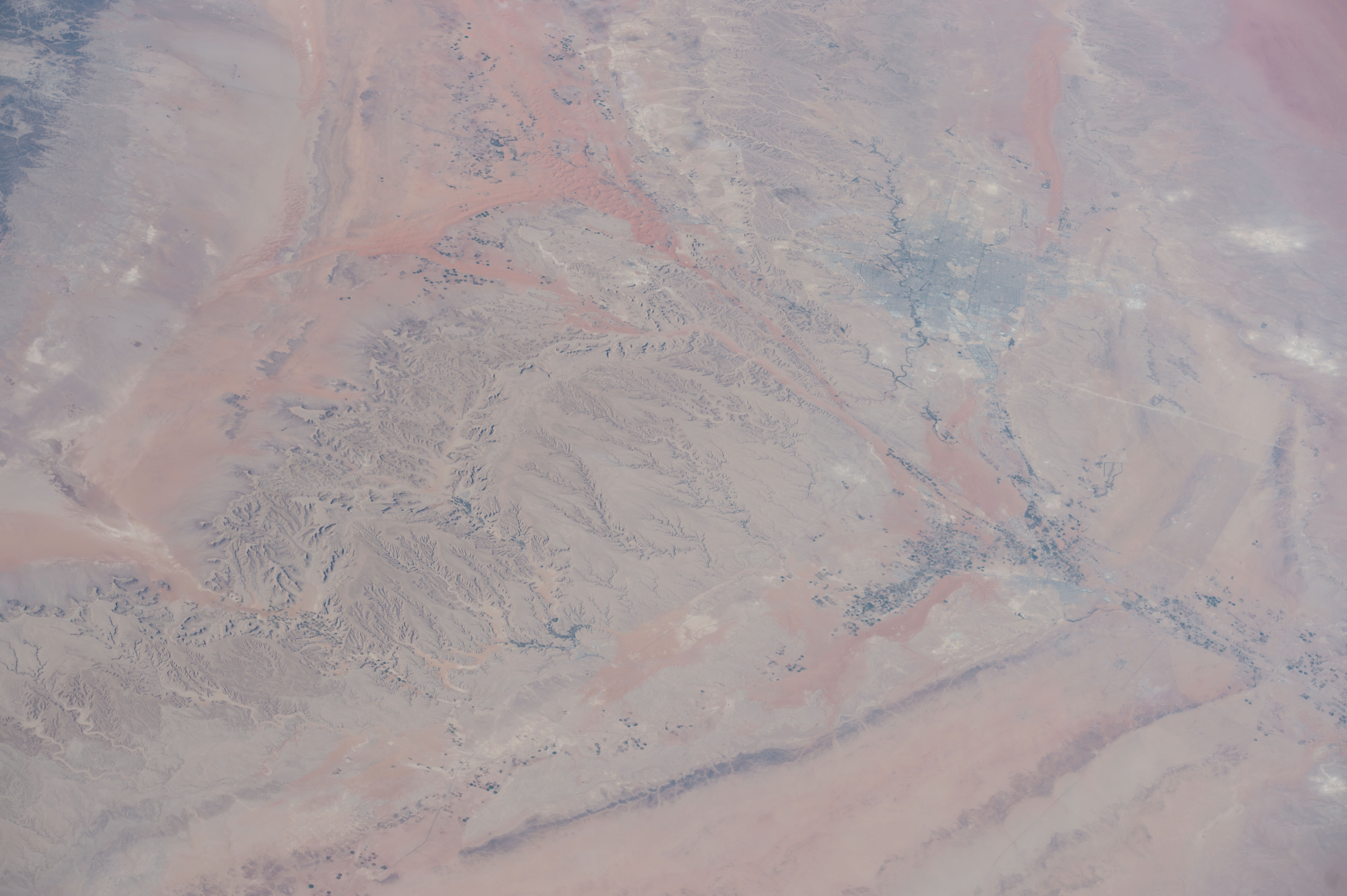
Image Caption: Central Saudi Arabia: Riyadh and dunes
Astronauts aboard the International Space Station took this photograph when the desert center of Arabia was partly obscured by a dusty atmosphere. With slight image enhancement, a wealth of detail appears--most strikingly, the swaths of red dunes, the straight lines of rock ridges, and the city of Riyadh (capital of Saudi Arabia).
Riyadh means "The Gardens," which aptly explains why the greens of this urban region of 5.7 million people contrast with the dun (gray-brown) desert landscape. The dark stipple of crops is concentrated near ancient water courses, where underground water is more readily available for irrigation. The upper left of the image is dominated by the tracery of gully-eroded hillsides.
