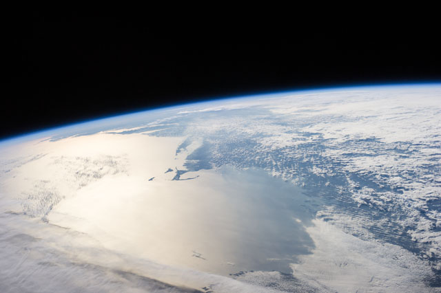
ISS041-E-78383
| NASA Photo ID | ISS041-E-78383 |
| Focal Length | 52mm |
| Date taken | 2014.10.17 |
| Time taken | 19:47:48 GMT |

Spacecraft nadir point: 46.0° N, 57.0° W
Photo center point: 42.5° N, 69.5° W
Photo center point by machine learning:
Photo center point: 42.5° N, 69.5° W
Photo center point by machine learning:
Nadir to Photo Center: West
Spacecraft Altitude: 222 nautical miles (411km)
Country or Geographic Name: | USA-MASSACHUSETTS |
Features: | CAPE COD B., NANTUCKEY I., MARTHAS VINEYARD, ATLANTIC O., LONG I., ATMOSPHERIC LIMB |
| Features Found Using Machine Learning: | PAN- |
Cloud Cover Percentage: | 100 (76-100)% |
Sun Elevation Angle: | 11° |
Sun Azimuth: | 244° |
Camera: | Nikon D3S Electronic Still Camera |
Focal Length: | 52mm |
Camera Tilt: | High Oblique |
Format: | 4256E: 4256 x 2832 pixel CMOS sensor, 36.0mm x 23.9mm, total pixels: 12.87 million, Nikon FX format |
Film Exposure: | |
| Additional Information | |
| Width | Height | Annotated | Cropped | Purpose | Links |
|---|---|---|---|---|---|
| 4256 pixels | 2832 pixels | No | No | Download Image | |
| 640 pixels | 426 pixels | No | No | Download Image |
Download Packaged File
Download a Google Earth KML for this Image
View photo footprint information
Download a GeoTIFF for this photo
Image Caption: CATALOGED BY TEXAS STATE UNIVERSITY
