ISS041-E-100484
| NASA Photo ID | ISS041-E-100484 |
| Focal Length | 800mm |
| Date taken | 2014.10.25 |
| Time taken | 16:21:36 GMT |
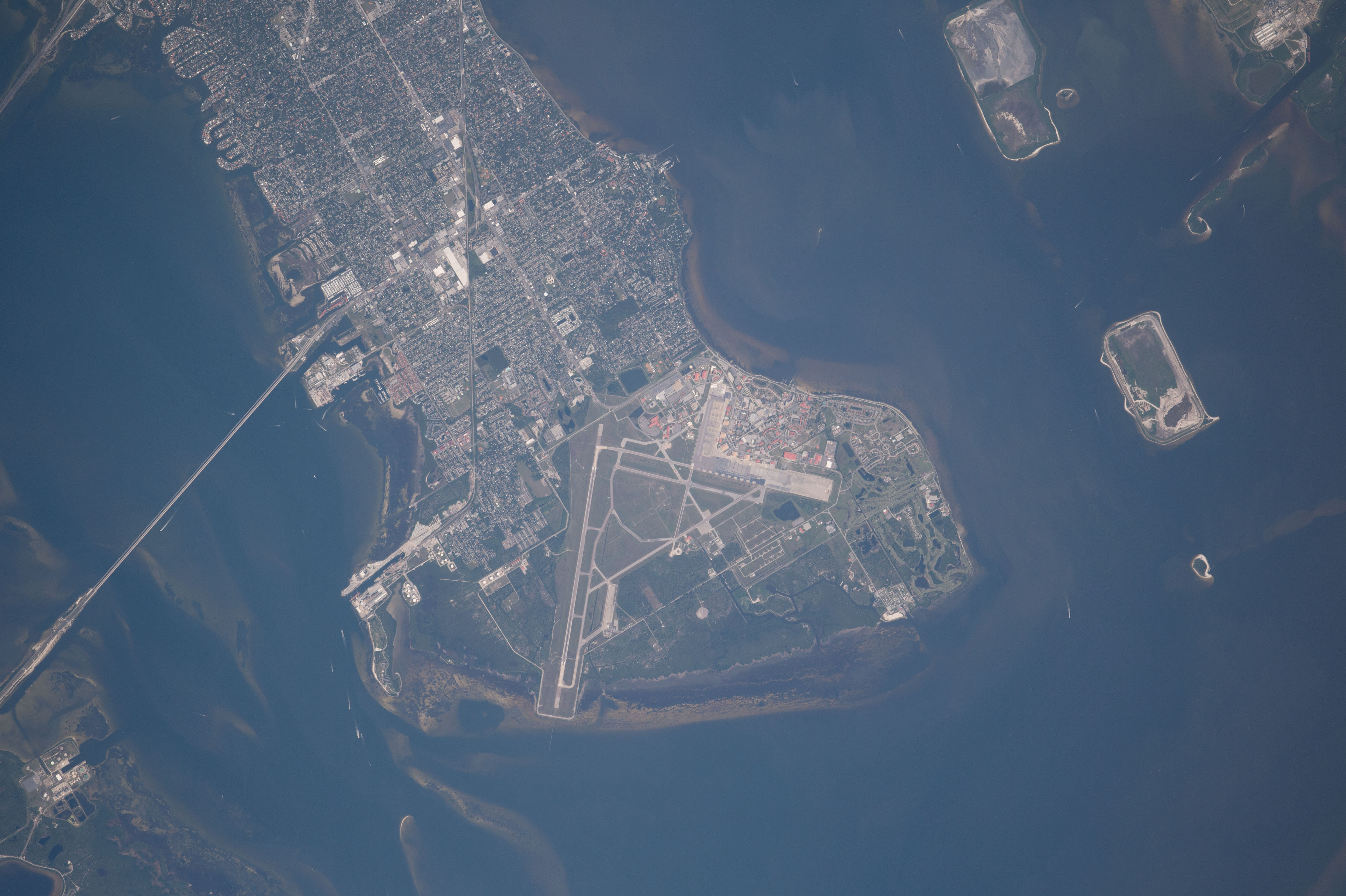


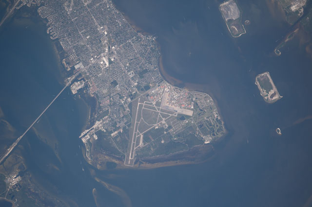
Spacecraft nadir point: 27.4° N, 82.5° W
Photo center point: 27.9° N, 82.5° W
Photo center point by machine learning:
Photo center point: 27.9° N, 82.5° W
Photo center point by machine learning:
Nadir to Photo Center: North
Spacecraft Altitude: 222 nautical miles (411km)
Country or Geographic Name: | USA-FLORIDA |
Features: | PUBLIC INPUTS (from public image detectives, not NASA): FLORIDA, MACDILL AFB, HILLSBOROUGH BAY, BALLAST POINT, ROUTE 92, PORT TAMPA POINT, SUNKEN ISLAND, BIRD ISLAND, PINE KEY,OLD TAMPA BAY, TAMPA BAY, HILSBOROUGH BAY, SOUTH TAMPA, BALLAST POINT,USA, FLORIDA, TAMPA BAY, MACDILL AIR FORCE BASE |
| Features Found Using Machine Learning: | TAMPA |
Cloud Cover Percentage: | 10 (1-10)% |
Sun Elevation Angle: | 48° |
Sun Azimuth: | 160° |
Camera: | Nikon D4 Electronic Still Camera |
Focal Length: | 800mm |
Camera Tilt: | 7 degrees |
Format: | 4928E: 4928 x 3280 pixel CMOS sensor, 36.0mm x 23.9mm, total pixels: 16.6 million, Nikon FX format |
Film Exposure: | |
| Additional Information | |
| Width | Height | Annotated | Cropped | Purpose | Links |
|---|---|---|---|---|---|
| 4928 pixels | 3280 pixels | No | No | Download Image | |
| 640 pixels | 426 pixels | No | No | Download Image |
Download Packaged File
Download a Google Earth KML for this Image
View photo footprint information
Download a GeoTIFF for this photo
Image Caption: none
