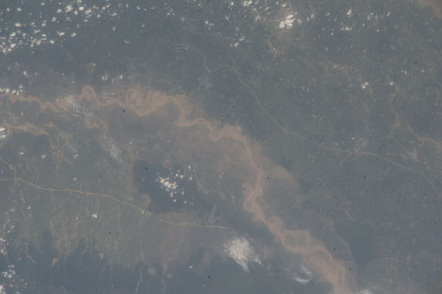
ISS040-E-105502
| NASA Photo ID | ISS040-E-105502 |
| Focal Length | 200mm |
| Date taken | 2014.08.22 |
| Time taken | 07:01:03 GMT |
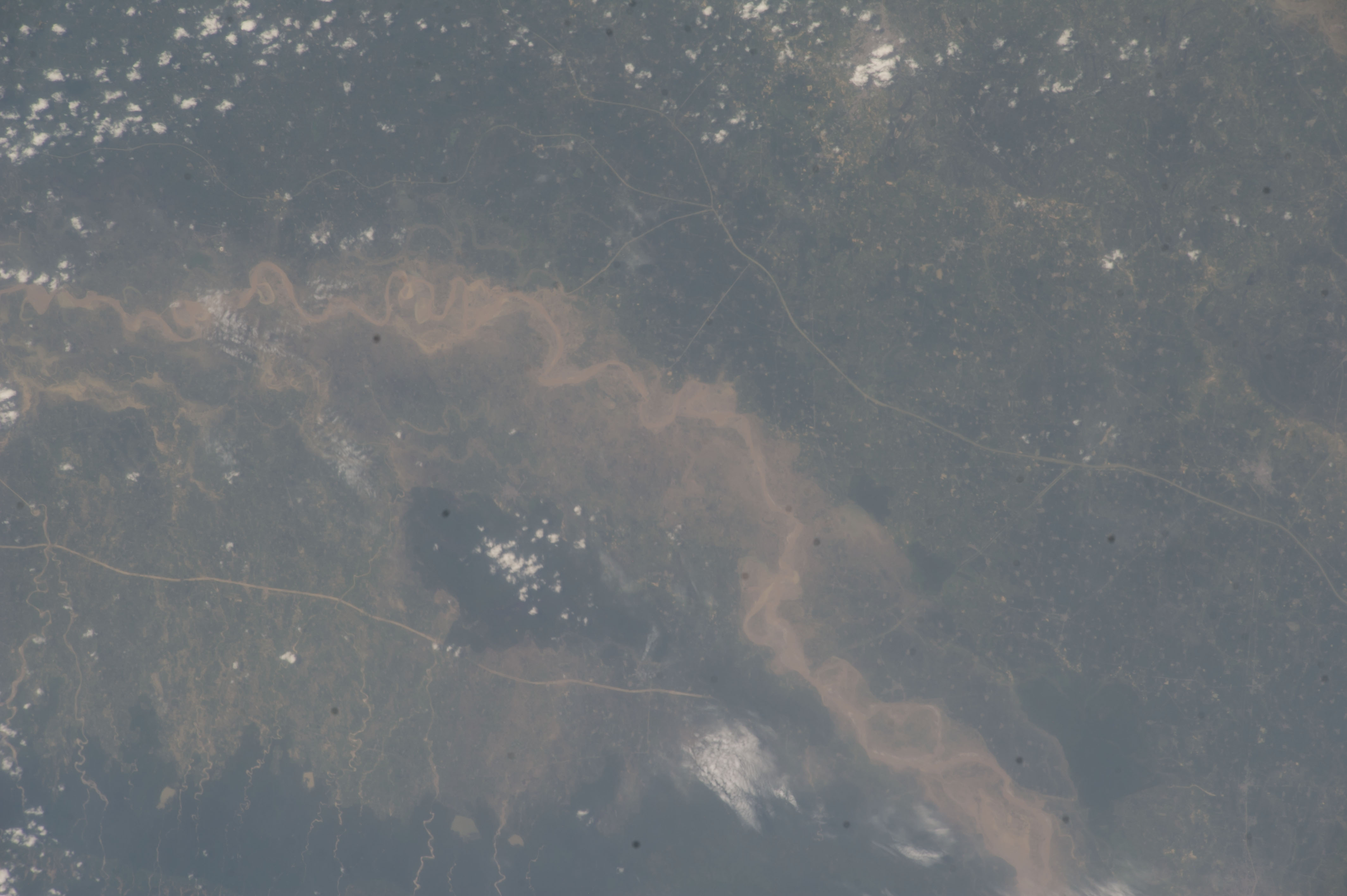

Spacecraft nadir point: 28.1° N, 81.0° E
Photo center point: 27.7° N, 81.8° E
Photo center point by machine learning:
Photo center point: 27.7° N, 81.8° E
Photo center point by machine learning:
Nadir to Photo Center: Southeast
Spacecraft Altitude: 221 nautical miles (409km)
Country or Geographic Name: | INDIA |
Features: | RAPTI RIVER, SEDIMENT, FLOODING, ROADS, FOR., BAHRAICH-BHINGA AREA, HAZE |
| Features Found Using Machine Learning: | |
Cloud Cover Percentage: | 10 (1-10)% |
Sun Elevation Angle: | 73° |
Sun Azimuth: | 199° |
Camera: | Nikon D3S Electronic Still Camera |
Focal Length: | 200mm |
Camera Tilt: | 14 degrees |
Format: | 4256E: 4256 x 2832 pixel CMOS sensor, 36.0mm x 23.9mm, total pixels: 12.87 million, Nikon FX format |
Film Exposure: | |
| Additional Information | |
| Width | Height | Annotated | Cropped | Purpose | Links |
|---|---|---|---|---|---|
| 4256 pixels | 2832 pixels | No | No | Download Image | |
| 640 pixels | 426 pixels | No | No | Download Image |
Download Packaged File
Download a Google Earth KML for this Image
View photo footprint information
Download a GeoTIFF for this photo
Image Caption: none
