ISS038-E-15047

| NASA Photo ID | ISS038-E-15047 |
| Focal Length | 1000mm |
| Date taken | 2013.12.06 |
| Time taken | 19:14:45 GMT |
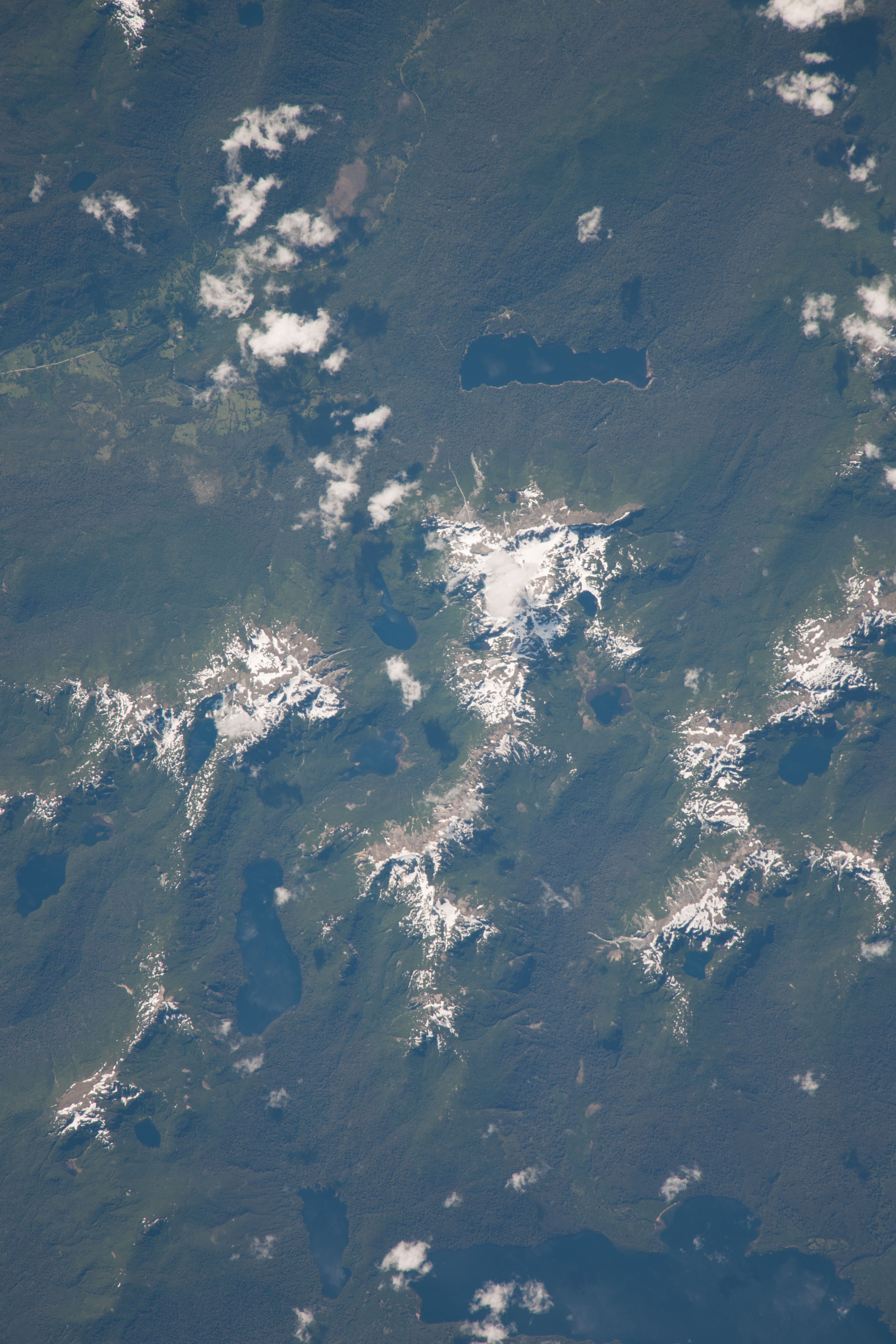
Spacecraft nadir point: 39.4° S, 71.5° W
Photo center point: 39.7° S, 71.5° W
Photo center point by machine learning:
Photo center point: 39.7° S, 71.5° W
Photo center point by machine learning:
Nadir to Photo Center: South
Spacecraft Altitude: 226 nautical miles (419km)
Country or Geographic Name: | ARGENTINA |
Features: | PAIMUN L., SNOW, LIFFI LAFQUEN L. |
| Features Found Using Machine Learning: | |
Cloud Cover Percentage: | 10 (1-10)% |
Sun Elevation Angle: | 53° |
Sun Azimuth: | 285° |
Camera: | Nikon D3X Electronic Still Camera |
Focal Length: | 1000mm |
Camera Tilt: | 05 degrees |
Format: | 6048E: 6048 x 4032 pixel CMOS sensor, 35.9mm x 24.0mm, total pixels: 25.72 million, Nikon FX format |
Film Exposure: | |
| Additional Information | |
| Width | Height | Annotated | Cropped | Purpose | Links |
|---|---|---|---|---|---|
| 4032 pixels | 6048 pixels | No | No | Download Image | |
| 427 pixels | 640 pixels | No | No | Download Image |
Download Packaged File
Download a Google Earth KML for this Image
View photo footprint information
Download a GeoTIFF for this photo
Image Caption: none
