ISS038-E-14999

| NASA Photo ID | ISS038-E-14999 |
| Focal Length | 1000mm |
| Date taken | 2013.12.05 |
| Time taken | 21:14:21 GMT |
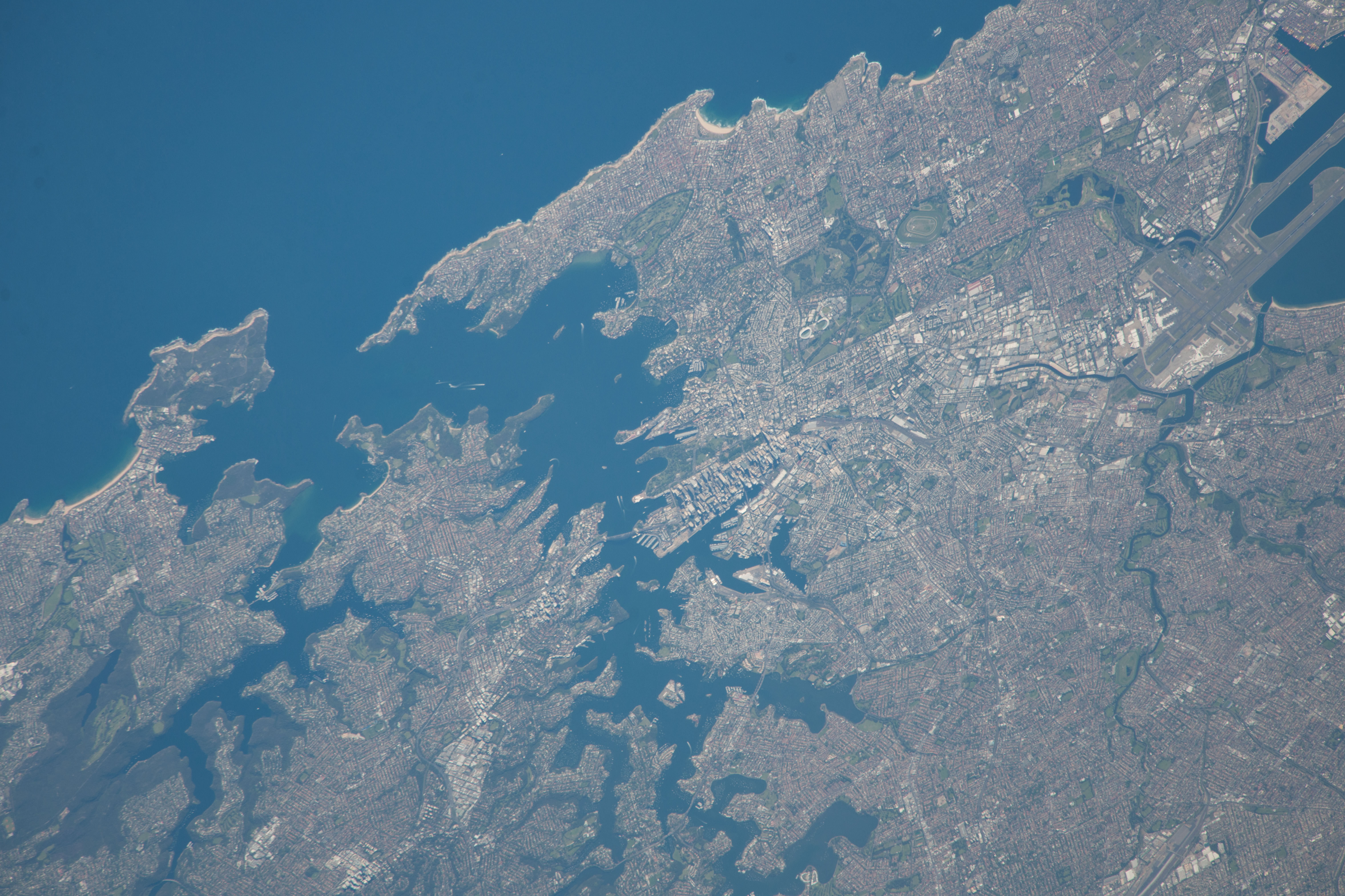
Spacecraft nadir point: 33.1° S, 155.1° E
Photo center point: 33.9° S, 151.2° E
Photo center point by machine learning:
Photo center point: 33.9° S, 151.2° E
Photo center point by machine learning:
Nadir to Photo Center: West
Spacecraft Altitude: 226 nautical miles (419km)
Country or Geographic Name: | AUSTRALIA-NSW |
Features: | SYDNEY, NEW S. WALES, PO. JACKSON, TASMAN S. |
| Features Found Using Machine Learning: | |
Cloud Cover Percentage: | 10 (1-10)% |
Sun Elevation Angle: | 33° |
Sun Azimuth: | 97° |
Camera: | Nikon D3X Electronic Still Camera |
Focal Length: | 1000mm |
Camera Tilt: | 47 degrees |
Format: | 6048E: 6048 x 4032 pixel CMOS sensor, 35.9mm x 24.0mm, total pixels: 25.72 million, Nikon FX format |
Film Exposure: | |
| Additional Information | |
| Width | Height | Annotated | Cropped | Purpose | Links |
|---|---|---|---|---|---|
| 6048 pixels | 4032 pixels | No | No | Download Image | |
| 640 pixels | 427 pixels | No | No | Download Image |
Download Packaged File
Download a Google Earth KML for this Image
View photo footprint information
Download a GeoTIFF for this photo
Georeferenced by human interaction - exported 2016-08-16-232927-UTCGeoreferenced by human interaction - exported 2016-08-24-001833-UTC
Georeferenced by human interaction - exported 2018-01-16-151033-UTC
An explanation of the georeference file(s) above
Image Caption: none
