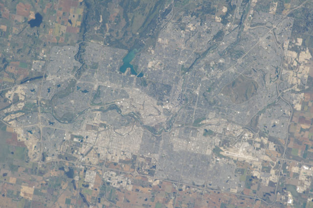
ISS037-E-658
| NASA Photo ID | ISS037-E-658 |
| Focal Length | 400mm |
| Date taken | 2013.09.12 |
| Time taken | 17:31:00 GMT |
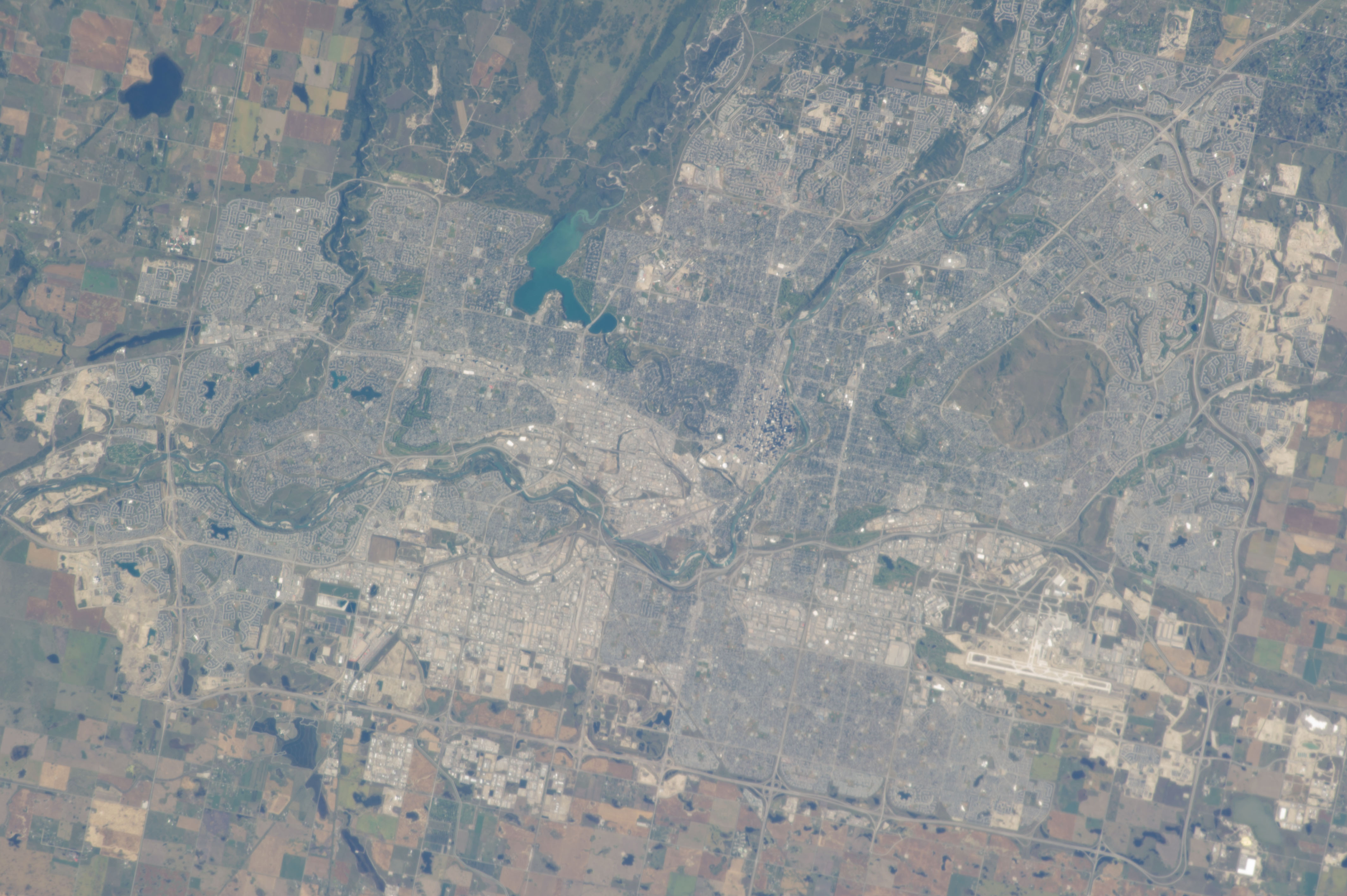


Spacecraft nadir point: 50.4° N, 112.3° W
Photo center point: 51.0° N, 114.1° W
Photo center point by machine learning:
Photo center point: 51.0° N, 114.1° W
Photo center point by machine learning:
Nadir to Photo Center: West
Spacecraft Altitude: 220 nautical miles (407km)
Country or Geographic Name: | CANADA-A |
Features: | CALGARY, BOW RIVER, NOSE HILL PARK, GLENMORE RES., URBAN AREAS, AGR, ROADS |
| Features Found Using Machine Learning: | |
Cloud Cover Percentage: | 10 (1-10)% |
Sun Elevation Angle: | 38° |
Sun Azimuth: | 143° |
Camera: | Nikon D3S Electronic Still Camera |
Focal Length: | 400mm |
Camera Tilt: | 27 degrees |
Format: | 4256E: 4256 x 2832 pixel CMOS sensor, 36.0mm x 23.9mm, total pixels: 12.87 million, Nikon FX format |
Film Exposure: | |
| Additional Information | |
| Width | Height | Annotated | Cropped | Purpose | Links |
|---|---|---|---|---|---|
| 4256 pixels | 2832 pixels | No | No | Download Image | |
| 640 pixels | 426 pixels | No | No | Download Image |
Download Packaged File
Download a Google Earth KML for this Image
View photo footprint information
Download a GeoTIFF for this photo
Image Caption: none
