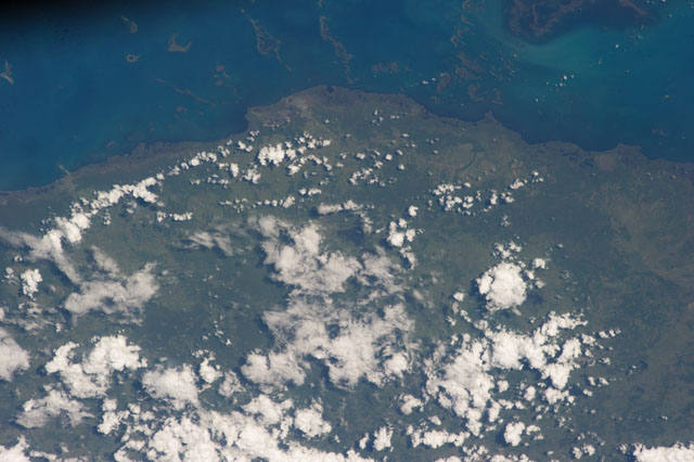
ISS037-E-15194
| NASA Photo ID | ISS037-E-15194 |
| Focal Length | 180mm |
| Date taken | 2013.10.16 |
| Time taken | 19:42:18 GMT |


Spacecraft nadir point: 19.1° N, 79.7° W
Photo center point: 20.9° N, 77.9° W
Photo center point by machine learning:
Photo center point: 20.9° N, 77.9° W
Photo center point by machine learning:
Nadir to Photo Center: Northeast
Spacecraft Altitude: 223 nautical miles (413km)
Country or Geographic Name: | CUBA |
Features: | G. OF GUAYCANAYABOS, CAYS, COASTAL WETLANDS, AGR., TOWNS, RES. |
| Features Found Using Machine Learning: | |
Cloud Cover Percentage: | 50 (26-50)% |
Sun Elevation Angle: | 42° |
Sun Azimuth: | 238° |
Camera: | Nikon D3S Electronic Still Camera |
Focal Length: | 180mm |
Camera Tilt: | 34 degrees |
Format: | 4256E: 4256 x 2832 pixel CMOS sensor, 36.0mm x 23.9mm, total pixels: 12.87 million, Nikon FX format |
Film Exposure: | |
| Additional Information | |
| Width | Height | Annotated | Cropped | Purpose | Links |
|---|---|---|---|---|---|
| 4256 pixels | 2832 pixels | No | No | Download Image | |
| 640 pixels | 426 pixels | No | No | Download Image |
Download Packaged File
Download a Google Earth KML for this Image
View photo footprint information
Download a GeoTIFF for this photo
Image Caption: none
