ISS036-E-2106
| NASA Photo ID | ISS036-E-2106 |
| Focal Length | 800mm |
| Date taken | 2013.05.18 |
| Time taken | 16:04:17 GMT |


Spacecraft nadir point: 49.5° N, 155.9° W
Photo center point: 55.4° N, 161.9° W
Photo center point by machine learning:
Photo center point: 55.4° N, 161.9° W
Photo center point by machine learning:
Nadir to Photo Center: Northwest
Spacecraft Altitude: 222 nautical miles (411km)
Country or Geographic Name: | USA-ALASKA |
Features: | PUBLIC INPUTS (from public image detectives, not NASA): PAVLOF VOL., ALASKA PEN.,VOLCANIC ASH AND SMOKE, PAVLOF VOL., ALEUTIAN RANGE, ALASKA PEN., PAVLOF SISTER MT., PAVLOF B.,USA, ALASKA, ALEUTIAN ISLANDS, UNIMAK ISLAND, MOUNT SHISHALDIN, ISANOTSKI VOLCANO FUMING,PAVLOF VOLCANO, ALASKA,PAVLOF VOLCANO |
| Features Found Using Machine Learning: | |
Cloud Cover Percentage: | 75 (51-75)% |
Sun Elevation Angle: | 12° |
Sun Azimuth: | 74° |
Camera: | Nikon D3S Electronic Still Camera |
Focal Length: | 800mm |
Camera Tilt: | High Oblique |
Format: | 4256E: 4256 x 2832 pixel CMOS sensor, 36.0mm x 23.9mm, total pixels: 12.87 million, Nikon FX format |
Film Exposure: | |
| Additional Information | |
| Width | Height | Annotated | Cropped | Purpose | Links |
|---|---|---|---|---|---|
| 4256 pixels | 2832 pixels | No | No | Download Image | |
| 640 pixels | 426 pixels | No | No | Download Image |
Download Packaged File
Download a Google Earth KML for this Image
View photo footprint information
Download a GeoTIFF for this photo
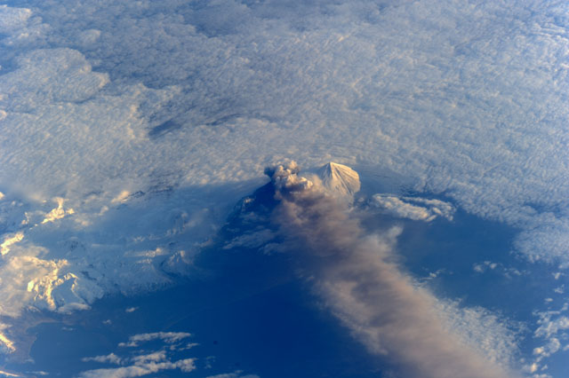
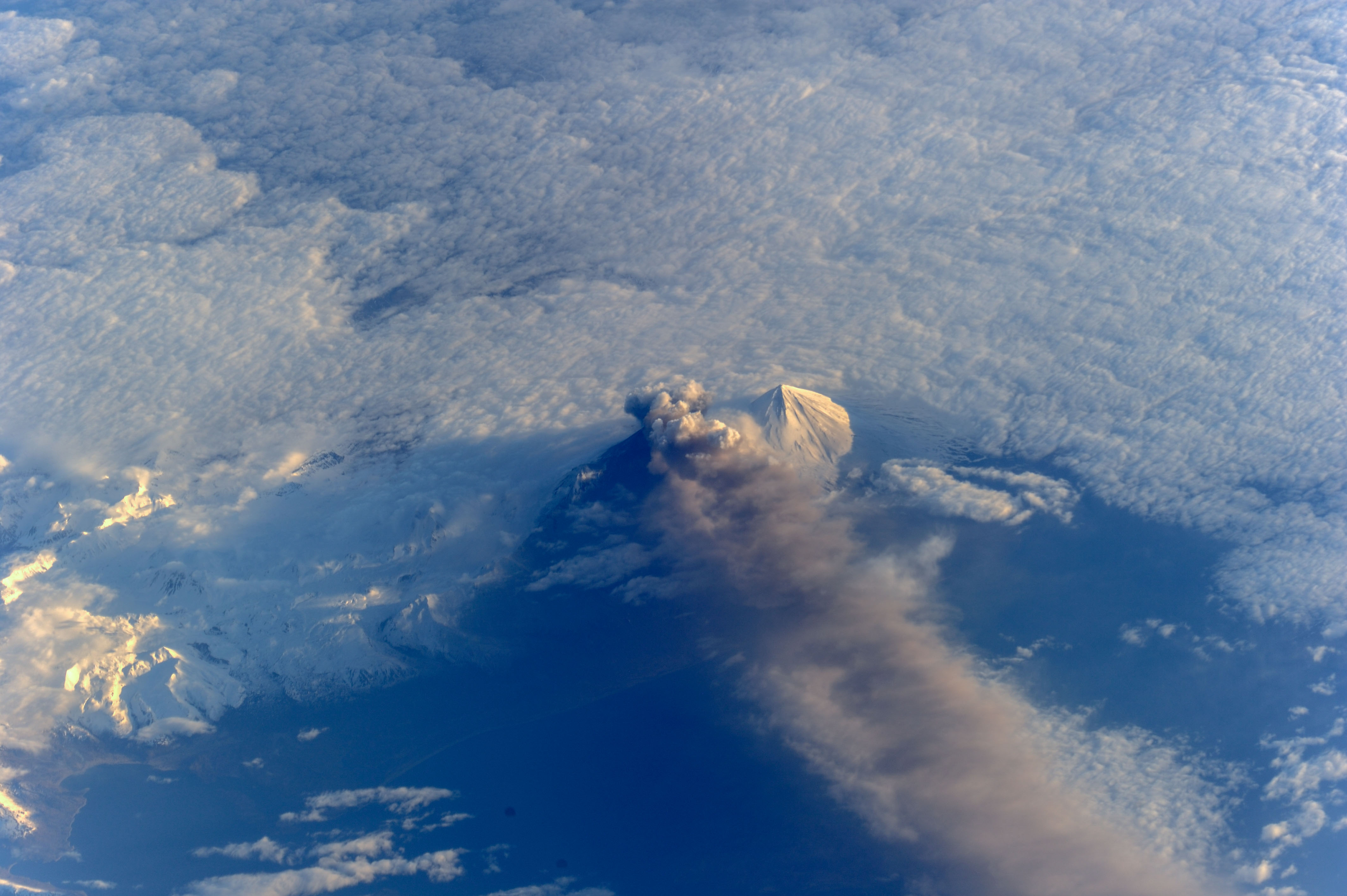
Image Caption: ISS036E002106 (18 May 2013) --- Pavlof Volcano was captured in the fourth day of its eruption by one of the Expedition 36 crew members on the International Space Station. Pavlof volcano, in the Aleutian Islands about 625 miles (1,000 kilometers) southwest of Anchorage, jetted lava into the air and spewed an ash cloud 20,000 feet (6,000 meters) high. The space station was above a point in the North Pacific Ocean located at 49.1 degrees north latitude and 157.4 degrees west longitude, about 475 miles south-southeast of the volcano. The volcanic plume extends southeastward. The volcano began erupting May 13.
